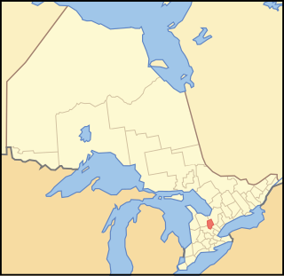
Caledon is a town in the Regional Municipality of Peel in the Greater Toronto Area of Ontario, Canada. The name comes from a shortened form of Caledonia, the Roman name for what is now Scotland. Caledon is primarily rural with a number of hamlets and small villages, but also contains the larger community of Bolton in its southeastern quadrant, adjacent to York Region. Some spillover urbanization also occurs in the south bordering the City of Brampton.

Vaughan is a city in Ontario, Canada. It is located in the Regional Municipality of York, just north of Toronto. Vaughan was the fastest-growing municipality in Canada between 1996 and 2006 with its population increasing by 80.2% during this time period and having nearly doubled in population since 1991. It is the fifth-largest city in the Greater Toronto Area, and the 17th-largest city in Canada.

Badlands are a type of dry terrain where softer sedimentary rocks and clay-rich soils have been extensively eroded. They are characterized by steep slopes, minimal vegetation, lack of a substantial regolith, and high drainage density. Ravines, gullies, buttes, hoodoos and other such geologic forms are common in badlands.

The Golden Horseshoe is a secondary region of Southern Ontario, Canada, which lies at the western end of Lake Ontario, with outer boundaries stretching south to Lake Erie and north to Lake Scugog, Lake Simcoe and Georgian Bay of Lake Huron. The region is the most densely populated and industrialized in Canada. Based on the 2021 census, with a population of 7,759,635 people in its core and 9,765,188 in its greater area, the Golden Horseshoe accounts for over 20 percent of the population of Canada and more than 54 percent of Ontario's population. It is part of the Quebec City–Windsor Corridor, itself part of the Great Lakes megalopolis.

The Regional Municipality of Peel is a regional municipality in the Greater Toronto Area, Southern Ontario, Canada. It consists of three municipalities to the west and northwest of the city of Toronto: the cities of Mississauga and Brampton, and the town of Caledon, each of which spans its full east–west width. The regional seat is in Brampton.

Georgetown is a large unincorporated community in the town of Halton Hills, Ontario, Canada, in the Regional Municipality of Halton. The town includes several small villages or settlements such as Norval, Limehouse, Stewarttown and Glen Williams near Georgetown and another large population centre, Acton. In 2016, the population of Georgetown was 42,123. It sits on the banks of the Credit River, approximately 40 km west of Toronto, and is part of the Greater Toronto Area. Georgetown was named after entrepreneur George Kennedy who settled in the area in 1821 and built several mills and other businesses.

Erin is a town in Wellington County, approximately 80 kilometres (50 mi) northwest of Toronto, Ontario, Canada. Erin is bordered by the Town of Caledon, Ontario to the east, the Town of Halton Hills to the south, the Township of Guelph/Eramosa to the west and the Township of East Garafraxa to the north.

The County of Brant is a single-tier municipality in the Canadian province of Ontario. Although it retains the word "county" in its name, the municipality is a single-tier municipal government and has no upper tier. The County of Brant has service offices in Burford, Paris, Oakland, Onondaga and St. George. The largest population centre is Paris.
Dufferin County is a county and census division located in Central Ontario, Canada. The county seat is Orangeville, and the current Warden is Wade Mills. The current chief administrative officer is Sonya Pritchard. Dufferin covers an area of 1,486.31 square kilometres (573.87 sq mi), and its population was 61,735 at the time of the 2016 Census.

Bolton is an unincorporated town that is the most populous community in the town of Caledon, Ontario, Canada, in the Regional Municipality of Peel. It is located beside the Humber River, approximately 50 kilometres northwest of Toronto. In regional documents, it is referred to as a 'Rural Service Centre'. It has 26,795 residents in 9,158 total dwellings. The downtown area that historically defined the village is in a valley, through which flows the Humber River. The village extends on either side of the valley to the north and south.

Palgrave is a Compact Rural Community and unincorporated place in the Town of Caledon, Regional Municipality of Peel in the Greater Toronto Area of Ontario, Canada. It is about 10 kilometres (6.2 mi) north of Bolton and about 50 kilometres (31 mi) northwest of Toronto. Palgrave is located east of Orangeville, south of Alliston, west of Newmarket and north of Brampton.

Following is an outline is for the history of Brampton, the fourth largest city in Ontario, Canada. European settlers arrived began to settle the area in the early 19th century, with Brampton being formally incorporated into a village in 1853.

Tullamore is a semi-rural community on the boundary of Brampton and Caledon, Ontario, Canada. It was named after the town of Tullamore in Ireland. The community is centred on the intersection of Airport Road and Mayfield Road. It had a population of 6 in 2006.

The Cheltenham Badlands are in Caledon, Ontario, on the southeast side of Olde Base Line Road, between Creditview and Chinguacousy Roads. The site occupies an area of approximately 0.4 square kilometers and features exposed and highly eroded Queenston shale. The Cheltenham Badlands are a significant educational site due to the readily visible geologic processes and the red colour and the unique topography of the exposed shale make this a popular tourist site. The site is a Provincial Earth Sciences Area of Natural and Scientific Interest (ANSI) since it is considered one of the best examples of "badlands topography" in Ontario.

Alton is a community located in Caledon, Ontario. It is also part of the Peel Region. It was established in 1820. Alton has a population of 1 116 people.

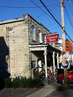
Belfountain is a quiet community located within the borders of the town of Caledon, in Peel Region, Ontario, Canada.

Caledon Village is an unincorporated community located within the largely rural Town of Caledon in Ontario, Canada. It has a population of 1 909 people.

Terra Cotta is a hamlet located in the town of Caledon, within Peel Region, Ontario, Canada.
Inglewood is a village located within the town of Caledon, in Peel, Ontario, Canada. It has a population of 1 175 people.