
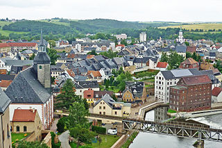
Zwickau (German pronunciation: [ˈtsvɪkaʊ]; is, with around 87,500 inhabitants, the fourth-largest city of Saxony after Leipzig, Dresden and Chemnitz and it is the seat of the Zwickau District. The West Saxon city is situated in the valley of the Zwickau Mulde, and lies in a string of cities sitting in the densely populated foreland of the Elster and Ore Mountains stretching from Plauen in the southwest via Zwickau, Chemnitz and Freiberg to Dresden in the northeast. From 1834 until 1952, Zwickau was the seat of the government of the south-western region of Saxony.

Chemnitz is the third-largest city in the German state of Saxony after Leipzig and Dresden. It is the 28th largest city of Germany as well as the fourth largest city in the area of former East Germany after (East) Berlin, Leipzig and Dresden. The city is part of the Central German Metropolitan Region, and lies in the middle of a string of cities sitting in the densely populated northern foreland of the Elster and Ore Mountains, stretching from Plauen in the southwest via Zwickau, Chemnitz and Freiberg to Dresden in the northeast.
Aue-Schwarzenberg is a former district in Saxony, Germany. It was bounded by the Czech Republic and the districts of Vogtlandkreis, Zwickauer Land, Stollberg and Annaberg.

The Zwickauer Mulde is a river in Saxony, Germany. It is the left tributary of the Mulde and 166 km (103 mi) in length.
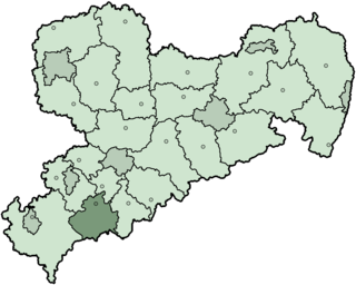
Zwickauer Land is a former Kreis (district) in the south-west of Saxony, Germany. Neighboring districts were Chemnitzer Land, Stollberg, Aue-Schwarzenberg, Vogtlandkreis, and the districts Greiz and Altenburger Land in Thuringia. The district-free city of Zwickau was located in the center of the district and nearly completely surrounded by it.

Mittweida is a former district in Saxony, Germany. It was bounded by the districts Muldentalkreis, Döbeln, Freiberg, the district-free city Chemnitz and the district Chemnitzer Land, the district Altenburger Land in Thuringia and the district Leipziger Land.

Stollberg is a former district in Saxony, Germany. It was bounded by the district-free city Chemnitz, and the districts Mittlerer Erzgebirgskreis, Annaberg, Aue-Schwarzenberg, Zwickauer Land and Chemnitzer Land.
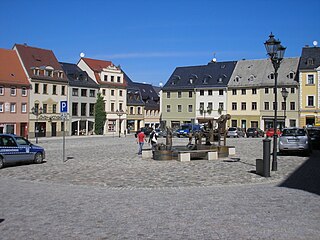
Glauchau is a town in the German federal state of Saxony, on the right bank of the Mulde, 7 miles north of Zwickau and 17 miles west of Chemnitz by rail. It is part of the Zwickau district.
Rochlitz is a major district town in the district of Mittelsachsen, in Saxony, Germany. Rochlitz is the head of the "municipal partnership Rochlitz" with its other members being the municipalities of Königsfeld, Seelitz and Zettlitz.

The Chemnitz–Adorf railway is a branch line in Saxony, Germany that was built and operated by the Chemnitz-Aue-Adorfer Eisenbahn-Gesellschaft (CAAE). The 115 km long line originally ran from Chemnitz in a southwesterly direction along the valley of the River Zwönitz to Aue. From Aue the line ran along the Zwickauer Mulde to Muldenberg and up to Schöneck and through Markneukirchen to Adorf in Vogtland.
Erzgebirgskreis is a district (Kreis) in the Free State of Saxony, Germany. It is named after the Erzgebirge, a mountain range in the southern part of the district which forms part of the Germany–Czech Republic border. It borders the districts of Vogtlandkreis and Zwickau, the urban district Chemnitz, the district Mittelsachsen and the Czech Republic.
Mittelsachsen is a district (Kreis) in the Free State of Saxony, Germany.
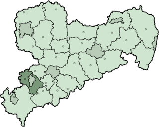
Zwickau is a district (Kreis) in the Free State of Saxony, Germany.

The Saxon Uplands, Saxon Hills or Ore Mountain Foreland is a strip of countryside of about 200 m to 500 m above sea level (NN) high, in the German state of Saxony, that lies immediately north of the German Ore Mountains and runs mainly through the areas of Zwickauer Land, Zwickau, Chemnitzer Land, Chemnitz, Mittelsachsen and the country south of Dresden. It borders on the Upper Pleißeland to the extreme west, the Ore Mountain Basin in the south and the Mulde Loess Hills to the north and east.
Joachim, Count of Schönburg-Glauchau was the nominal successor head of the former mediatised German Counts of Schönburg-Glauchau until 1945. Dispossessed and expelled from his homeland in 1945, he and his family migrated to the Rhineland, where he was an author and journalist. After the fall of the Berlin Wall, he returned to his homeland, represented the district in the Bundestag, and served in local government.

The Bezirk Karl-Marx-Stadt, also known as Bezirk Chemnitz, was a district (Bezirk) of East Germany. The administrative seat and the main town was Karl-Marx-Stadt, renamed back to Chemnitz during the reunification of Germany.
The Dresden–Werdau railway is an electrified, double-track main line in the German state of Saxony. It runs from Dresden via Freiberg, Chemnitz and Zwickau to Werdau wye, where it joins the Leipzig-Hof railway.

The Glauchau–Gößnitz railway is a single-track electrified main line railway in the German states of Saxony and Thuringia. It was originally built and operated with the support of the Saxon government and eventually became part of the Royal Saxon State Railways. It opened in 1858 and it is one of the oldest railways in Germany.

The Central Saxon Hills, is a region of Hügelland with indistinct boundaries in the centre of the German state of Saxony.
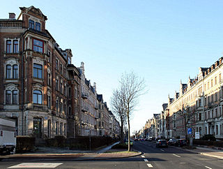
Kaßberg is the most densely populated neighbourhood within the German city of Chemnitz and belongs to the largest Gründerzeit and Art Nouveau neighbourhoods in Germany. It is near the Chemnitz River and is to the west of the Chemnitz city centre. Its highest point is about 30 metres above the level of the city centre.

