Annaberg is a former district in Saxony, Germany. It was bounded by the Czech Republic and the districts of Aue-Schwarzenberg, Stollberg and Mittlerer Erzgebirgskreis. Its colors are pink, green, and blue.

The Ore Mountains lie along the Czech–German border, separating the historical regions of Bohemia in the Czech Republic and Saxony in Germany. The highest peaks are the Klínovec in the Czech Republic, which rises to 1,244 metres (4,081 ft) above sea level and the Fichtelberg in Germany.

The Zwickauer Mulde is a river in Saxony, Germany. It is the left tributary of the Mulde and 166 km (103 mi) in length.
Zwickauer Land is a former Kreis (district) in the south-west of Saxony, Germany. Neighboring districts were Chemnitzer Land, Stollberg, Aue-Schwarzenberg, Vogtlandkreis, and the districts Greiz and Altenburger Land in Thuringia. The district-free city of Zwickau was located in the center of the district and nearly completely surrounded by it.

Mittweida is a former district in Saxony, Germany. It was bounded by the districts Muldentalkreis, Döbeln, Freiberg, the district-free city Chemnitz and the district Chemnitzer Land, the district Altenburger Land in Thuringia and the district Leipziger Land.
The Sächsische Schweiz is a former district (Kreis) in the south of Saxony, Germany. Neighboring districts were Weißeritzkreis, the district-free city Dresden and the districts Kamenz and Bautzen. To the south it borders the Czech Republic.

Stollberg is a former district in Saxony, Germany. It was bounded by the district-free city Chemnitz, and the districts Mittlerer Erzgebirgskreis, Annaberg, Aue-Schwarzenberg, Zwickauer Land and Chemnitzer Land.

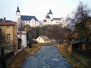
Aue is a small town in Germany at the outlet of the river Schwarzwasser into the river Zwickauer Mulde in the Ore Mountains, and has roughly 16,000 inhabitants. It was merged into the new town Aue-Bad Schlema in January 2019. Aue was the administrative seat of the former district of Aue-Schwarzenberg in Saxony, and is part of the Erzgebirgskreis since August 2008. It belongs to the Silberberg Town League

Schwarzenberg is a town in the district of Erzgebirgskreis in Saxony’s Ore Mountains, near the German–Czech border. The town lies roughly 15 km southeast of Aue, and 35 km southwest of Chemnitz.

Schneeberg is a town in Saxony’s district of Erzgebirgskreis. It has roughly 16,400 inhabitants and belongs to the Town League of Silberberg. It lies 4 km west of Aue, and 17 kilometres (11 mi) southeast of Zwickau.

Johanngeorgenstadt is a mining town in Saxony’s Ore Mountains, 17 km south of Aue, and 27 km northwest of Karlovy Vary. It lies in the district of Erzgebirgskreis, on the border with the Czech Republic, is a state-recognized health resort (Erholungsort), and calls itself Stadt des Schwibbogens. Its population decline since the 1950s has been extremely severe falling from 45,000 residents in 1953 to only about one tenth of that now.
The town of Lauter lies in the district of Erzgebirgskreis in the Free State of Saxony, Germany, between the two towns of Aue and Schwarzenberg. It lies in the Ore Mountains, 4 km southeast of Aue, and 4 km northwest of Schwarzenberg, has 4,927 inhabitants in an area of 21.55 km² and belongs to the Town League of Silberberg. Since 1 January 2013, it is part of the town Lauter-Bernsbach.

Boží Dar is a small town in Karlovy Vary District in the Karlovy Vary Region of the Czech Republic. It has about 200 inhabitants. Situated in the Ore Mountains at 1,028 m (3,373 ft) above sea level, it is considered the highest town in the Czech Republic.
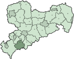
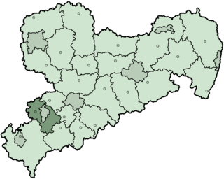
Erzgebirgskreis is a district (Kreis) in the Free State of Saxony, Germany. It is named after the Erzgebirge, a mountain range in the southern part of the district which forms part of the Germany–Czech Republic border. It borders the districts of Vogtlandkreis and Zwickau, the urban district Chemnitz, the district Mittelsachsen and the Czech Republic.
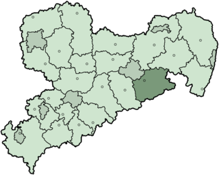
Mittelsachsen is a district (Kreis) in the Free State of Saxony, Germany.
The Zwickau–Schwarzenberg railway is a main line railway in the German state of Saxony. It extends from Zwickau through the valleys of the Zwickauer Mulde and the Schwarzwasser via Bad Schlema and Aue to Schwarzenberg. It opened in 1858 and it is one of the oldest railways in Germany. It is now served by Regionalbahn trains, operated by Erzgebirgsbahn between Zwickau and Johanngeorgenstadt.

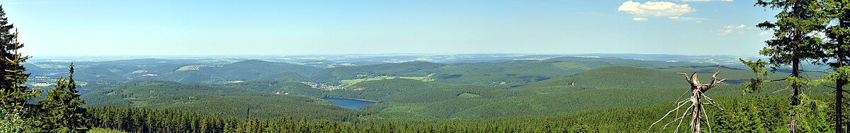
The Western Ore Mountains is a natural region that forms the westernmost part of the Ore Mountains in the German state of Saxony. It is also part of the major landscape unit known as the Saxon Highlands and Uplands. It extends eastwards to include the valley of the Schwarzwasser, and, below its mouth, that of the Zwickauer Mulde, and incorporates the western parts of the former major units known as the Lower and Upper Western Ore Mountains, no. 423, as well as the Southern Slopes of the Ore Mountains, no. 420.
The Schwarzwasser or Černá is a river in Germany and the Czech Republic. The name means 'black'. It is a right tributary of the Zwickauer Mulde in the German state of Saxony. It flows through Schwarzenberg.

The Kleiner Kranichsee is one of the most important raised bogs in the Ore Mountains of Central Europe. The bog straddles the German/Czech border; the part lying in the German state of Saxony has been protected since 1930, whilst the Czech part was declared a nature reserve in 1962.
Jugel is a division of the town of Johanngeorgenstadt in the German district of Erzgebirgskreis. This dispersed settlement is surrounded by woods, is divided into Ober- and Unterjugel and runs along the German-Czech border from the Lehmergrund to the crest of the Western Ore Mountains. In the vicinity lies the 980 metre-high Scheffelsberg. Jugel is a tourist destination for hikers and winter sportsmen.