Cherang'any Hills

Last updated
Cherangani Hills
Cherang'any
Cherangani Hills-1.jpg
Highest point
Elevation 3,530 m (11,580 ft)
Prominence 1,521 m (4,990 ft)
Parent peak Mount Satima
Coordinates 1°16′02″N35°29′59″E / 1.26719°N 35.49962°E / 1.26719; 35.49962
Geography
Kenya relief location map.jpg
Red triangle with thick white border.svg
Cherangani Hills
Location in Kenya
Range coordinates 1°16′02″N35°29′59″E / 1.26719°N 35.49962°E / 1.26719; 35.49962
Geology
Mountain type Residual Mountain

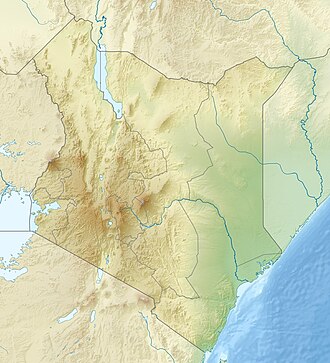
The Cherang'any Hills are a range of hills in the western highlands of Kenya. The hills are one of Kenya's five main forests and catchment areas. The highlands, the large central plateau, is divided by the Mau Escarpment which rises from the border with Tanzania up to the Cherang'any Hills. The escarpment bounds the plateau that rises to the slopes of Mount Elgon. [1] The Cherangany Hills span three counties namely Trans Nzoia, Elgeyo Marakwet and West Pokot. The highest point of the range is the summit of Nakugen at 3530 m, which can be ascended from the south from parking space at a Kenyan Wildlife Service station, located at 1°09′46″N35°29′36″E / 1.16284°N 35.49325°E / 1.16284; 35.49325 . [2] [3] [4] Other notable peaks include; Chemnirot (3520 m), Kameleogon (3500 m), Chebon (3375 m), Chepkotet (3370 m), Karelachgelat (3350 m) and Sodang (3211 m). They are home to a marginalized hunter-gatherer community called the Sengwer.

Contents

Geology

The Cherang'any Hills were formed due to Faulting. They form the western flank of the Gregory Rift Valley (East African Rift Valley) that stretches from Djibouti in the North to Mozambique in the South . They are located on a forested escarpment with sheer cliff walls surrounding them on three sides. Rocks found in Cherangani Hills are majorly Gneisses rich in Biotite and Muscovite. A Gneiss sample from Chepsiro, one of the smaller peaks of Cherangani was found to be containing Iron Ore. White Quartzite rocks are found in Lelan in West Pokot. Other minerals that have been recorded before by Geologists in Cherangani Hills include Red Garnets near Talau in West Pokot and Beryl in Sebit. Chromite has also been found by Geologists in the colonial era. The Cheranganyi Hills are a source to River Moiben and Chepkaitit, the Major Tributaries of River Nzoia. [5] Visible are forested ridges and stark, rocky gorges. The hills form the source of Moiben River, one of the two tributaries of the Nzoia River, the other being Mount Elgon. [6]

Ecology

The Cherang'any Hills are monitored by the United Nations Environmental Programme as one of the five most important water catchment areas in Kenya. [7] As of the last report, monitoring the change in forestation between 2000 and 2003, the Cherang'any Hills were the least affected of the forests monitored, with 174.3 hectares deforested, this loss is occurring within Marakwet District and West Pokot District. Since this forest cover is indigenous, the report recommends that the area be closely watched to prevent further destruction. [8] The thirteen forest reserves there are collectively known as the Cherangani Hills Forest.

The De Brazza's monkey has been sighted here. [9] The monkeys are confined to small areas in the Cherang'any Hills that offer them little protection. [10]

See also

Related Research Articles

<span class="mw-page-title-main">Kitale</span> Municipality in Trans-Nzoia County, Kenya

Kitale is an agricultural town in the northern Rift Valley, situated between Mount Elgon and the Cherangany Hills.The town has an elevation of around 1,900 metres (6,200 ft) Its population was 162,174 as of 2019. Kitale town is the headquarter of Trans-Nzoia County. Kitale is reachable by air through Kitale Airport. The postal code for Kitale is 30200.

<span class="mw-page-title-main">Trans-Nzoia County</span> County of Kenya

Trans-Nzoia County is a county in the former Rift Valley Province, Kenya, located between the Nzoia River and Mount Elgon, 380 km northwest of Nairobi. At its centre is the town of Kitale which is the capital and largest town. The county borders Bungoma to the west, Uasin Gishu and Kakamega to the south, Elgeyo-Marakwet to the east, West Pokot to the north and the Republic of Uganda to the Northwest. Trans Nzoia covers an area of 2495.5 square kilometres.

<span class="mw-page-title-main">Tugen people</span> Tribe of Kenya

The Tugen are a sub tribe of the Kenyan Kalenjin people. They fall under the highland nilotes category. They occupy Baringo County and some parts of Nakuru County and Elgeyo Marakwet County in the former Rift Valley Province. Daniel Arap Moi, the second president of Kenya (1978–2002), came from this sub-tribe. The Tugen people speak the Tugen language. The Tugen population was 197,556 as of 2019.

<span class="mw-page-title-main">Uasin Gishu County</span> County of Rift Valley Province, Kenya

Uasin Gishu County is one of the 47 counties of Kenya located in the former Rift Valley Province. Eldoret has the county's largest population centre as well as its administrative and commercial centre. "It lies between longitudes 34 degrees 50' east and 35 degrees 37' West and latitudes 0 degrees 03' South and 0 degrees 55' North. It is a highland plateau with altitudes falling gently from 2,700 metres (8,900 ft) above sea level to about 1,500 metres (4,900 ft) above sea level. The topography is higher to the east and declines gently towards the western border".

The Oropom were the aboriginal inhabitants of much of Karamoja in Uganda, Mt. Elgon area and West Pokot, Trans Nzoia and Turkana regions in Kenya. Their descendants were largely assimilated into various communities present in their former territories, including the Iteso, Karamojong, Pokot, Turkana and Bukusu. They are or were found in scattered pockets between the Turkwel River, Chemorongit Mountains and Mt. Elgon. One report indicates that they formerly spoke the unclassified Oropom language.

<span class="mw-page-title-main">De Brazza's monkey</span> Species of Old World monkey

De Brazza's monkey is an Old World monkey endemic to the riverine and swamp forests of central Africa. The largest species in the guenon family, it is one of the most widespread arboreal African primates. Aside from size, it can be differentiated from other Cercopithecus monkeys by its orange diadem and white beard. Due to its cryptic nature, the species is not well documented in all of its habitats but has shown unique traits, such as pair-bonding and aggressive behavior towards other guenons.

<span class="mw-page-title-main">Elgeyo people</span> Ethnic group

The Elgeyo are an ethnic group who are part of the larger Kalenjin ethnic group of Nilotic origin. They live near Eldoret, Kenya, in the highlands of the former Keiyo District, now part of the larger Elgeyo Marakwet County. The Elgeyo originally settled at the foothills of the Elgeyo escarpment, in the area between Kerio river to the east and the escarpment to the west. Due to drought and famine in the valley, the Keiyos climbed the escarpment and started to settle on the highland east of Uasin Gishu plateau. When the British came, the Keiyos were pushed to settle in clusters called reserves.

<span class="mw-page-title-main">Marakwet people</span>

The Marakwet are one of the groups forming the ethnolinguistic Kalenjin community of Kenya, they speak the Markweta language. The Marakwet live in five territorial sections namely Almoo, Cherangany, Endoow, Sombirir (Borokot) and Markweta. Cutting across these territorial groups are a number of clans to which each Marakwet belongs. There were 119,969 Marakwet people in 2019.

<span class="mw-page-title-main">Mount Elgon National Park</span> National park in Uganda and Kenya

Mount Elgon National Park is a national park in Kenya and Uganda that lies 140 kilometres (87 mi) northeast of Lake Victoria. The park covers an area of 1,279 square kilometres (494 sq mi). The Ugandan part of the park covers 1,110 km2 (430 sq mi) while the Kenyan part covers 169 km2 (65 sq mi). The Kenyan part of the park was gazetted in 1968, the Ugandan part in 1992.

Elgeyo escarpment is a fault-scarp caused by post-Miocene faulting. Miocene beds are still visible. The escarpment is part of the western wall of the Great Rift Valley.

<span class="mw-page-title-main">Kerio Valley</span>

Kerio Valley lies between the Tugen Hills and the Elgeyo Escarpment in Kenya. It sits at an elevation of 1,000 meters in the Great Rift Valley.

Mount Mtelo (Sekerr) is the seventh-highest mountain in Kenya, after Mount Kenya, Mount Elgon, Aberdares, High Cheranganis, and Mount Kipipiri, and is situated in the North West highlands of West Pokot County, approximately 120 km north of Kitale Town.

<span class="mw-page-title-main">Great Rift Valley, Kenya</span> Part of an intra-continental ridge system that runs through Kenya

The Great Rift Valley is part of an intra-continental ridge system that runs through Kenya from north to south. It is part of the Gregory Rift, the eastern branch of the East African Rift, which starts in Tanzania to the south and continues northward into Ethiopia. It was formed on the "Kenyan Dome" a geographical upwelling created by the interactions of three major tectonics: the Arabian, Nubian, and Somalian plates. In the past, it was seen as part of a "Great Rift Valley" that ran from Madagascar to Syria. Most of the valley falls within the former Rift Valley Province.

<span class="mw-page-title-main">Sub-Counties of Kenya</span>

Sub-counties, also known as Districts, are the decentralised units through which government of Kenya provides functions and services. At national level, sub-counties take a more administrative function like security, statistical purposes, provision of government services, etc. Even though the sub-counties are divisions of counties, powers to create new national sub-counties lies with the national government. As of 2023, there are 314 sub-counties, compared to 290 constituencies. A deputy county commissioner is appointed by the state to lead each sub-county. The sub-counties are further divided into divisions, locations and sub-locations.

<span class="mw-page-title-main">Elgeyo-Marakwet County</span> County in Kenya

Elgeyo-Marakwet County is one of Kenya's 47 counties, which is located in the former Rift Valley Province with its capital and largest town as Iten. It borders the counties of West Pokot to the north, Baringo County to the east, southeast and south, Uasin Gishu to the southwest and west, and Trans Nzoia to the northwest.

Trans-Nzoia District was an administrative district of Rift Valley Province, Kenya, located between the Nzoia River and Mount Elgon with its centre at the town of Kitale.

<span class="mw-page-title-main">Sengwer people</span>

The Sengwer people are an indigenous community who primarily live in the Embobut forest in the western highlands of Kenya and in scattered pockets across Trans Nzoia, West Pokot and Elgeyo-Marakwet counties. The Sengwer are sometimes portrayed as a component of the Marakwet people but are a distinct ethnic grouping.

The Chemwal people were a Kalenjin-speaking society that inhabited regions of western and north-western Kenya as well as the regions around Mount Elgon at various times through to the late 19th century. The Nandi word Sekker was used by Pokot elders to describe one section of a community that occupied the Elgeyo escarpment and whose territory stretched across the Uasin Gishu plateau. This section of the community appears to have neighbored the Karamojong who referred to them as Siger, a name that derived from the Karimojong word esigirait. The most notable element of Sekker/Chemwal culture appears to have been a dangling adornment of a single cowrie shell attached to the forelock of Sekker women, at least as of the late 1700s and early 1800s.

<span class="mw-page-title-main">Sirikwa culture</span> Pastoral Iron Age Kenyan culture

The Sirikwa culture was the predominant Kenyan hinterland culture of the Pastoral Iron Age, c.2000 BP. Seen to have developed out of the Elmenteitan culture of the East African Pastoral Neolithic c.3300-1200 BP, it was followed in much of its area by the Kalenjin, Maa, western and central Kenyan communities of the 18th and 19th centuries.

The Siger people were a community commonly spoken of in the folklore of a number of Kenyan communities that inhabited regions of northwestern Kenya at various points in history.

References

  1. "Kenyalogy: Geography - Rift Valley and Highlands". www.kenyalogy.com. Retrieved 2008-03-18.
  2. Paul Clarke (1989). The Mountains of Kenya: A Walker's Guide. Mountain Club of Kenya, 1989. p. 191. Retrieved 2020-03-02.
  3. "Nakugen - Peakbagger" . Retrieved 2020-03-02.
  4. "Nakugen". Petter Bjorstad. 2020-02-07. Retrieved 2020-03-02.
  5. "Mountains>Western Highlands". www.magicalkenya.com. Archived from the original on 2008-06-03. Retrieved 2008-03-18.
  6. Joseph Bindloss, Tom Parkinson & Matt Fletcher (2003). Kenya - Google Book Search. p. 328. ISBN   9781864503036 . Retrieved 2008-03-18.
  7. "- Changes in Forest Cover in Kenya's". www.africanconservation.org. Archived from the original on June 1, 2007. Retrieved 2008-03-18.
  8. "Changes in forest cover in Kenya's five "water towers" 20002003". United Nations Environment Programme (UNEP). Archived from the original on 23 June 2006.
  9. Karere G. Mugambi; Thomas M. Butynski; Mbaruk A. Suleman; Wilbur Ottichilo (1997). "The Vanishing De Brazza's Monkey (Cercopithecus neglectus Schlegel) in Kenya". International Journal of Primatology. 18 (6). Springer Verlag: 995–1004. doi:10.1023/A:1026352331577. S2CID   20340955.
  10. Brennan, E. Jean (1985). "De Brazza's monkeys (Cercopithecus neglectus) in Kenya: Census, distribution, and conservation". American Journal of Primatology. 8 (4). Wiley: 269–277. doi:10.1002/ajp.1350080402. PMID   31986800. S2CID   84353142. Archived from the original on 2012-12-16. Retrieved 2008-03-18.