Cherkasskoye

Last updated
Cherkasskoe
Kazakhstan adm location map.svg
Red pog.svg
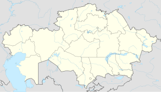
Cherkasskoe
Location in Kazakhstan
Coordinates: 45°40′04″N80°22′02″E / 45.66778°N 80.36722°E / 45.66778; 80.36722
Country Kazakhstan
Region Jetisu Region
District Sarkand District
Elevation
2,346 ft (715 m)
Time zone UTC+6 (Omsk Time)

Cherkasskoye is a village in Jetisu Region of south-eastern Kazakhstan. Cherkasskoye is located near the Lepsi River. [1]

Related Research Articles

<span class="mw-page-title-main">Indiana State Road 9</span> Highway in Indiana

State Road 9 in the U.S. State of Indiana is a long north–south state highway in the eastern portion of Indiana. Its southern terminus is near Columbus at State Road 46, and the northern terminus is at the Michigan/Indiana border between Howe, Indiana, and Sturgis, Michigan, where it continues as M-66.

<span class="mw-page-title-main">Google Maps</span> Googles web mapping service (launched 2005)

Google Maps is a web mapping platform and consumer application offered by Google. It offers satellite imagery, aerial photography, street maps, 360° interactive panoramic views of streets, real-time traffic conditions, and route planning for traveling by foot, car, bike, air and public transportation. As of 2020, Google Maps was being used by over one billion people every month around the world.

<span class="mw-page-title-main">Maryland Route 2</span> State highway in Maryland, US

Maryland Route 2 is the longest state highway in the U.S. state of Maryland. The 79.24-mile (127.52 km) route runs from Solomons Island in Calvert County north to an intersection with U.S. Route 1 /US 40 Truck in Baltimore. The route runs concurrent with MD 4 through much of Calvert County along a four-lane divided highway known as Solomons Island Road, passing through rural areas as well as the communities of Lusby, Port Republic, Prince Frederick, and Huntingtown. In Sunderland, MD 2 splits from MD 4 and continues north as two-lane undivided Solomons Island Road into Anne Arundel County, still passing through rural areas. Upon reaching Annapolis, the route runs concurrent with US 50/US 301 to the north of the city. Between Annapolis and Baltimore, MD 2 runs along the Governor Ritchie Highway, a multilane divided highway that heads through suburban areas, passing through Arnold, Severna Park, Pasadena, Glen Burnie, and Brooklyn Park. In Baltimore, the route heads north on city streets and passes through the downtown area of the city.

<span class="mw-page-title-main">Maryland Route 5</span> Highway in Maryland, United States

Maryland Route 5 is a 74.34-mile (119.64 km) long state highway that runs north–south in the U.S. state of Maryland. The highway runs from Point Lookout in St. Mary's County north to the Washington, D.C. border in Suitland, Prince George's County. MD 5 begins as two-lane undivided Point Lookout Road which runs from Point Lookout to an intersection with MD 235 in the northern part of St. Mary's County. Point Lookout Road passes through rural areas as well as the county seat of Leonardtown. After the MD 235 intersection, the route becomes four-lane divided Three Notch Road and continues into Charles County, where it becomes Leonardtown Road. Here, the route bypasses Hughesville and continues north toward the Waldorf area, which it bypasses to the east on Mattawoman Beantown Road. The route merges onto U.S. Route 301 and enters Prince George's County, splitting from US 301 at an interchange in Brandywine. From here, MD 5 continues north on Branch Avenue, running through suburban areas, before becoming a freeway as it passes Andrews Air Force Base and has an interchange with Interstate 95 (I-95)/I-495. Past the Capital Beltway, the route runs through suburban areas of Hillcrest Heights and Suitland before reaching the Washington, D.C. border, where Branch Avenue SE continues, crossing Pennsylvania Avenue SE and eventually terminating at Randle Circle.

<span class="mw-page-title-main">Alberta Highway 26</span>

Alberta Provincial Highway No. 26, commonly referred to as Highway 26, is an east–west highway in central Alberta, Canada that connects Highway 13 in Camrose to Highway 14 near Kinsella. The route follows 12th Correction Line for its entire length, and does not pass through any communities east of Camrose.

Endoxon is a company that was partially acquired by Google in December 2006. The company is based in Lucerne, Switzerland. Endoxon now provides the maps for European countries in Google Maps. Its products included maps that have geo-referenced data with high-resolution aerial and satellite images for dynamic internet and mobile services.

<span class="mw-page-title-main">R134 road (Ireland)</span> Road in Ireland

The R134 road is a regional road in South Dublin, Ireland connecting the R110 to the R120.

<span class="mw-page-title-main">Rainbow (ride)</span> Amusement park ride

Rainbow is an Amusement park ride created by HUSS Maschinenfabrik of Bremen, Germany. The Rainbow was manufactured from 1982 to 2000 and is often confused with its cousins Ali Baba and 1001 Nachts plus other similar models. The HUSS Rainbow has developed a vast fan base due to its large stature, smooth ride, bright lights, and iconic motor noise.

Google Business Photos is a virtual tour service started by Google. It uses the same photography technique used in Google Street View in order to offer 360˚ interactive panoramas inside businesses. Once the virtual tour is published by Google, the link to the tour is displayed directly on the search results page. The tour is also published on Google+ Local pages and Google Maps. A user visiting a business published virtual tour can navigate inside the business in the same way a user of Google Street View can navigate roads, streets and highways.

Monteagudo Airport is an airport serving Monteagudo, a town in the Chuquisaca Department of Bolivia.

Copacabana Airport is an extremely high elevation airport serving Copacabana, a town on Lake Titicaca in the La Paz Department of Bolivia.

Chimoré Airport is an airport serving Chimoré, a town in the Cochabamba Department of Bolivia.

Under Chinese law, the use of geographic information in the People's Republic of China is restricted to entities that have special authorization from the administrative department for surveying and mapping under the State Council. Consequences of the restriction include fines for unauthorized surveys, lack of geotagging information on many cameras when the GPS chip detects a location within China, and incorrect alignment of street maps with satellite maps in various applications.

Google Cloud Search is an AI-powered assistant which aid users to quickly find relevant information, as and when they need it across all associated Google apps, including Gmail, Google Docs, Google Drive, Google Calendar, Google Contacts and others alike. It also provides “actionable information & recommendations” to users based on statistical probability gathered using Machine Learning.

References

  1. "Google Maps". Google Maps. Retrieved 2020-02-02.