Matay

Last updated
Matay
Village
Kazakhstan adm location map.svg
Red pog.svg
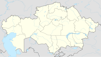
Matay
Location in Kazakhstan
Coordinates: 45°53′42″N78°43′05″E / 45.89500°N 78.71806°E / 45.89500; 78.71806
Country Kazakhstan
Region Jetisu Region
Time zone UTC+6 (Omsk Time)

Matay is a village in Jetisu Region, in south-eastern Kazakhstan. [1]

Climate

Matay has a steppe climate (Köppen: BSk), [2] with hot summers and very cold winters.

Climate data for Matay (1991–2020)
MonthJanFebMarAprMayJunJulAugSepOctNovDecYear
Mean daily maximum °C (°F)−6.7
(19.9)
−3.3
(26.1)
6.9
(44.4)
19.7
(67.5)
26.1
(79.0)
31.8
(89.2)
33.4
(92.1)
32.1
(89.8)
25.7
(78.3)
17.1
(62.8)
5.6
(42.1)
−3.3
(26.1)
15.4
(59.7)
Daily mean °C (°F)−12.5
(9.5)
−9.3
(15.3)
0.3
(32.5)
11.7
(53.1)
18.0
(64.4)
23.8
(74.8)
25.6
(78.1)
23.8
(74.8)
17.0
(62.6)
8.9
(48.0)
−0.6
(30.9)
−8.6
(16.5)
8.2
(46.8)
Mean daily minimum °C (°F)−17.4
(0.7)
−14.4
(6.1)
−5.1
(22.8)
4.2
(39.6)
9.8
(49.6)
15.6
(60.1)
17.7
(63.9)
15.3
(59.5)
8.8
(47.8)
2.0
(35.6)
−5.4
(22.3)
−12.9
(8.8)
1.5
(34.7)
Average precipitation mm (inches)19.6
(0.77)
16.3
(0.64)
18.8
(0.74)
21.3
(0.84)
23.3
(0.92)
21.7
(0.85)
28.1
(1.11)
11.4
(0.45)
10.7
(0.42)
20.6
(0.81)
28.4
(1.12)
23.0
(0.91)
243.2
(9.57)
Average precipitation days (≥ 1.0 mm)5.54.54.94.34.84.44.52.72.33.95.55.452.7
Source: NOAA [3]

Related Research Articles

<span class="mw-page-title-main">Temperate climate</span> Main climate class

In geography, the temperate climates of Earth occur in the middle latitudes, which span between the tropics and the polar regions of Earth. These zones generally have wider temperature ranges throughout the year and more distinct seasonal changes compared to tropical climates, where such variations are often small and usually only have precipitation differences.

<span class="mw-page-title-main">Desert climate</span> Arid climate subtype in the Köppen climate classification system with very little precipitation

The desert climate or arid climate is a dry climate sub-type in which there is a severe excess of evaporation over precipitation. The typically bald, rocky, or sandy surfaces in desert climates are dry and hold little moisture, quickly evaporating the already little rainfall they receive. Covering 14.2% of Earth's land area, hot deserts are the second most common type of climate on Earth after the polar climate.

<span class="mw-page-title-main">Mediterranean climate</span> Type of climate

A Mediterranean climate, also called a dry summer climate, described by Köppen as Cs, is a temperate climate type that occurs in the lower mid-latitudes. Such climates typically have dry summers and wet winters, with summer conditions ranging from warm to hot and winter conditions typically being mild to cool. These weather conditions are typically experienced in the majority of Mediterranean-climate regions and countries, but remain highly dependent on proximity to the ocean, altitude and geographical location.

<span class="mw-page-title-main">Tropical climate</span> One of the five major climate groups in the Köppen climate classification

Tropical climate is the first of the five major climate groups in the Köppen climate classification identified with the letter A. Tropical climates are defined by a monthly average temperature of 18 °C (64.4 °F) or higher in the coolest month, and feature hot temperatures all year-round. Annual precipitation is often abundant in tropical climates, and shows a seasonal rhythm but may have seasonal dryness to varying degrees. There are normally only two seasons in tropical climates, a wet (rainy/monsoon) season and a dry season. The annual temperature range in tropical climates is normally very small. Sunlight is intense in these climates.

<span class="mw-page-title-main">Köppen climate classification</span> Climate classification system

The Köppen climate classification is one of the most widely used climate classification systems. It was first published by German-Russian climatologist Wladimir Köppen (1846–1940) in 1884, with several later modifications by Köppen, notably in 1918 and 1936. Later, German climatologist Rudolf Geiger (1894–1981) introduced some changes to the classification system in 1954 and 1961, which is thus sometimes called the Köppen–Geiger climate classification.

<span class="mw-page-title-main">Oceanic climate</span> Climate classification

An oceanic climate, also known as a marine climate, is the temperate climate sub-type in Köppen classification represented as Cfb, typical of west coasts in higher middle latitudes of continents, generally featuring cool summers and mild winters, with a relatively narrow annual temperature range and few extremes of temperature. Oceanic climates can be found in both hemispheres generally between 40 and 60 degrees latitude, with subpolar versions extending to 70 degrees latitude in some coastal areas. Other varieties of climates usually classified together with these include subtropical highland climates, represented as Cwb or Cfb, and subpolar oceanic or cold subtropical highland climates, represented as Cfc or Cwc. Subtropical highland climates occur in some mountainous parts of the subtropics or tropics, some of which have monsoon influence, while their cold variants and subpolar oceanic climates occur near polar or tundra regions.

<span class="mw-page-title-main">Semi-arid climate</span> Climate with precipitation below potential evapotranspiration

A semi-arid climate, semi-desert climate, or steppe climate is a dry climate sub-type. It is located on regions that receive precipitation below potential evapotranspiration, but not as low as a desert climate. There are different kinds of semi-arid climates, depending on variables such as temperature, and they give rise to different biomes.

Mount Smythe is a mountain in Jasper National Park, Alberta, Canada.

<span class="mw-page-title-main">Humphreys Peak</span> Highest mountain in Arizona

Humphreys Peak is the highest natural point and the second most prominent peak after Mount Graham in the U.S. state of Arizona, with an elevation of 12,637 feet (3,852 m) and is located within the Kachina Peaks Wilderness in the Coconino National Forest, about 11 miles (17.7 km) north of Flagstaff, Arizona. Humphreys Peak is the highest of a group of dormant volcanic peaks known as the San Francisco Peaks.

<span class="mw-page-title-main">Humid continental climate</span> Category in the Köppen climate classification system

A humid continental climate is a climatic region defined by Russo-German climatologist Wladimir Köppen in 1900, typified by four distinct seasons and large seasonal temperature differences, with warm to hot summers, and cold and snowy winters. Precipitation is usually distributed throughout the year, but often these regions do have dry seasons. The definition of this climate in terms of temperature is as follows: the mean temperature of the coldest month must be below 0 °C (32.0 °F) or −3 °C (26.6 °F) depending on the isotherm, and there must be at least four months whose mean temperatures are at or above 10 °C (50 °F). In addition, the location in question must not be semi-arid or arid. The cooler Dfb, Dwb, and Dsb subtypes are also known as hemiboreal climates. Although amount of snowfall is not a factor used in defining the humid continental climate, snow during the winter in this type of climate is almost a guarantee, either intermittently throughout the winter months near the poleward or coastal margins, or persistently throughout the winter months elsewhere in the climate zone.

<span class="mw-page-title-main">Vermilion Range (Alberta)</span> Subrange of the Front and Park Ranges in Alberta, Canada

The Vermilion Range is a mountain range of the Canadian Rockies, in Banff National Park, Canada. The range is east of the Sawback Range and west of the Bare and Palliser Ranges.

<span class="mw-page-title-main">Tuy Hòa</span> City in Phú Yên, Vietnam

Tuy Hòa is the coastal city and capital of Phú Yên Province in South-Central Vietnam. The city has a total area of 107 square kilometres or 41 square miles and a population of 202,030. The city is located approximately midway between Nha Trang and Qui Nhơn. The city is formulated mainly from alluvial of the downstream of Đà Rằng River. There are two mountains in the center of the city: Chóp Chài Mountain and Nhạn Mountain. There is a Champa Temple on the top of Nhạn Mountain.

<span class="mw-page-title-main">Abbot Pass</span> Mountain pass in Alberta, Canada

Abbot Pass lies between Mount Lefroy and Mount Victoria, in the divide between the valleys of Lake O'Hara and Lake Louise. It was named for Philip Stanley Abbot who died in 1896 in an attempt to climb Mount Lefroy with Charles Fay, Charles Thompson, and George T. Little.

<span class="mw-page-title-main">Climate of Alaska</span> Overview of the climate of the U.S. state of Alaska

The climate of Alaska is determined by average temperatures and precipitation received statewide over many years. The extratropical storm track runs along the Aleutian Island chain, across the Alaska Peninsula, and along the coastal area of the Gulf of Alaska which exposes these parts of the state to a large majority of the storms crossing the North Pacific. The climate in Juneau and the southeast panhandle is a mid-latitude oceanic climate, in the southern sections and a subarctic oceanic climate in the northern parts. The climate in Southcentral Alaska is a subarctic climate due to its short, cool summers. The climate of the interior of Alaska is best described as extreme and is the best example of a true subarctic climate, as the highest and lowest recorded temperatures in Alaska have both occurred in the interior. The climate in the extreme north of Alaska is an Arctic climate with long, cold winters, and cool summers where snow is possible year-round.

<span class="mw-page-title-main">Florange</span> Commune in Grand Est, France

Florange is a commune in the Moselle department in Grand Est in north-eastern France.

Sarkand is a town in Sarkand District in Jetisu Region of south-eastern Kazakhstan. It is the capital of the district.

<span class="mw-page-title-main">Humid subtropical climate</span> Transitional climatic zone

A humid subtropical climate is a temperate climate type characterized by hot and humid summers, and cool to mild winters. These climates normally lie on the southeast side of all continents, generally between latitudes 25° and 40° and are located poleward from adjacent tropical climates, and equatorward from either humid continental or oceanic climates. It is also known as warm temperate climate in some climate classifications.

<span class="mw-page-title-main">Three Rivers Peak</span> Mountain in Wyoming, United States

Three Rivers Peak is a 9,958-foot (3,035 m) mountain summit in the southern section of the Gallatin Range in Yellowstone National Park, in the U.S. state of Wyoming.

Muddy Mountain is a peak in the Laramie Mountains approximately 12 miles (19 km) south-south-east of Casper, Wyoming. There is a two-mile (3.2 km) "interpretive nature trail" maintained by the Bureau of Land Management, as well as a series of trails popular with mountain bikers, horseback riders, and ATVs in the summer, and snowmobiles in the winter.

<span class="mw-page-title-main">Trewartha climate classification</span> Categorical system for longer-range recurrent weather patterns of Earth, orig. 1966

The Trewartha climate classification (TCC) or the Köppen–Trewartha climate classification (KTC) is a climate classification system first published by American geographer Glenn Thomas Trewartha in 1966. It is a modified version of the Köppen–Geiger system, created to answer some of its deficiencies. The Trewartha system attempts to redefine the middle latitudes to be closer to vegetation zoning and genetic climate systems.

References

  1. National Geospatial-Intelligence Agency. GeoNames database entry. (search) Accessed 13 May 2011.
  2. "Table 1 Overview of the Köppen-Geiger climate classes including the defining criteria". Nature: Scientific Data.
  3. "World Meteorological Organization Climate Normals for 1991-2020 — Matay". National Oceanic and Atmospheric Administration. Retrieved January 18, 2024.