
Gorno-Altaysk is the capital town of the Altai Republic, Russia.

There are 11 time zones in Russia, which currently observe times ranging from UTC+02:00 to UTC+12:00. Daylight saving time (DST) has not been used in Russia since 26 October 2014. From 27 March 2011 to 26 October 2014, permanent DST was used.

Krasnoyarsk Time (KRAT) is the time zone seven hours ahead of UTC (UTC+07:00) and 4 hours ahead of Moscow Time (MSK+4). KRAT is the official time zone for central and east Siberian regions of Krasnoyarsk Krai, Kemerovo Oblast, Khakassia and Tuva.

Onguday is a rural locality and the administrative center of Ongudaysky District in the Altai Republic, Russia, located on the Ursul River, 210 kilometers (130 mi) from Gorno-Altaysk, the capital of the republic. As of the 2010 Census, its population was 5,655, consisting mainly of the Altai people and Russians.
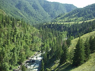
Ongudaysky District is an administrative and municipal district (raion), one of the ten in the Altai Republic, Russia. It is located in the center of the republic. The area of the district is 11,744 square kilometers (4,534 sq mi). Its administrative center is the rural locality of Onguday. As of the 2010 Census, the total population of the district was 15,046, with the population of Onguday accounting for 37.6% of that number.

Samara Time (SAMT) is the time zone four hours ahead of UTC (UTC+4) and 1 hour ahead of Moscow Time (MSK+1). Samara Time is used in Astrakhan Oblast, Samara Oblast, Saratov Oblast, Udmurtia, and Ulyanovsk Oblast.

Kamchatka Time or Petropavlovsk Time (PETT; Russian: камчатское время, kamchatskoye vremya), also known as Anadyr Time (ANAT), is a time zone in Russia, named after the Kamchatka Peninsula. It is 12 hours ahead of UTC (UTC+12:00) and 9 hours ahead of Moscow Time (MSK+9). This time zone is used in the two easternmost regions of Russia after October 2014 and was also used before the time zone reform of 2010.
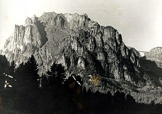
Choysky District is an administrative and municipal district (raion), one of the ten in the Altai Republic, Russia. It is located in the north of the republic. The area of the district is 4,526 square kilometers (1,747 sq mi). Its administrative center is the rural locality of Choya. As of the 2010 Census, the total population of the district was 8,348, with the population of Choya accounting for 23.0% of that number.

Kosh-Agachsky District is an administrative and municipal district (raion), one of the ten in the Altai Republic, Russia. It is located in the south and southeast of the republic. The area of the district is 19,845 square kilometers (7,662 sq mi). Its administrative center is the rural locality of Kosh-Agach. As of the 2010 Census, the total population of the district was 18,263, with the population of Kosh-Agach accounting for 43.3% of that number.

Mayminsky District is an administrative and municipal district (raion), one of the ten in the Altai Republic, Russia. It is located in the northwest of the republic. The area of the district is 1,285 square kilometers (496 sq mi). Its administrative center is the rural locality of Mayma. As of the 2010 Census, the total population of the district was 28,642, with the population of Mayma accounting for 56.5% of that number.

Turochaksky District is an administrative and municipal district (raion), one of the ten in the Altai Republic, Russia. It is located in the north of the republic. The area of the district is 11,015 square kilometers (4,253 sq mi). Its administrative center is the rural locality of Turochak. As of the 2010 Census, the total population of the district was 12,484, with the population of Turochak accounting for 44.7% of that number.
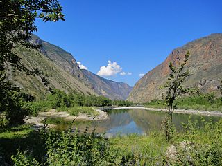
Ulagansky District is an administrative and municipal district (raion), one of the ten in the Altai Republic, Russia. It is located in the east of the republic and borders Turochaksky District, Choysky District, Ongudaysky District, and Kosh-Agachsky District, as well as the republics of Tuva and Khakassia. The area of the district is 18,367 square kilometers (7,092 sq mi). Its administrative center is the rural locality of Ulagan. As of the 2010 Census, the total population of the district was 11,388, with the population of Ulagan accounting for 28.3% of that number. Altai make up 57.2% of the district's population, followed by Russians (20.2%), Telengits (16.3%), Kazakhs (4.5%) and Uzbeks (1.8%).

Ust-Koksinsky District is an administrative and municipal district (raion), one of the ten in the Altai Republic, Russia. It is located in the west and southwest of the republic. The area of the district is 12,960 square kilometers (5,000 sq mi). Its administrative center is the rural locality of Ust-Koksa. As of the 2010 Census, the total population of the district was 17,020, with the population of Ust-Koksa accounting for 25.7% of that number.
Medvedevo is an urban locality and the administrative center of Medvedevsky District of the Mari El Republic, Russia. As of the 2010 Census, its population was 16,841.
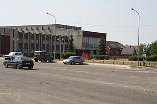
Morki is an urban locality and the administrative center of Morkinsky District of the Mari El Republic, Russia. As of the 2010 Census, its population was 9,914.

Kosh-Agach is a rural locality and the administrative center of Kosh-Agachsky District of the Altai Republic, Russia. Population: 7,900 (2010 Census); 5,701 (2002 Census); 3,501 (1989 Soviet census).
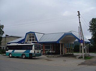
Turochak is a rural locality and the administrative center of Turochaksky District of the Altai Republic, Russia. Population: 5,582 (2010 Census); 5,484 (2002 Census); 5,080 (1989 Soviet census).

Ust-Koksa is a rural locality and the administrative center of Ust-Koksinsky District of the Altai Republic, Russia. Population: 4,373 (2010 Census); 3,986 (2002 Census); 3,526 (1989 Soviet census).
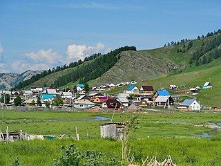
Ust-Kan is a rural locality and the administrative center of Ust-Kansky District of the Altai Republic, Russia. Population: 4,123 (2010 Census); 3,528 (2002 Census); 3,022 (1989 Soviet census).
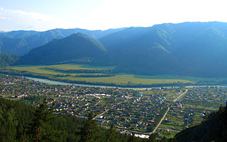
Chemal is a rural locality and the administrative center of Chemalsky District of the Altai Republic, Russia. Population: 3,602 (2010 Census); 3,266 (2002 Census);


