Missionary Ridge is a geographic feature in Chattanooga, Tennessee, site of the Battle of Missionary Ridge, a battle in the American Civil War, fought on November 25, 1863. Union forces under Maj. Gens. Ulysses S. Grant, William T. Sherman, and George H. Thomas routed Confederate forces under General Braxton Bragg and lifted the siege of the city.

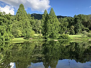
The Troy University Arboretum is an arboretum and nature preserve, located next to the Troy University campus in Troy, Alabama. The Arboretum includes 75 acres, and over 300 different species of trees, as well as a 2.5 miles (4.0 km) nature trail with a swamp, stream, and the 4 acres Mullis Pond. It is open to the public.

The Leila Arboretum is an arboretum and garden located at 928 West Michigan Avenue, Battle Creek, Michigan. The arboretum is 72 acres, and is open to the public.
Honor Heights Park is a 132-acre botanical garden and arboretum located at 1400 Honor Heights Drive in Muskogee, Oklahoma. It is a public park operated by the City of Muskogee.

Chadwick Arboretum is a 62 acres (25 ha) arboretum on the Agriculture campus of Ohio State University, in Columbus, Ohio, United States. The main arboretum collection is located just across Lane Avenue from the Schottenstein Center with its other collections nearby. The arboretum is open daily without charge.
Bonny Oaks Arboretum is an arboretum located at 6183 Adamson Circle, Chattanooga, Tennessee. It is open daily without charge.

Reflection Riding Arboretum and Nature Center is a nonprofit arboretum, botanical garden, nature center and historical site located at 400 Garden Road, Chattanooga, Tennessee.
The Connecticut Audubon Society Coastal Center at Milford Point is a nature center and bird sanctuary in Milford, Connecticut, established in 1995. Over 300 different species of bird have been observed at this location. The Coastal Center is located on an 8.4-acre (34,000 m2) barrier beach—the Smith-Hubbell Wildlife Refuge & Bird Sanctuary—and is situated next to the 840-acre (3.4 km2) Charles E. Wheeler Wildlife Management Area at the mouth of the Housatonic River. The Coastal Center provides easy access to Long Island Sound and its many habitats: tidal salt marshes, barrier beaches, tide pools and coastal dunes, and utilizes these habitats for environmental education for youth and adults. These various environments and habitats support a variety of bird, plant and animal communities for observation and study. The Coastal Center also contains educational exhibits and live animals.
Proctor Wildlife Sanctuary is a protected area maintained by the New Hampshire Audubon Society. It is located in Center Harbor, New Hampshire. The sanctuary is 47 acres (190,000 m2) of second generation woodlands that has about two miles of hiking trails.

The Ipswich River Wildlife Sanctuary, which is one of the Massachusetts Audubon Society’s largest wildlife sanctuaries, is located in Topsfield and Wenham, Massachusetts. Much of its 1,955-acre (7.91 km2) landscape was created by a glacier 15,000 years ago.

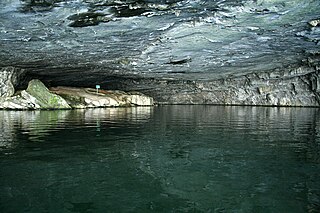
Nickajack Cave is a large, partially flooded cave in Marion County, Tennessee. It was partially flooded by the Tennessee Valley Authority's Nickajack Lake, created by the construction of Nickajack Dam in 1967. The entrance was originally 140 feet wide and 50 feet high. There is now about 25–30 feet of water at the entrance, so the portion of the entrance above water is 140 feet wide and 20–25 feet high. It houses a large colony of gray bats, an endangered species, and the water levels have posed a danger to the bat colony. The cave took its name from the Chickamauga Cherokee town of Nickajack, located between its mouth and the Tennessee River. The town was once attacked and destroyed in 1794 by the Nickajack Expedition.

WMBW is a non-commercial educational radio station licensed to Chattanooga, Tennessee serving the Chattanooga metropolitan area. Owned by the Moody Bible Institute since 1973, the station broadcasts a religious format and is the Chattanooga affiliate for Moody Radio.

Whiteside is an unincorporated community in Marion County, Tennessee. It was originally settled as a Cherokee town in the late eighteenth century.

Centre Municipal Airport is a city-owned, public-use airport located three nautical miles east of the central business district of Centre, a city in Cherokee County, Alabama, United States. It is owned by the City of Centre.
The Fore River Sanctuary is an 85-acre (34 ha) protected area in Portland, Maine. Located in the Stroudwater neighborhood, the sanctuary is home of Jewell Falls, Portland's only natural waterfall and the former home of the Cumberland and Oxford Canal. It also includes a salt water marsh which attracts a number of different species of birds and small mammals. It is named after the nearby Fore River and was protected by the National Audubon Society prior to being given to Portland Trails. The land was donated to Portland Trails by Tom Jewell, one of the founders of Portland Trails, a non-profit urban land trust preserving lands throughout Greater Portland.

The Brainerd Mission was a Christian mission to the Cherokee in present-day Chattanooga, Tennessee. The associated Brainerd Mission Cemetery is the only part that remains, and is listed on the National Register of Historic Places.
Oostanaula is an unincorporated community in Gordon County, in the U.S. state of Georgia.

Audubon Center at Bent of the River is a 700-acre preserve in Southbury, Connecticut. It is located off South Britain Road and is open year-round.
The Treaty of Dewitts Corner ended the initial Overhill Cherokee targeted attacks on colonial settlements that took place at the beginning of the American Revolution. A peace document signed by the Cherokee and South Carolina, the treaty instead laid the foundation for the decades long Cherokee–American wars fought between the European-Americans and the Chickamauga Cherokee people.

Cherokee Removal Memorial Park is a public park in Meigs County, Tennessee that is dedicated in memory of the Cherokee who were forced to emigrate from their ancestral lands during the Cherokee removal, in an event that came to be known as the Trail of Tears. It was established in 2005, and has since expanded.


