Related Research Articles

Spotsylvania County is a county in the U.S. state of Virginia. As of the July 2021 estimate, the population was 143,676. Its county seat is Spotsylvania Courthouse.

Riverwood is a home rule-class city in northeastern Jefferson County, Kentucky, United States. The population was 446 at the 2010 census.
Idylwood is a census-designated place (CDP) in Fairfax County, Virginia, United States. The population was 17,954 as of the 2020 census. It originally developed as a suburban community along the route of the Washington and Old Dominion Railroad, and later along Virginia State Route 7. The construction of the Capital Beltway in the 1960s, and I-66 and the Orange Line of the Washington Metrorail system in the 1980s, as well as the concurrent development of nearby Tysons Corner into Washington's leading suburban business district, led to the development of several apartment, townhouse, and small-lot single-family housing complexes, as well as the high-rise Idylwood Towers condominium, in the portion of Idylwood lying to the north of I-66. The area to the south of I-66 remains primarily large-lot single-family.

Merrifield is a census-designated place (CDP) in Fairfax County, Virginia, United States. The population was 15,212 at the 2010 census.

Wolf Trap is an affluent census-designated place (CDP) in Fairfax County, Virginia, United States. The population was 16,131 at the 2010 census. Wolf Trap National Park for the Performing Arts is located in the CDP.
Cassville is a census-designated place (CDP) in Monongalia County, West Virginia, United States. The population was 701 at the 2010 census. It is included in the Morgantown, West Virginia Metropolitan Statistical Area. Cassville was named after Lewis Cass, a prominent American statesman who served as Secretary of War, Secretary of State, and Governor of Michigan.

The boundary markers of the original District of Columbia are the 40 milestones that marked the four lines forming the boundaries between the states of Maryland and Virginia and the square of 100 square miles (259 km2) of federal territory that became the District of Columbia in 1801. Working under the supervision of three commissioners that President George Washington had appointed in 1790 in accordance with the federal Residence Act, a surveying team that Major Andrew Ellicott led placed these markers in 1791 and 1792. Among Ellicott's assistants were his brothers Joseph and Benjamin Ellicott, Isaac Roberdeau, George Fenwick, Isaac Briggs and an African American astronomer, Benjamin Banneker.
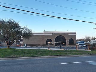
Cosner's Corner is a village in Spotsylvania County, Virginia. It is located at the intersection of U.S. Route 17 and U.S. Route 1 just south of Fredericksburg.
Seven Corners Shopping Center was the first major shopping center to open in suburban Washington, D.C. It is located in Seven Corners, Fairfax County, Virginia. At its opening in 1956, it was the largest regional shopping center in Virginia. The backsplit two-story mall structure was razed in the mid-1990s and replaced with a dual ground level power center.
Fairfax Square is an upscale mixed-use development located directly south of Tysons Corner Center across Leesburg Pike in Tysons Corner, Virginia. It includes 400,000 sq ft (37,160 m2) of Class A office space, primarily occupied by financial tenants such as American Express, Merrill Lynch, and New York Life, and high-end ground-floor retail among its three identical high-rises. Fairfax Square was designed by Skidmore, Owings & Merrill. Its buildings are clad in Brazilian granite, and its lobbies are finished with Italian marble and wood paneling. Ground was broken for the development in 1988.
Blades Corner is an unincorporated community in Spotsylvania County, in the U.S. state of Virginia.
Lanes Corner is an unincorporated community in Spotsylvania County, in the U.S. state of Virginia.
Olivers Corner is an unincorporated community in Spotsylvania County, in the U.S. state of Virginia.
Shady Grove Corner is an unincorporated community in Spotsylvania County, in the U.S. state of Virginia.
Holly Corner is an unincorporated community in Stafford County, in the U.S. state of Virginia.
Nancy Wrights Corner is an unincorporated community in Caroline County, in the U.S. state of Virginia. It is located along US 1 and VSR 605, west of Woodford. The community was one of the sites of the Battle of North Anna.
Oak Corner is an unincorporated community in Caroline County, in the U.S. state of Virginia.

The Civil War Monuments in Washington, D.C. are a group of seventeen outdoor statues which are spread out through much of central and northwest Washington, D.C. The statues depict 11 Union generals and formerly included one Confederate general, Albert Pike, who was depicted as a Mason and not as a general. The Pike statue was torn down on Juneteenth 2020, as part of the George Floyd protests. Two Union admirals are honored, although Admiral Samuel Francis DuPont's statue was removed to Wilmington, Delaware, and he is now honored with a fountain. Other statues depict nuns, peace, emancipation, and the Grand Army of the Republic.
Avoca is an unincorporated community in Clay County, in the U.S. state of West Virginia.

Little Venice Island is a small island in the Sacramento–San Joaquin River Delta. It is part of San Joaquin County, California. Its coordinates are 38°03′02″N121°30′05″W, and the United States Geological Survey measured its elevation as 0 ft (0 m) in 1981. It appears on a 1952 USGS map of the area.
References
Municipalities and communities of Spotsylvania County, Virginia, United States | ||
|---|---|---|
| CDPs |  | |
| Unincorporated communities |
| |
| Footnotes | ‡This populated place also has portions in an adjacent county or counties | |
Coordinates: 38°03′02″N77°39′43″W / 38.05056°N 77.66194°W
| | This Spotsylvania County, Virginia state location article is a stub. You can help Wikipedia by expanding it. |