Related Research Articles
Idylwood is a census-designated place (CDP) in Fairfax County, Virginia, United States. The population was 17,954 as of the 2020 census. It originally developed as a suburban community along the route of the Washington and Old Dominion Railroad, and later along Virginia State Route 7. The construction of the Capital Beltway in the 1960s, and I-66 and the Orange Line of the Washington Metrorail system in the 1980s, as well as the concurrent development of nearby Tysons Corner into Washington's leading suburban business district, led to the development of several apartment, townhouse, and small-lot single-family housing complexes, as well as the high-rise Idylwood Towers condominium, in the portion of Idylwood lying to the north of I-66. The area to the south of I-66 remains primarily large-lot single-family.

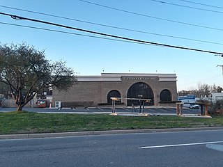
Merrifield is a census-designated place (CDP) in Fairfax County, Virginia, United States. The population was 15,212 at the 2010 census.

Prosperity is a census-designated place (CDP) in Raleigh County, West Virginia, United States. The population was 1,498 at the 2010 census.
Bethany College is a private liberal arts college in Bethany, West Virginia. Founded in 1840 by Alexander Campbell of the Restoration Movement, who gained support by the Virginia legislature, Bethany College was the first institution of higher education in what is now West Virginia.

Red Square, officially Central Plaza, is a large open square on the Seattle campus of the University of Washington that serves as a hub for two of the University's major axes, connecting the campus's northern Liberal Arts Quadrangle with the science and engineering buildings found on the lower campus. The plaza is paved with red brick, and becomes notoriously slippery during rain.

The Cidacos River is a tributary of the Ebro. Its source is Los Campos, in Soria, and it flows for 77 km (48 mi) until its reaches the Ebro at Calahorra.
Doctors Charter School of Miami Shores is a public charter school located on 5 acres (20,000 m2) at Barry University Campus in Miami Shores, in the U.S. state of Florida.
Blades Corner is an unincorporated community in Spotsylvania County, in the U.S. state of Virginia.
Chewnings Corner is an unincorporated community in Spotsylvania County, in the U.S. state of Virginia.
Lanes Corner is an unincorporated community in Spotsylvania County, in the U.S. state of Virginia.
Shady Grove Corner is an unincorporated community in Spotsylvania County, in the U.S. state of Virginia.
Holly Corner is an unincorporated community in Stafford County, in the U.S. state of Virginia.
Loving Fork is an unincorporated community in Caroline County, in the U.S. state of Virginia.
Mica is an unincorporated community in Caroline County, in the U.S. state of Virginia.
Nancy Wrights Corner is an unincorporated community in Caroline County, in the U.S. state of Virginia. It is located along US 1 and VSR 605, west of Woodford. The community was one of the sites of the Battle of North Anna.
Olive is an unincorporated community in Spotsylvania County, in the U.S. state of Virginia.

Paige is an unincorporated community in Caroline County, in the U.S. state of Virginia.
Oak Hill is an unincorporated community in northwest Crawford County, in the U.S. state of Missouri. The community is located on the east bank of Brush Creek, one-quarter mile south of the Crawford-Gasconade county line and is on Missouri Route CC, one mile east of Missouri Route 19.
Kagel is an unincorporated community in Scott County, in the U.S. state of Missouri.

Wolf Run Shoals was an important crossing point on the Occoquan River in northern Virginia between Alexandria and Richmond during the 18th and 19th centuries. It consisted of three islands and a mill, now submerged under the Occoquan due to higher water levels following damming for flood control, water supply, and power generation. It is located near the unincorporated communities of Butts Corner, Makleys Corner, and Farrs Corner in southern Fairfax County, Virginia.
References
Municipalities and communities of Spotsylvania County, Virginia, United States | ||
|---|---|---|
| CDPs |  | |
| Unincorporated communities |
| |
| Footnotes | ‡This populated place also has portions in an adjacent county or counties | |
Coordinates: 38°12′21″N77°39′21″W / 38.20583°N 77.65583°W
| | This Spotsylvania County, Virginia state location article is a stub. You can help Wikipedia by expanding it. |