This article needs additional citations for verification .(July 2013) |
Chhimtuipui district | |
|---|---|
former district of India | |
| Country | India |
| State | Mizoram |
| Time zone | UTC+5:30 (IST) |
This article needs additional citations for verification .(July 2013) |
Chhimtuipui district | |
|---|---|
former district of India | |
| Country | India |
| State | Mizoram |
| Time zone | UTC+5:30 (IST) |
Subdivisional headquarters were at Lawngtlai and Chawngte. Chhimtuipui District was divided into four rural development blocks, namely Lawngtlai, Sangau, Tuipang and Chawngte. [1] In November 1998 Lawngtlai District was created out of Chhimtuipui District, consisting of the Lawngtlai RD Block and the Chawngte RD Block. [1] The remaining area of Sangau RD Block and Tuipang RD Block was still called Chhimtuipui District, but the reduced district's name was soon changed to Siaha district.
In addition to Mizo, Kuki-Chin languages spoken in southern Mizoram (Chhimtuipui District and neighboring Lunglei District) include:

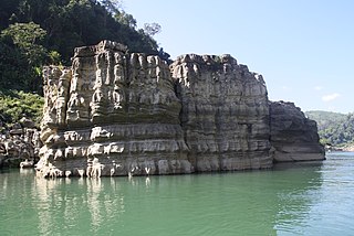
Lunglei, formerly known as Lungleh, is the second-largest town in Mizoram, northeastern India, situated in the south-central part of the state. The town served as the capital of British South Lushai Hills from 1889 to 1898. It is situated 729 metres above sea level and is situated on a ridge surrounded by hills. Lunglei has an estimated population of 80,000 residents as of 2023.

Phawngpui, also known as Blue Mountain, is the highest mountain peak in the Mizo Hills and in the state of Mizoram, India, with an elevation of 2157 m. It is in Lawngtlai district, in the southeastern region of Mizoram near the Myanmar border.

Sheikhupura District, is a district located in Lahore Division of Punjab Province, Pakistan. Sheikhupura is the headquarters of Sheikhupura district. According to the 1998 census of Pakistan, the district had a population of 3,321,029 of which 25.45% were urban. In 2005 one of its subdivisions was split off to form the new Nankana Sahib District.

Siaha district is one of the eleven districts of Mizoram state in India. The district is bounded on the northwest by Lunglei district, on the north and west by Lawngtlai District and on the south and east by Myanmar. The district occupies an area of 1399.9 km2. Siaha town is the administrative headquarters of the Mara Autonomous District Council. The population had Increased from 56,574 to 67,658. It is the least populous district of Mizoram.
Lawngtlai district is one of the eleven districts of Mizoram state in India.

The Kaladan or Kissapanadi River, also known as the Beino, Bawinu and Kolodyne, is a river in eastern Mizoram State of India, and in Chin State and Rakhine State of western Myanmar. The Kaladan River is called the Chhimtuipui River in India. It forms the international border between India and Burma between 22° 47′ 10" N and 22° 11′ 06" N.

Thantlang Township is one of the nine townships in Chin State. Thantlang is the administrative town of inclusive nine circles attributed to the geographical and dialectical arrangements of the area. They are Khualhring Tlang, Vanzang Tlang, Zahnak Tlang, Bual Tlang, Vailam Tlang Lautu Tlang, Mara Tlang, Vailam Tlang, Zophei Tlang and Bawipa Tlang. Only four circles speak Lai dialect. Zophei(Zophei and Bawipa circles), Lautu, HawThai speak their tribal language. The other fives circles and in Thantlang town speak Lai dialect. In Thantlang township, Lai dialect is the common use dialect. Lai dialect is also spoken at Hakha township and Falam township.
Mara is a Kuki-Chin language spoken by Mara people, mostly the Tlosai tribe living in 30 villages of Chhimtuipui district, southern Mizoram, India and the adjacent villages in Burma.

The Chakma Autonomous District Council is an autonomous council under the Republic of India. It is located in the Northeast Indian state of Mizoram, of which it covers about 3.25% area of the state. It is a landlocked region sharing international borders with Myanmar to the south and Bangladesh to the west, domestic border with Lai Autonomous District Council to the east and Lunglei district to the North. At the 2011 Census, the population was 62,094.Its headquarters is at Kamalanagar. The Chakma people has been demanding to change the status of the Chakma Autonomous District Council into a Union territory under the name Chakmaland.

The Lai Autonomous District Council (LADC) is one of the three Autonomous District Councils in Mizoram state in north-east India. It covers the Lawngtlai and Sangau subdivisions of the Lawngtlai district. It is an autonomous district council for the Lai people living in south-eastern Mizoram.
Lai, Laiholh, or Pawi is a Kuki-Chin language spoken in central Chin State in Myanmar, and Lawngtlai district of Mizoram, India. Hakha Chin-speaking minorities are also found in the Sagaing and Magway Regions of Myanmar, and in the Chittagong Hill Tracts of southeastern Bangladesh by the Bawm minority.

Lawngtlai is a town located in the southern part of Mizoram, India. It serves as the administrative headquarters of the Lawngtlai district and is home to the Pawi people, also known as the Hakha Chin people in Myanmar. Lawngtlai celebrates a variety of indigenous festivals, such as the Hlukhla Kut, similar to that of Chapchar Kut.
Ralte is a Kuki-Chin language of India. Fewer than a thousand Ralte people speak the language.

The Kaladan Road Project is a US$484 million project connecting the eastern Indian seaport of Kolkata with Sittwe seaport in Rakhine State, Myanmar by sea. In Myanmar, it will then link Sittwe seaport to Paletwa in Chin State via the Kaladan river boat route, and then from Paletwa by road to Mizoram state in Northeast India. All components of the project, including Sittwe port and power, river dredging, Paletwa jetty, have been completed, except the under construction Zorinpui-Paletwa road. Originally, the project was scheduled to be completed by 2014, but end-to-end project is expected to be fully operational only by December 2023 as per November 2023 update.

National Highway 2 is a national highway in India that runs from Dibrugarh in Assam to Tuipang in Mizoram. This national highway passes through the Indian states of Assam, Nagaland, Manipur and Mizoram. This national highway is 1,325.6 km (823.7 mi) long. Before renumbering of national highways, NH-2 was variously numbered as old national highways 37, 61, 39, 150 and 54.
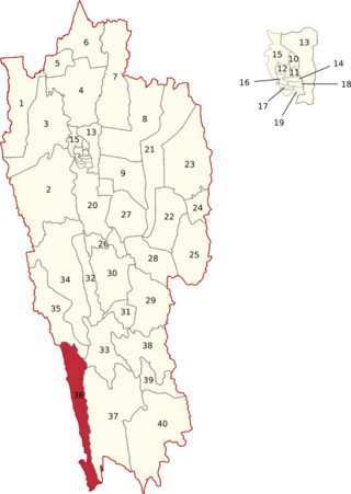
Tuichawng is one of the 40 Legislative Assembly constituencies of Mizoram state in India.

Lawngtlai West is one of the 40 Legislative Assembly constituencies of Mizoram state in India. It was established in 2008 after the passing of the Delimitation of Parliamentary and Assembly Constituencies Order, 2008.

Lawngtlai East is one of the 40 Legislative Assembly constituencies of Mizoram state in India.
Borapansury I is an Indian village in Chawngte Block of Lawngtlai district, part of the Chakma Autonomous District Council, in Mizoram, India.