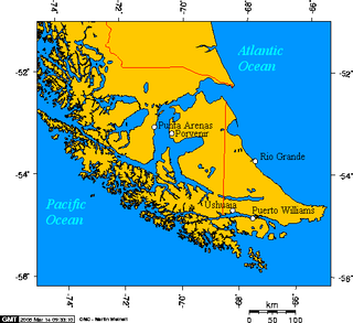
Southernmost settlements are cities, towns, weather stations or permanent military bases which are farther south than latitude 45°S. They are closely related to the Southern Ocean or either the Roaring Forties or Furious Fifties. Antarctic bases are excluded due to not having a permanent population.

The Churchill Mountains is a major range of mountains and associated elevations bordering the western side of the Ross Ice Shelf, between Byrd Glacier and Nimrod Glacier. They are south of the Britannia Range and north of the Geologists Range, Miller Range and Queen Elizabeth Range.
The Deep Freeze Range is a rugged mountain range, over 80 nautical miles long and about 10 nautical miles wide, rising between Priestley and Campbell Glaciers in Victoria Land, Antarctica, and extending from the edge of the polar plateau to Terra Nova Bay. It is southwest of the Southern Cross Mountains, south of the Mesa Range and northeast of the Eisenhower Range of the Prince Albert Mountains.
The Northumberland Islands are a scattered island chain off the eastern coast of Queensland, Australia.

Cortelazor is a town located in the province of Huelva, Spain. According to the 2005 census, it has a population of 289 inhabitants and covers an area of forty square kilometres. It sits at an altitude of 622 metres above sea level, and is 120 kilometres from the capital.
Zykov Glacier is a valley glacier about 25 nautical miles long in the Anare Mountains of Victoria Land, Antarctica. It flows northwest and reaches the coast between Cape Williams and Cooper Bluffs. It was photographed by the Soviet Antarctic Expedition (SovAE) in 1958 and named for student navigator Ye. Zykov, who died in Antarctica, Feb. 3, 1957.

Lieskovany is a tiny village and municipality in the Spišská Nová Ves District in the Košice Region of central-eastern Slovakia.
Siedliki is a village in the administrative district of Gmina Parczew, within Parczew County, Lublin Voivodeship, in eastern Poland. It lies approximately 5 kilometres (3 mi) east of Parczew and 49 km (30 mi) north-east of the regional capital Lublin.

The N8 is a national route in South Africa that connects Groblershoop with Maseru in Lesotho via Kimberley and Bloemfontein. It is maintained by the South African National Roads Agency.

The Duchy of Limburg was created in 1839 from parts of the Dutch Province of Limburg as a result of the Treaty of London. Its territory was the territory of the modern day province of Limburg with the exceptions of the cities of Maastricht and Venlo. The Duchy of Limburg was also a member state of the German Confederation.
Belev dol is a village in Smolyan Municipality, located in the Smolyan Province of southern Bulgaria. The village covers an area of 3.764 km2 and is located 178.3 km from Sofia. As of 2007, the village had a population of 87 people.
Krumovo Gradishte is a village in Karnobat Municipality, in Burgas Province, in southeastern Bulgaria.

Visoka is a village in the municipality of Arilje, Serbia. According to the 2011 census, the village has a population of 357 people.
Pilica is a village in the municipality of Bajina Bašta, Serbia. According to the 2002 census, the village has a population of 653 people.

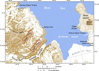
Mackay Glacier is a large glacier in Victoria Land, descending eastward from the Antarctic Plateau, between the Convoy Range and Clare Range, into the southern part of Granite Harbour. It was discovered by the South magnetic pole party of the British Antarctic Expedition, 1907–09, and named for Alistair Mackay, a member of the party. The glacier's tongue is called Mackay Glacier Tongue. First mapped by the British Antarctic Expedition, 1910–13 and named for Alistair F. Mackay, a member of the party. Its mouth is south of the Evans Piedmont Glacier and the Mawson Glacier. It is north of the Wilson Piedmont Glacier and the Ferrar Glacier.
Štulac is a village in the municipality of Vrnjačka Banja, Serbia. According to the 2011 census, the village has a population of 1,185 people.
Alto Zaza is a town and commune in Angola, located in the province of Uíge.


