Manthani is a municipal town in Manthani mandal in Peddapalli district of the Indian state of Telangana. It is located in Manthani mandal on the banks of the river Godavari..Manthani is nearest town of Godavarikhani, Ramagundam & Peddapalli. Manthani gave political birth to very many like swargeeya PV Narsimha Rao elevated to PM Status from MLA CM gradually .Swargeeya Sripada Rao as Speaker & Sridhar Babu now with great record of more than hatrick/s

Gooty is a town in Anantapur district of the Indian state of Andhra Pradesh. It is the headquarters of Gooty mandal in Anantapur revenue division. The town is renowned for the Gooty hill fort.
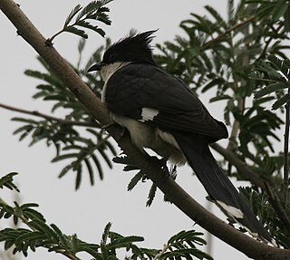
Mrugavani National Park is a national park located in Hyderabad, Telangana State, India. It is situated at Chilkur in Moinabad mandal, 20 km from MGBS and covers an area of 3.6 square kilometres (1.4 sq mi) or 1211 acres. It is home to a 600 different types of plant life. The Park is home to around 350 spotted deer. The animals include: indian hare, Jungle cat, civet, Indian rat snake, Russell's viper, chital and the flower pecker.

Guntur district is one of the twenty six districts in the Coastal Andhra region of the Indian state of Andhra Pradesh. The administrative seat of the district is located at Guntur, the largest city of the district in terms of area and with a population of 670,073. It has a coastline of approximately 100 km (62 mi) on the right bank of Krishna River, that separates it from Krishna district and NTR district. It is bounded on the south by Bapatla district and on the west by Palnadu district. It has an area of 2,443 km2 (943 sq mi), with a population of 20,91,075, as per 2011 census of India.
Bankapura is a panchayat town in Haveri district in the state of Karnataka, India. It is in Shiggaon taluk, is just 2.5 km from the Pune-Bangalore national highway NH-4, 22 km from Haveri town. Bankapura is about 45 km from Hubli-Dharwad. An historical site, Bankapura is famous for the Nagareshwara temple, Bankapura fort, The Bankapura Peacock Sanctuary. Baada, the birthplace of Kanakadasa is near to Bankapura.

Lakshmeshwara is a town, and newly created Taluk place along with Gajendragad in Gadag district, in the Indian state of Karnataka. It is about 40 km from Gadag and 55 km from Hubli. It is an agricultural trading town. Lakshmeshwara Temple dedicated to Shiva. There are many important temples in this historic town, including the other Shiva temple, the Someshwara Temple. There are two ancient Jain temples in the town, as well as a notable Jamma Masjid. Lakshmeshwara is also home for many smaller shrines, a dargah, the Kodiyellamma temple, the Mukha Basavanna shrine, and a gigantic idol of Suryanarayana.

Vinukonda is a town in Palnadu district of the Indian state of Andhra Pradesh. It is a municipality and the headquarters of Vinukonda mandal and administered under Narasaraopet revenue division.

Chitradurga Fort, or as the British called it Chitaldoorg, is a fortification that straddles several hills and a peak overlooking a flat valley in the Chitradurga District, Karnataka, India. The fort's name Chitrakaldurga, which means 'picturesque fort' in Kannada, is the namesake of the town Chitradurga and its administrative district.

Cherukupalli Mandal is one of the fifty seven mandals in Bapatla district of the Indian state of Andhra Pradesh. It is under the administration of Repalle revenue division of the district. The village of Cherukupalli is the administrative seat of the mandal.

Sudi, is a panchayat town in the Gadag District of Karnataka, India. It is about 30 km from Badami, 12 km from Gajendragad and 3 km from Itagi Bhimambika temple. In the past it was an important town of the Kalyani Chalukyas during 1000 AD. It is notable for rare stone carved monuments like Twin towered temple, Mallikarjuna temple and nagakunda , and few other structural temples. For long time these structures were abandoned, but recently they caught the eye of the Indian Archaeological Department.
Moinabad is a Town in Ranga Reddy district of the Indian state of Telangana. It falls under Moinabad mandal of Chevella revenue division.
Madakasira is a town with a population 19,432 in 2001 and also a mandal in Sri Satya Sai district in the state of Andhra Pradesh in India. It is located near the state border with Karnataka. The Madakasira Hill Fort in the town is a centrally protected monument of national importance.
The following are the temples located in and around Hyderabad
Himayatnagar is a village in Moinabad Mandal, Rangareddy District in Telangana state formerly part of Andhra pradesh state, India.

Mallabhum was the kingdom ruled by the Malla kings of Bishnupur, primarily in the present Bankura district in Indian state of West Bengal.
Chilkur (Chilkuru) is a census town in Suryapet district of the Indian state of Telangana.It is 50 km away from district headquarters Suryapet and Lies between Kodad and Huzurnagar..It is the headquarters of Chilkur mandal of Kodad revenue division.
Jambai is a 1 km2 (0.39 sq mi) village in Tirukkoyilur taluk in Kallakurichi district in the Indian state of Tamil Nadu. The major occupation of the people living at this place is agriculture and handloom. In 2011, it had a population of 2,000 people.
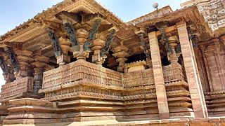
The earliest temples in Telangana include the Alampur Navabrahma Temples built during the 6th century CE by the Badami Chaulukyas.
Chilkur mandal is one of the 23 mandals in Suryapet district of the Indian state of Telangana. It is under the administration of Kodad revenue division with its headquarters at Chilkur. The mandal is bounded by Kodad mandal to the east, Huzurnagar mandal to the south, Munagala mandal to the north.
Moinabad mandal is one of the 27 mandals in Ranga Reddy district of the Indian state of Telangana. It is under the administration of Chevella revenue division and has its headquarters at Moinabad.


