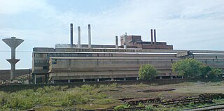
Chinnachowk | |
---|---|
Town | |
Coordinates: 14°28′34″N78°50′20″E / 14.47611°N 78.83889°E Coordinates: 14°28′34″N78°50′20″E / 14.47611°N 78.83889°E | |
Country | |
State | Andhra Pradesh |
District | Cuddapah |
Population (2001) | |
• Total | 64,053 |
Languages | |
• Official | Telugu |
Time zone | IST (UTC+5:30) |
Vehicle registration | AP |
Chinnachowk is a census town in Cuddapah district in the state of Andhra Pradesh, India.
A census town is a type of town that satisfies certain characteristics, depending on the country in which it is located.
Andhra Pradesh is one of the 29 states of India. Situated in the south-east of the country, it is the seventh-largest state in India, covering an area of 162,970 km2 (62,920 sq mi). As per the 2011 census, it is the tenth most populous state, with 49,386,799 inhabitants. The largest city in Andhra Pradesh is Visakhapatnam. Telugu, one of the classical languages of India, is the major and official language of Andhra Pradesh.
India, also known as the Republic of India, is a country in South Asia. It is the seventh largest country by area and with more than 1.3 billion people, it is the second most populous country as well as the most populous democracy in the world. Bounded by the Indian Ocean on the south, the Arabian Sea on the southwest, and the Bay of Bengal on the southeast, it shares land borders with Pakistan to the west; China, Nepal, and Bhutan to the northeast; and Bangladesh and Myanmar to the east. In the Indian Ocean, India is in the vicinity of Sri Lanka and the Maldives, while its Andaman and Nicobar Islands share a maritime border with Thailand and Indonesia.
As of 2001 [update] India census, [1] Chinnachowk had a population of 64,053. Males constitute 51% of the population and females 49%. Chinnachowk has an average literacy rate of 71%, higher than the national average of 59.5%; with male literacy of 78% and female literacy of 64%. 11% of the population is under 6 years of age.
Paharpur is a census town in Gaya district in the Indian state of Bihar.
Chikkanayakana Halli is a town in Tumkur district, in the state of Karnataka, India. It is 67 km away from Tumkur and 132 km from Bangalore.
Choubepur Kalan is a census town in Kanpur district in the state of Uttar Pradesh, India.
Gajsinghpur is a town of Soni caste and a Arora's municipality in Sri Ganganagar district in the Indian state of Rajasthan. Census of 2011 is 9995.
Goredi Chancha is a census town in Nagaur district in the Indian state of Rajasthan.
Jalalpur is a town and a municipal board in Ambedkar Nagar district in the Indian state of Uttar Pradesh.
Kandwa is a census town in Varanasi district in the Indian state of Uttar Pradesh.
Keeripatti is a Town Panchayat in Salem district in the Indian state of Tamil Nadu.
Kurthi Jafarpur is a census town in Mau district in the Indian state of Uttar Pradesh.
Malhargarh is a town and a tehsil in Mandsaur district in the Indian state of Madhya Pradesh. It is located between Neemuch and Mandsaur on the Ratlam- Chittaurgarh Section of Indian railway. Malhargarh is rich in agriculture and part of the Malwa region.
Mallankinaru is a panchayat town in Virudhunagar district in the Indian state of Tamil Nadu.
Melacheval is a panchayat town in Tirunelveli district in the Indian state of Tamil Nadu.
Pratitnagar is a census town in Dehradun district in the Indian state of Uttarakhand.
South Kannanur is a panchayat town in Tiruchirappalli district in the Indian state of Tamil Nadu.
Sahnewal is a town and a nagar council in Ludhiana district in the Indian state of Punjab.
Sriramnagar is a census town in Vizianagaram district of the Indian state of Andhra Pradesh. It is located in Garividi mandal of Vizianagaram revenue division.
Thevaram is a Town Panchayat in Theni district in the Indian state of Tamil Nadu. Thevaram is located in Tamil Nadu near on border of Kerala at the Eastern side foot-hill of Western Ghats. The State Highway SH-100 passes through this town.
Papparapatti is a census town in Salem district in the Indian state of Tamil Nadu.
Mera is a census town in Nirsa CD Block in Dhanbad district in the Indian state of Jharkhand.
Kerur is a City in Bagalkot district in Karnataka, which located on NH 218. It has an average elevation of 617 meters (2024 feet). Its a birthplace of Jagadish Shettar, a former Chief Minister of Karnataka. Kerur is a Town Panchayat city in district of Bagalkot, Karnataka. The Kerur city is divided into 16 wards for which elections are held every five years. The Kerur Town Panchayat has population of 19,731 of which 9,929 are males while 9,802 are females as per report released by Census India 2011.
This article about a location in Kadapa district, Andhra Pradesh is a stub. You can help Wikipedia by expanding it. |