Bhaderwah or Bhadarwah is a town, tehsil, and sub-district in the Doda district of Jammu Division of Jammu and Kashmir, India.

Udaipur district is one of the 50 districts of Rajasthan state in western India. The historic city of Udaipur is the administrative headquarters of the district. The district is part of the Mewar region of Rajasthan.

Lucknow district is a district located in the state of Uttar Pradesh in northern India. The city of Lucknow is the district headquarters and the district is part of Lucknow division. It is also the capital city of Uttar Pradesh. Lucknow is bounded on the east by Barabanki district, on the west by Unnao and Hardoi districts, on the south by Raebareli district and in the north by Sitapur district.
Shahkot is a small city and one of the five tehsils of Jalandhar district in Punjab, India. Shahkot is situated on Jalandhar-Moga-Barnala-Sirsa National Highway 703. Shahkot is administered by the Municipal Committee. About 176 villages belong to Shahkot tehsil.
Gandoh is a tehsil in district Doda of the Indian union territory of Jammu and Kashmir. The village is located on Thathri-Gandoh National Highway.

Varanasi Tehsil is one of three tehsils (sub-districts) in the district of Varanasi in Uttar Pradesh state, India, the other two being Pindra and Raja Talab tehsils. Varanasi tehsil consists of Varanasi city urban and rural areas. It has 38 census towns and 835 villages.

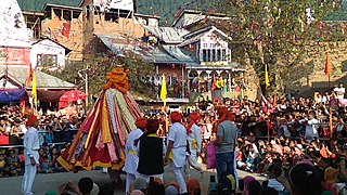
Thathri is a town and a notified area committee in Doda district in the Indian union territory of Jammu and Kashmir. Thathri valley is located in the foothills of the Himalayan mountains, about 85 km from Batote. Apart from having ample forests, the town contains many small streams flowing through its various parts. It is located on the banks of the Chenab River and the town area is spread over 1.50 sq. Km².

Jantroon Dhar or Jantroon Top is a location in the Doda district, in Jammu and Kashmir, India. It is a local hill station and a meadow in the Forest Block area, 15 kilometers away from Thathri. The place is surrounded by lush green meadows, snow in winters and covered with dense vegetation. Thousands of local tourists visit every year for spectating three days dangal-cum-wrestling match.
Zea Abad, is a village in Thathri sub division of Doda district. It is the part of panchayat Jangalwar located on the Batote-Kishtwar National Highway.

Bhalessa is a geographical area within Doda district in the Jammu region of India-administered Kashmir. It consists of the Bunjwah and Bhalessa Valleys, and comprises the three Tehsils of Kahara, Chilly Pingal and Gandoh.

Kahara is a village and tehsil in the Doda district of the Jammu division of the Indian union territory of Jammu and Kashmir. It is situated between mountainous cliffs 13 kilometres (8.1 mi) from Thathri on the Thathri-Gandoh road.
Ranote is a village in the Thathri tehsil of Doda district in the union territory of Jammu and Kashmir, India.
Donadi is a village in Kahara tehsil of Doda district in the Indian union territory of Jammu and Kashmir. It is famous for a hydroelectric power project called Lower Kalnie Power Project Donadi.

Bunjwah is a region and tehsil located in the Kishtwar district of Jammu and Kashmir, India. It comprises nine panchayat and two nayabats; it became a tehsil in 2014.
Phagsoo is a village and tehsil in the Doda district of the Jammu division of Jammu and Kashmir, India. It was previously part of the Thathri tehsil. Also, the biggest village in Doda
Badanoo is a village in Thathri tehsil of Doda district in Jammu and Kashmir. It is located at least 36 kilometres from its district headquarters. This village is the part of Patwar Halqa Jangalwar.
Jangalwar is a village and panchayat in the Thathri tehsil of Doda district in the Jammu division of Jammu and Kashmir, India.
Mahri is a village in Tehsil Thathri of Doda district in Jammu and Kashmir. This village was one of the villages of Chenab Valley which was without electricity till 2022.
Halaran is a village and panchayat located in the Kahara tehsil of Doda district in the Indian administered union territory of Jammu and Kashmir. The village is situated approximately 13 kilometers away from the sub-divisional headquarters, Thathri, and 43 kilometers away from the district headquarters, Doda.
Dalwah is a village located in the Gool tehsil of the Ramban district in the Indian-administered union territory of Jammu and Kashmir. It is situated 37 kilometers away from its district headquarters Ramban.
