
Palakkad is one of the 14 districts in the Indian state of Kerala. It was carved out of the southeastern region of the former Malabar District on 1 January 1957. It is located at the central region of Kerala and is the second largest district in the state after Idukki. The city of Palakkad is the district headquarters. Palakkad is bordered on the northwest by the Malappuram district, on the southwest by the Thrissur district, on the northeast by Nilgiris district, and on the east by Coimbatore district of Tamil Nadu. The district is nicknamed "The granary of Kerala". Palakkad is the gateway to Kerala due to the presence of the Palakkad Gap, in the Western Ghats. The 2,383 m high Anginda peak, which is situated in the border of Palakkad district, Nilgiris district, and Malappuram district, in Silent Valley National Park, is the highest point of elevation in Palakkad district. Palakkad city is about 347 kilometres (216 mi) northeast of the state capital, Thiruvananthapuram.
Padiyoor is a small town in Kannur district of Kerala state, India. Padiyoor village is part of Padiyoor-Kalliad Grama Panchayat in Iritty taluk.
Alathur is a town, taluk and gram panchayat in Palakkad District, Kerala, India. It is the administrative headquarters of the Alathur Taluk and is situated about 24 km from the district headquarters Palakkad through National Highway 544.Gayathripuzha River, one of the tributary of Bharathapuzha, flows through Alathur. Alathur is one among the 20 Parliamentary Constituencies in Kerala. A Mini Civil Station is also located here which provides government related services.

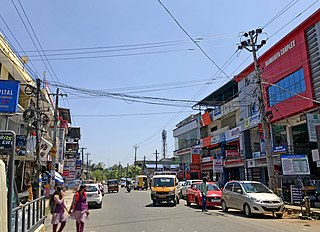
Chittur-Thathamangalam is a town and municipality in Palakkad district of Kerala State, India. It is the headquarters of Chittur taluk, 13 km (8.1 mi) south-east of Palakkad, on the banks of the Kannadipuzha, a major headstream of the Bharathapuzha, the second longest river in Kerala. A Mini Civil Station is also located here which provides government related services. It consists of two areas, Chittur and Thathamangalam which together form the municipality.
Panniyannur is a census town in Thalassery taluk of Kannur district in the Indian state of Kerala. It is part of Greater Mahé Region.
Udumbanchola is a taluk in Idukki district of the Indian state of Kerala. This is in the high ranges. Nedumkandam is the major town and capital of Udumbanchola taluk. Mathikettan Shola National Park is located in Udumbanchola.

Bison valley is a village in Udumbanchola Taluk in the Idukki district of the southwestern Indian state of Kerala. Bison valley is situated at around 914 metres (3000 ft) above mean sea level, in the Western Ghats range of mountains.
Eruvatti is a census town in Thalassery taluk of Kannur district in the Indian state of Kerala.
Vayakkara is a village located in Payyanur Taluk of Kannur district in the Indian state of Kerala.
Karindalam is a village in Kasaragod district in the state of Kerala, India.
Kollengode is a town in Palakkad district, Kerala, India. Kollengode Town is the headquarters of Kollengode Grama Panchayat and Kollengode Block Panchayat.
Nallepilly is a village in the Palakkad district, state of Kerala, India. It is the main village of the Nalleppilly gram panchayat and forms a part of Chittur taluk.
Thekkedesom is a village in the Palakkad district, state of Kerala, India. It forms a part of the Nalleppilly gram panchayat, which is itself subordinate to the Chittur taluk.

Kottakamboor is a village in Devikulam taluk of Idukki district in the state of Kerala, in southwestern India.
Eruvessi is a village in Irikkur Block Panchayat, Taliparamba Taluk, Kannur district in Kerala, India, around 50 kilometers from Kannur. It was ruled by Mannanar dynasty of Muthedath Aramana and Elayadath Aramana.

Agali is a village in Palakkad district in the state of Kerala, India. It forms a part of the Agali Grama Panchayat.

Palakkad District has four types of administrative hierarchies:
Devikulam taluk is one of the 5 taluks in Idukki district of the Indian state of Kerala. Devikulam taluk comprises 13 villages.

Peerumedu taluk is one of the 5 taluks in Idukki district in the Indian state of Kerala. It consists of 10 revenue villages.
Kottathara is a village in the Sholayur grama panchayat of Palakkad district in Kerala state, India. It was earlier part of Mannarkkad taluk prior to the formation of Attappady taluk.


