
Lublin County is a unit of territorial administration and local government (powiat) in Lublin Voivodeship, eastern Poland. It was established on January 1, 1999, as a result of the Polish local government reforms passed in 1998. Its administrative seat is the city of Lublin, although the city is not part of the county. The only towns in Lublin County are Bełżyce, which lies 23 km (14 mi) west of Lublin, and Bychawa, 26 km (16 mi) south of Lublin.

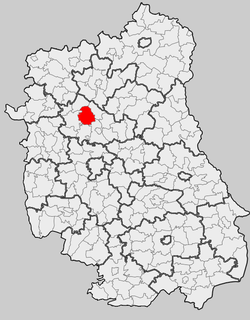
Wandzin is a village in the administrative district of Gmina Lubartów, within Lubartów County, Lublin Voivodeship, in eastern Poland. It lies approximately 6 kilometres (4 mi) south-west of Lubartów and 22 km (14 mi) north-west of the regional capital Lublin. Moreover Wandzin produce Easter palms.
Annobór is a village in the administrative district of Gmina Lubartów, within Lubartów County, Lublin Voivodeship, in eastern Poland. It lies approximately 4 kilometres (2 mi) south of Lubartów and 21 km (13 mi) north of the regional capital Lublin.
Annobór-Kolonia is a village in the administrative district of Gmina Lubartów, within Lubartów County, Lublin Voivodeship, in eastern Poland. It lies approximately 6 kilometres (4 mi) south of Lubartów and 20 km (12 mi) north of the regional capital Lublin.
Brzeziny is a village in the administrative district of Gmina Lubartów, within Lubartów County, Lublin Voivodeship, in eastern Poland. It lies approximately 6 kilometres (4 mi) south of Lubartów and 20 km (12 mi) north of the regional capital Lublin.
Wola Lisowska is a village in the administrative district of Gmina Lubartów, within Lubartów County, Lublin Voivodeship, in eastern Poland. It lies approximately 7 kilometres (4 mi) north-west of Lubartów and 30 km (19 mi) north of the regional capital Lublin.
Gmina Firlej is a rural gmina in Lubartów County, Lublin Voivodeship, in eastern Poland. Its seat is the village of Firlej, which lies approximately 12 kilometres (7 mi) north-west of Lubartów and 35 km (22 mi) north of the regional capital Lublin.

Gmina Niedźwiada is a rural gmina in Lubartów County, Lublin Voivodeship, in eastern Poland. Its seat is the village of Niedźwiada, which lies approximately 10 kilometres (6 mi) north-east of Lubartów and 34 km (21 mi) north of the regional capital Lublin.

Gmina Ostrówek is a rural gmina in Lubartów County, Lublin Voivodeship, in eastern Poland. Its seat is the village of Ostrówek, which lies approximately 13 kilometres (8 mi) north of Lubartów and 37 km (23 mi) north of the regional capital Lublin.
Gmina Serniki is a rural gmina in Lubartów County, Lublin Voivodeship, in eastern Poland. Its seat is the village of Serniki, which lies approximately 6 kilometres (4 mi) south-east of Lubartów and 22 km (14 mi) north of the regional capital Lublin.
Sosnówka is a village in the administrative district of Gmina Abramów, within Lubartów County, Lublin Voivodeship, in eastern Poland. It lies approximately 3 kilometres (2 mi) north of Abramów, 20 km (12 mi) west of Lubartów, and 31 km (19 mi) north-west of the regional capital Lublin.
Skrobów is a village in the administrative district of Gmina Lubartów, within Lubartów County, Lublin Voivodeship, in eastern Poland. It lies approximately 4 kilometres (2 mi) west of Lubartów and 25 km (16 mi) north of the regional capital Lublin.
Trójnia is a village in the administrative district of Gmina Lubartów, within Lubartów County, Lublin Voivodeship, in eastern Poland. It lies approximately 8 kilometres (5 mi) north of Lubartów and 32 km (20 mi) north of the regional capital Lublin.
Lisów is a village in the administrative district of Gmina Lubartów, within Lubartów County, Lublin Voivodeship, in eastern Poland. It lies approximately 6 kilometres (4 mi) south of Lubartów and 20 km (12 mi) north of the regional capital Lublin.
Mieczysławka is a village in the administrative district of Gmina Lubartów, within Lubartów County, Lublin Voivodeship, in eastern Poland. It lies approximately 6 kilometres (4 mi) south of Lubartów and 20 km (12 mi) north of the regional capital Lublin.
Nowodwór is a village in the administrative district of Gmina Lubartów, within Lubartów County, Lublin Voivodeship, in eastern Poland. It lies approximately 6 kilometres (4 mi) south of Lubartów and 20 km (12 mi) north of the regional capital Lublin.
Szczekarków is a village in the administrative district of Gmina Lubartów, within Lubartów County, Lublin Voivodeship, in eastern Poland. It lies approximately 6 kilometres (4 mi) south of Lubartów and 20 km (12 mi) north of the regional capital Lublin.
Wincentów is a village in the administrative district of Gmina Lubartów, within Lubartów County, Lublin Voivodeship, in eastern Poland. It consists of a scattering of farmsteads across flat arable land to the west of highway 19. It lies approximately 6 kilometres (4 mi) south of Lubartów and 20 km (12 mi) north of the regional capital Lublin.


