
Karnice is a village in the administrative district of Gmina Żmigród, within Trzebnica County, Lower Silesian Voivodeship, in south-western Poland. Prior to 1945 it was in Germany.
Starczówek is a village in the administrative district of Gmina Ziębice, within Ząbkowice Śląskie County, Lower Silesian Voivodeship, in south-western Poland. Prior to 1945 it was in Germany.
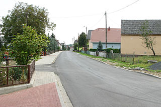
Kwiatkowo is a village in the administrative district of Gmina Bądkowo, within Aleksandrów County, Kuyavian-Pomeranian Voivodeship, in north-central Poland.
Wielkie Lniska is a village in the administrative district of Gmina Grudziądz, within Grudziądz County, Kuyavian-Pomeranian Voivodeship, in north-central Poland. It lies approximately 5 kilometres (3 mi) south-east of Grudziądz and 52 km (32 mi) north of Toruń.
Kolonia is a village in the administrative district of Gmina Żmudź, within Chełm County, Lublin Voivodeship, in eastern Poland.
Józefów is a village in the administrative district of Gmina Poddębice, within Poddębice County, Łódź Voivodeship, in central Poland. It lies approximately 11 kilometres (7 mi) north-west of Poddębice and 47 km (29 mi) north-west of the regional capital Łódź.
Mętków is a village in the administrative district of Gmina Babice, within Chrzanów County, Lesser Poland Voivodeship, in southern Poland. It lies approximately 6 kilometres (4 mi) west of Babice, 10 km (6 mi) south of Chrzanów, and 41 km (25 mi) west of the regional capital Kraków.

Słomiana is a village in the administrative district of Gmina Słupia Konecka, within Końskie County, Świętokrzyskie Voivodeship, in south-central Poland. It lies approximately 5 kilometres (3 mi) north-east of Słupia, 25 km (16 mi) south-west of Końskie, and 37 km (23 mi) north-west of the regional capital Kielce.
Bidziny is a village in the administrative district of Gmina Wojciechowice, within Opatów County, Świętokrzyskie Voivodeship, in south-central Poland. It lies approximately 3 kilometres (2 mi) east of Wojciechowice, 15 km (9 mi) east of Opatów, and 72 km (45 mi) east of the regional capital Kielce.
Milejowice is a village in the administrative district of Gmina Waśniów, within Ostrowiec County, Świętokrzyskie Voivodeship, in south-central Poland. It lies approximately 7 kilometres (4 mi) south of Waśniów, 16 km (10 mi) south-west of Ostrowiec Świętokrzyski, and 44 km (27 mi) east of the regional capital Kielce.
Nadbrzeż is a village in the administrative district of Gmina Karczew, within Otwock County, Masovian Voivodeship, in east-central Poland. It lies approximately 5 kilometres (3 mi) south-west of Karczew, 8 km (5 mi) south-west of Otwock, and 24 km (15 mi) south-east of Warsaw.
Kuczków is a village in the administrative district of Gmina Pleszew, within Pleszew County, Greater Poland Voivodeship, in west-central Poland.
Obreda is a settlement in the administrative district of Gmina Książ Wielkopolski, within Śrem County, Greater Poland Voivodeship, in west-central Poland.
Bogaczów is a village in the administrative district of Gmina Trzebiel, within Żary County, Lubusz Voivodeship, in western Poland, close to the German border. It lies approximately 3 kilometres (2 mi) south-east of Trzebiel, 21 km (13 mi) west of Żary, and 58 km (36 mi) south-west of Zielona Góra.
Mochów, German Mochau, is a village in the administrative district of Gmina Głogówek, within Prudnik County, Opole Voivodeship, in south-western Poland, close to the Czech border. It lies approximately 3 kilometres (2 mi) north-west of Głogówek, 20 km (12 mi) east of Prudnik, and 35 km (22 mi) south of the regional capital Opole.
Malary is a village in the administrative district of Gmina Skarszewy, within Starogard County, Pomeranian Voivodeship, in northern Poland. It lies approximately 6 kilometres (4 mi) west of Skarszewy, 15 km (9 mi) north-west of Starogard Gdański, and 40 km (25 mi) south-west of the regional capital Gdańsk.
Miejski Las is a settlement in the administrative district of Gmina Mrągowo, within Mrągowo County, Warmian-Masurian Voivodeship, in northern Poland. It lies approximately 4 kilometres (2 mi) south-east of Mrągowo and 56 km (35 mi) east of the regional capital Olsztyn.
Dragolice is a village in the administrative district of Gmina Łukta, within Ostróda County, Warmian-Masurian Voivodeship, in northern Poland. It lies approximately 3 kilometres (2 mi) west of Łukta, 14 km (9 mi) north-east of Ostróda, and 30 km (19 mi) west of the regional capital Olsztyn.
Konotop is a village in the administrative district of Gmina Drawno, within Choszczno County, West Pomeranian Voivodeship, in north-western Poland. It lies approximately 10 kilometres (6 mi) south-east of Drawno, 30 km (19 mi) east of Choszczno, and 89 km (55 mi) east of the regional capital Szczecin.
Utonie is a settlement in the administrative district of Gmina Myślibórz, within Myślibórz County, West Pomeranian Voivodeship, in north-western Poland.


