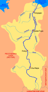
Chulym River (Malye Chany Lake)

Last updated
Chulym River Chulym.JPG
Chulym River

Chulym (Russian : Чулым) is a river in the endorheic drainage basin of Lake Chany in the southeastern part of the West Siberian Plain in Russia. The river is 392 kilometres (244 mi) long, with a drainage basin of 17,900 square kilometres (6,900 sq mi).

Russian language East Slavic language

Russian is an East Slavic language, which is official in the Russian Federation, Belarus, Kazakhstan and Kyrgyzstan, as well as being widely used throughout Eastern Europe, the Baltic states, the Caucasus and Central Asia. It was the de facto language of the Soviet Union until its dissolution on 25 December 1991. Although, nowadays, nearly three decades after the breakup of the Soviet Union, Russian is used in official capacity or in public life in all the post-Soviet nation-states, as well as in Israel and Mongolia, the rise of state-specific varieties of this language tends to be strongly denied in Russia, in line with the Russian World ideology.

Lake Chany lake

Lake Chany is one of the largest lakes in Russia. It is a shallow, freshwater lake that has a fluctuating water level, which can change from season to season and year to year. A variety of ecosystems that surround the lake include a mixture of wetlands, salt marshes, and a mixture of birch and aspen forests. Lake Chany in particular is critically important for the migratory birds of Siberia, and is listed as a Ramsar Site of International Importance.
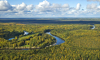
West Siberian Plain large plain that occupies the western portion of Siberia

The West Siberian Plain, also known as Zapadno-sibirskaya Ravnina, is a large plain that occupies the western portion of Siberia, between the Ural Mountains in the west and the Yenisei River in the east, and by the Altay Mountains on the southeast. Much of the plain is poorly drained and consists of some of the world's largest swamps and floodplains. Important cities include Omsk, Novosibirsk, Tomsk and Chelyabinsk.

The Chulym is formed by several tributaries in the Toyskoye Zaymishche (Russian: Тойское Займище) and Troshinskoye Zaymishche (Russian: Трошинское Займище) swamps north of Baraba Steppe, some 100 kilometres (62 mi) northwest of Novosibirsk, at an elevation of 150 metres (490 ft). The river flows over the Baraba Steppe in a southwesterly direction, and flows through the lakes of Sargul (Russian: Саргуль), 34.6 square kilometres (13.4 sq mi), and Uryum (Russian: Урюм), 84.1 square kilometres (32.5 sq mi), before it finally terminates, at 106 metres (348 ft) elevation, in Malyye Chany Lake (Russian: Малые Чаны Little Chany), which is connected to Lake Chany through a short strait.

Novosibirsk City in Novosibirsk Oblast, Russia

Novosibirsk is the third-most populous city in Russia, after Moscow and St. Petersburg. It is the most populous city in Asian Russia, with a population of 1,612,833 as of the 2018 Census, and is the administrative center of Novosibirsk Oblast as well as of the Siberian Federal District.

Strait A naturally formed, narrow, typically navigable waterway that connects two larger bodies of water

A strait is a naturally formed, narrow, typically navigable waterway that connects two larger bodies of water. Most commonly it is a channel of water that lies between two land masses. Some straits are not navigable, for example because they are too shallow, or because of an unnavigable reef or archipelago.

In its lower reaches the river is some 30 metres (98 ft) wide and 5 metres (16 ft) deep. Its main tributaries are the Suma River (left), and the Kargat River (right).
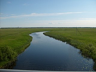
Kargat River river in Russia

The Kargat is a river in Novosibirsk Oblast, Russia. It is a right tributary of the Chulym River. The Kargat is 387 kilometres (240 mi) in length, with a drainage basin of 7,200 square kilometres (2,800 sq mi)

In its upper course is the town of Chulym, named after the river. Here the river is crossed by the Trans-Siberian Railway and the M51 highway.
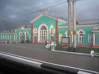
Chulym, Chulymsky District, Novosibirsk Oblast Town in Novosibirsk Oblast, Russia

Chulym is a town and the administrative center of Chulymsky District in Novosibirsk Oblast, Russia, located on the Chulym River 131 kilometers (81 mi) of Novosibirsk, the administrative center of the oblast. Population: 11,568 (2010 Census); 12,275 (2002 Census); 13,703 (1989 Census). It was previously known as Chulymskoye.

Trans-Siberian Railway network of railways connecting Moscow with the Russian Far East and the Sea of Japan

The Trans-Siberian Railway is a network of railways connecting Moscow with the Russian Far East. With a length of 9,289 kilometres, from Moscow to Vladivostok, it is the longest railway line in the world. There are connecting branch lines into Mongolia, China and North Korea. It has connected Moscow with Vladivostok since 1916, and is still being expanded.

The Chulym is frozen over from November to April or May.

Coordinates: 54°36′22″N78°05′51″E / 54.6061°N 78.0975°E / 54.6061; 78.0975

Geographic coordinate system Coordinate system

A geographic coordinate system is a coordinate system that enables every location on Earth to be specified by a set of numbers, letters or symbols. The coordinates are often chosen such that one of the numbers represents a vertical position and two or three of the numbers represent a horizontal position; alternatively, a geographic position may be expressed in a combined three-dimensional Cartesian vector. A common choice of coordinates is latitude, longitude and elevation. To specify a location on a plane requires a map projection.


Related Research Articles

Ob River river in Russia, the second longest river in Asia

The Ob River, also Ob', is a major river in western Siberia, Russia, and is the world's seventh-longest river. It forms at the confluence of the Biya and Katun Rivers which have their origins in the Altay Mountains. It is the westernmost of the three great Siberian rivers that flow into the Arctic Ocean.

Rivers in Himachal Pradesh Wikimedia list article

Himachal Pradesh provides water to both the Indus and Ganges basins. The drainage systems of the region are the Chandra Bhaga or the Chenab, the Ravi, the Beas, the Sutlej and the Yamuna. These rivers are perennial and are fed by snow and rainfall. They are protected by an extensive cover of natural vegetation.

Boyne River (Central Queensland) river in Central Queensland, Australia

The Boyne River is a river located in Central Queensland, Australia.

Kazim is a river in Russia. It flows over the West Siberian Plain, and is a right tributary of the Ob. The Kazim is 659 kilometres (409 mi) long, with a drainage basin of 35,600 square kilometres (13,700 sq mi). Its average discharge is 267 cubic metres per second (9,400 cu ft/s).

Bolshoy Uzen River river

The Bolshoy Uzen is a river in Saratov Oblast of Russia and West Kazakhstan Province of Kazakhstan. It is 650 kilometres (400 mi) long, with a drainage basin of 15,600 square kilometres (6,000 sq mi).

Karasuk is a river in Novosibirsk Oblast, Russia. It is 531 kilometres (330 mi) long, with a drainage basin of 11,300 square kilometres (4,400 sq mi).

Markha is a river in the Sakha Republic in Russia. It is a left tributary of the Vilyuy River. Markha is 1,181 kilometres (734 mi) long, with a drainage basin of 99,000 square kilometres (38,000 sq mi). Its average discharge is 405 cubic metres per second (14,300 cu ft/s). The river has its sources on the Vilyuy Plateau, a part of the Central Siberian Plateau.

Inya River river in Russia

Inya is a river in Kemerovo and Novosibirsk Oblasts of Russia. It is a right tributary of the Ob River. It is 663 kilometres (412 mi) long, with a drainage basin of 17,600 square kilometres (6,800 sq mi).

Bely Iyus is a river in the republic of Khakassia in Russia. A right tributary of the Chulym River, it is 224 kilometres (139 mi) long, with a drainage basin of 5,370 square kilometres (2,070 sq mi).

Kiya River river in Russia

Kiya is a river in Tomsk and Kemerovo Oblasts of Russia. It is a tributary of the Chulym, and is 548 kilometres (341 mi) long, with a drainage basin of 32,200 square kilometres (12,400 sq mi). The river has its sources in the Kuznetsky Alatau and flows in a northwesterly direction to its mouth in the Chulym River some 40 kilometres (25 mi) upriver from the town of Asino.

Biryusa River river in Russia

Biryusa is a river in Irkutsk Oblast, Russia. The Biryusa is 1,012 kilometres (629 mi) long, with a drainage basin of 55,800 square kilometres (21,500 sq mi).

Borzya is a river in Zabaykalsky Krai, Russia. It is a right tributary of the Onon River. It is 304 kilometres (189 mi) long, with a drainage basin of 7,080 square kilometres (2,730 sq mi).

The Dudypta River is a river in Krasnoyarsk Krai in Russia, a right tributary of the Pyasina River. The river is 687 kilometres (427 mi) long, and its drainage basin covers 33,100 square kilometres (12,800 sq mi). The Dudypta River originates from Lake Makar and flows over the central part of the North Siberian Plain. The river is navigable for 150 kilometres (93 mi) upstream from its estuary.

Sit River river in Russia

The Sit' River (Сить) is a tributary of the Rybinsk Reservoir. The river flows for 159 kilometres (99 mi) through Sonkovsky District of Tver Oblast and Nekouzsky and Breytovsky Districts of Yaroslavl Oblasts of Russia before entering the Rybinsk Reservoir near the large village of Breitovo. Its average width varies from 40 to 50 metres. The river mouth is about 1,500 metres (4,900 ft) wide. The drainage basin occupies some 1,900 square kilometres (730 sq mi). The river is 159 kilometres (99 mi) long.

Subansiri River river in India

The Subansiri River is a tributary of the Brahmaputra River in the Indian states of Assam and Arunachal Pradesh, and the Tibet Autonomous Region of China. The Subansiri is 442 kilometres (275 mi) long, with a drainage basin 32,640 square kilometres (12,600 sq mi) large. The Subansiri is the largest tributary of the Brahmaputra. Its maximum observed discharge was 18,799 cubic metres per second (663,900 cu ft/s), and its minimum 131 m3/s (4,600 cu ft/s). It contributes 7.92% of the Brahmaputra's total flow.

Selennyakh River river in Sakha Republic, Russia

The Selennyakh is a river in Sakha Republic, Russia. It is a left tributary of the Indigirka River.

Lake Volgo is a lake in Ostashkovsky, Penovsky, and Selizharovsky Districts of Tver Oblast, Russia. The Volga River flows through the lake in its upper course. The area of the lake is 61 square kilometres (24 sq mi), and the area of its drainage basin is 3,500 square kilometres (1,400 sq mi). The urban-type settlement of Peno is located on the western bank of the lake.

Lake Ubinskoye lake in Novosibirsk Oblast, Russia

Lake Ubinskoye is a freshwater lake located in the Baraba steppe in Novosibirsk Oblast, Russia, where it is divided between Ubinsky District in the west and Kargatsky District in the east. The name of the lake derives from Siberian Tatar ubu, meaning swamp or marsh.