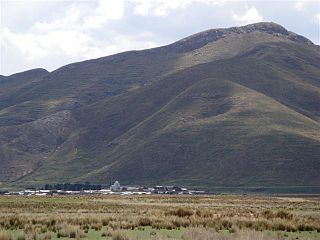
Omasuyos or Uma Suyu is a province in the La Paz Department in Bolivia. Its capital is Achacachi.

Chaupi Orco or Viscachani is a mountain in the Andes on the border of Bolivia and Peru. It has a height of 6,044 metres (19,829 ft). On the Bolivian side it is located in the La Paz Department, Franz Tamayo Province, Pelechuco Municipality, and on the Peruvian side it lies in the Puno Region, Putina Province, Sina District. It lies north of Salluyu.
Paraccra is an archaeological site in the Andes of Peru on a mountain of the same name. It is situated in the Arequipa Region, Caylloma Province, Sibayo District, near the Colca River. The site contains towers, round houses and black walls.

Pukarani is a mountain with an archaeological site of the same name in the Andes of Peru, about 4,301.9 m (14,114 ft) high. It is located in the Puno Region, Lampa Province, Nicasio District.

Millo is a mountain in the Vilcanota mountain range in the Andes of Peru, about 5,500 metres (18,045 ft) high. It is situated in the Cusco Region, Canchis Province, Checacupe District, and in the Puno Region, Carabaya Province, Corani District. Millo lies northwest of the large glaciated area of Quelccaya and west of Unollocsina.

Huilacollo is a mountain in the Andes of southern Peru which reaches a height of approximately 5,000 m (16,000 ft). It is located in the Tacna Region, Candarave Province, on the border of the districts of Camilaca and Candarave. Huilacollo lies southwest of the Tutupaca volcano and east of Sallajaque.

Quellhuacota is a mountain in the Vilcanota mountain range in the Andes of Peru, about 5,300 metres (17,388 ft) high. It is located in the Cusco Region, Canchis Province, San Pablo District, and in the Puno Region, Melgar Province, Nuñoa District. It is situated southwest of the mountains Jochajucho, Jatun Sallica and Wiqu, and northeast of the mountain Sampu.

Tutallipina is a mountain in the Vilcanota mountain range in the Andes of Peru, about 5,200 metres (17,060 ft) high. It is situated in the Cusco Region, Canchis Province, Checacupe District, and in the Puno Region, Carabaya Province, Corani District. Tutallipina lies southwest of the mountain Otoroncane and Huancane Apacheta and south of Sayrecucho.

Jachatira is a 5,320-metre-high (17,450 ft) mountain in the Vilcanota mountain range in the Andes of Peru. It is situated in the Puno Region, Carabaya Province, Corani District, west of Corani (Qurani). Jachatira lies northwest of Tarucani in the eastern part of the large glaciated area of Quelccaya.

Wilaquta is a mountain in the Peruvian Andes, about 5,100 metres (16,732 ft) high. It is situated in the Moquegua Region, Mariscal Nieto Province, Carumas District, and in the Puno Region, Puno Province, Acora District. Wilaquta lies north of the lake Aqhuyach'alla and southeast of the mountain Qurini.

Wila Chunkara is a mountain in the Andes of southern Peru, about 4,800 metres (15,748 ft) high. It is situated in the Puno Region, El Collao Province, on the border of the districts Capazo and Santa Rosa. Wila Chunkara lies northwest of the mountain Jiwaña and the plain named Jiwaña Pampa (Jihuaña Pampa). The Jiwaña River (Jihuaña) originates near the mountain. It flows through the plain before it reaches the Mawri River (Mauri).

Viluyo is a mountain in the Vilcanota mountain range in the Andes of Peru, about 5,200 metres (17,060 ft) high. It is located in the Cusco Region, Canchis Province, Pitumarca District, east of Sibinacocha. It lies south and southwest of Condoriquiña.

Chhijmuni is a 5,080-metre-high (16,667 ft) mountain in the Wansu mountain range in the Andes of Peru. It is located in the Arequipa Region, La Unión Province, Puyca District. Chhijmuni lies south of Wayta Urqu.

Wila Quta is a mountain in the Wansu mountain range in the Andes of Peru, about 5,100 metres (16,732 ft) high. It is situated in the Apurímac Region, Antabamba Province, Antabamba District, and in the Arequipa Region, La Unión Province, Huaynacotas District. Wila Quta lies west of Taruja Marka and Allqa Walusa and southeast of Wallqa Wallqa.

Lluqu Chuyma is a mountain in the Wansu mountain range in the Andes of Peru, about 5,000 metres (16,404 ft) high. It is situated in the Apurímac Region, Antabamba Province, Antabamba District. Lluqu Chuyma lies southwest of Llulluch'a.

Millka is an archaeological site in Peru. It is located in the Ayacucho Region, Víctor Fajardo Province, Sarhua District, northeast of Sarhua. The site of the Chanka period lies on top of a mountain at 3,500 m (11,483 ft).

Cóndor Sallani is a 5,102-metre-high (16,739 ft) mountain in the Vilcanota mountain range in the Andes of Peru. It is situated in the Cusco Region, Canchis Province, Checacupe District.
Mullu Q'awa is an archaeological site in Peru on a mountain of that name. It is located in the Cusco Region, Espinar Province, Alto Pichigua District. It lies near the village of Mullu Q'awa (Molloccahua, Molloqhawa). It is situated on top of the mountain at a height of about 4,000 m (13,000 ft).

Lluqu Qullu is a mountain in the Barroso mountain range in the Andes of Peru, about 5,000 m (16,000 ft) high. It is located in the Tacna Region, Tacna Province, Palca District, and in the Tarata Province, Tarata District.

Chuqi Quta is a mountain in the Andes of Peru, about 5,200 metres (17,060 ft) high. It is located in the Puno Region, El Collao Province, Santa Rosa District. It lies southwest of Jisk'a Mawruma.


