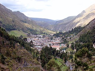
Huallanca or Wallanka is a district of the Bolognesi Province in the Ancash Region of Peru.

The Huallanca mountain range (possibly from Quechua, wallanka mountain range; a cactus plant ; also called Chaupi Janca or Shicra Shicra lies in the Andes of Peru. It is located in the Ancash Region, Bolognesi Province. The Huallanca mountain range is a small range southeast of the Cordillera Blanca and north of the Huayhuash mountain range extending between 9°52' and 10°03'S and 76°58' and 77°04'W for about 19 km in a northeasterly direction.
Lake Niancocha is a lake in the Huallanca District of Bolognesi Province, in Peru's Ancash Region. It is northeast of the Cordillera Huayhuash, south of Lake Condorcocha and northwest of Mount Chonta.
Yanashallash, Yanashalla, or Yanashayash is a mountain in the north of the Wallanka mountain range in the Andes of Peru, about 4,600 m (15,100 ft) high.
Huallanca, also known as Burro, is a 5,470 m (17,950 ft)) high mountain in the Andes of Peru. It is the highest peak in the Huallanca mountain range. Huallanca is located in the Ancash Region, Bolognesi Province, in the districts of Aquia and Huallanca. It is situated in the northern half of the range, southeast of the Yanashallash pass and the peaks of Tankan, Ch'uspi and Tankanqucha. Kuntur Wayi lies southwest of it. Winchus 4,795 m (15,732 ft)) is the peak west of Wallanka at the Tuna Kancha valley.

Kuntur Wayi or Kuntur Wayin is a 5,171-metre-high (16,965 ft) mountain in the Wallanka mountain range in the Andes of Peru. It is situated in the Ancash Region, Bolognesi Province, on the border of the districts of Aquia and Huallanca. Kuntur Wayi lies east of the Minapata valley, southwest of Kunkush, south of Wallanka and southeast of Minapata.
Tankan or Ruq'a Qaqa, qaqa rock, Hispanicized Rucagaga) is a 5,162-metre-high (16,936 ft) mountain in the northern part of the Wallanka mountain range in the Andes of Peru. It is located in the Ancash Region, Bolognesi Province, in the districts of Aquia and Huallanca.
Chawpi Hanka is a mountain in the Andes of Peru, about 4,800 m (15,748 ft) high. It is situated in the Ancash Region, Bolognesi Province, in the districts of Huallanca and Huasta, and the Huánuco Region Lauricocha Province, Queropalca District. It lies on a ridge north of the Waywash mountain range.
Tancancocha is a mountain in the north of the Huallanca mountain range in the Andes of Peru at a small lake of that name. The mountain reaches an altitude of approximately 5,200 m (17,100 ft). It is located in the Ancash Region, Bolognesi Province, in the districts of Aquia and Huallanca.
Chaupijanca or Chaupi Janca is a 5,283-metre-high (17,333 ft) mountain in the Huallanca mountain range in the Andes of Peru. It is located in the Ancash Region, Bolognesi Province, in the districts of Huallanca and Huasta.

Calapo or Kallapu is a mountain in the Huallanca mountain range in the Andes of Peru which reaches an altitude of approximately 4,800 m (15,700 ft). It is located in the Ancash Region, Bolognesi Province, Aquia District, east of the town of Pachapaqui.
Puma Wayin is a mountain in the Andes of Peru which reaches a height of approximately 4,400 m (14,436 ft). It is located in the Ancash Region, Bolognesi Province, Huallanca District, east of Ismu Cruz.
Pampacocha is a lake in the south of the Huallanca mountain range in the Andes of Peru. It is situated at a height of 4,408 m (14,462 ft) comprising an area of 0.020234 km2 (20,234 m2). Pampacocha is located in the Ancash Region, Bolognesi Province, Huallanca District, near a lake named Suerococha.
Mama Hirka is a mountain in the Andes of Peru which reaches a height of approximately 4,200 m (13,800 ft). It is located in the Ancash Region, Bolognesi Province, Huallanca District.
Millwa Qaqa is a mountain in the Andes of Peru which reaches a height of approximately 4,600 m (15,100 ft). It is located in the Ancash Region, Bolognesi Province, Huallanca District.
Yanajirca or Yana Hirka is a mountain in the Andes of Peru which reaches an altitude of approximately 4,800 m (15,700 ft). It is located in the Ancash Region, Bolognesi Province, on the border of the districts of Huallanca and Huasta. Yana Hirka lies east of Wamash Mach'ay.
Yanajirca or Yana Hirka is a mountain in the Andes of Peru which reaches an altitude of approximately 4,600 m (15,100 ft). It is located in the Ancash Region, Bolognesi Province, Huallanca District. Yana Hirka lies southeast of the Wallanka mountain range.
Chancayoc or Chhankayuq is a mountain in the Andes of Peru which reaches an altitude of approximately 4,800 m (15,700 ft). It is located in the Ancash Region, Bolognesi Province, Huasta District. Chancayoc lies near Pisqan Punta, southwest of the Huallanca mountain range.
Muya Wayin is a mountain in the eastern extensions of the Wallanka mountain range in the Andes of Peru which reaches a height of approximately 4,600 m (15,092 ft). It is located in the Ancash Region, Bolognesi Province, Huallanca District. Muya Wayin lies on a ridge east of Wallanka, west of Yana Pukyu.
Rupha Wayi is a mountain in the Andes of Peru which reaches a height of approximately 4,400 m (14,436 ft). It is located in the Ancash Region, Bolognesi Province, Huallanca District.

