
The Mohawk River is a 149-mile-long (240 km) river in the U.S. state of New York. It is the largest tributary of the Hudson River. The Mohawk flows into the Hudson in Cohoes, New York, a few miles north of the city of Albany. The river is named for the Mohawk Nation of the Iroquois Confederacy. It is a major waterway in north-central New York. The largest tributary, the Schoharie Creek, accounts for over one quarter (26.83%) of the Mohawk River's watershed. Another main tributary is the West Canada Creek which makes up for 16.33% of the Mohawk's watershed.

The Chenango River is a 90-mile-long (140 km) tributary of the Susquehanna River in central New York in the United States. It drains a dissected plateau area in upstate New York at the northern end of the Susquehanna watershed.

Oneida Lake is the largest lake entirely within New York State, with a surface area of 79.8 square miles (207 km2). The lake is located northeast of Syracuse and near the Great Lakes. It feeds the Oneida River, a tributary of the Oswego River, which flows into Lake Ontario. From the earliest times until the opening of the Erie Canal in 1825, the lake was part of an important waterway connecting the Atlantic seaboard of North America to the continental interior.
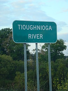
The Tioughnioga River is a 34.2-mile-long (55.0 km) tributary of the Chenango River in central New York in the United States. It drains a dissected plateau area east of the Finger Lakes at the northernmost edge of the watershed of the Susquehanna River.
The Otselic River(aht-SEEL-ik), formerly known as Otselic Creek is a 55.4-mile-long (89.2 km) tributary of the Tioughnioga River in central New York in the United States. It drains a hilly area, mostly forested and agricultural, east of the Finger Lakes at the northern edge of the Susquehanna River watershed.

Lassen National Forest is a United States national forest of 1,700 square miles (4,300 km2) in northeastern California. It is named after pioneer Peter Lassen, who mined, ranched and promoted the area to emigrant parties in the 1850s.

The West Canada Creek is a 76-mile-long (122 km) river in upstate New York, United States. West Canada Creek is an important water way in Hamilton, Oneida, and Herkimer counties, draining the south part of the Adirondack Mountains before emptying into the Mohawk River near the Village of Herkimer. The name "Canada" is derived from a Native American word for "village" (Kanata).

Colma Creek is a small creek that flows to the San Francisco Bay from its source in the Crocker Hills portion of San Bruno Mountain State and County Park, north of San Mateo County's Guadalupe Canyon Parkway, with contribution from April Brook on San Bruno Mountain proper, south of the Parkway. It flows southwest and makes a 90 degree bend in Daly City to flow southeastward, through Daly City, Colma, and South San Francisco to the bay. Its small delta is between South San Francisco and the San Francisco International Airport.
Popolopen is the name of several related landmarks mainly within the Hudson Highlands of Orange County, New York. These include a mountain, Popolopen Torne—or simply "The Torne", and a short and steep-sided nearby valley officially called Hell Hole, but often Popolopen Gorge. Popolopen Creek runs through this valley. The Popolopen Bridge spans its mouth at the Hudson River and is crossed by Route 9W. Popolopen Lake feeds the headwaters of its namesake creek. Despite local usage, the United States Board on Geographical Names recognizes only the lake, creek and bridge as bearing the name "Popolopen."

Wappinger Creek is a 41.7-mile-long (67.1 km) creek which runs from Thompson Pond to the Hudson River at New Hamburg in Dutchess County, New York, United States. It is the longest creek in Dutchess County, with the largest watershed in the county.
New York State Route 28N (NY 28N) is an east–west state highway in the North Country of New York in the United States. It extends for 50.95 miles (82.00 km) through the Adirondack Mountains from Blue Mountain Lake to North Creek. The route is a northerly alternate route to NY 28 between both locations; as such, it passes through several communities that NY 28 bypasses to the south. The westernmost 10 miles (16 km) of NY 28N overlap with NY 30 through the town of Long Lake. NY 28N and NY 30 split in the hamlet of Long Lake, from where NY 30 heads to the north and NY 28N proceeds eastward through mountainous regions of Adirondack Park.

The geography of New York state varies widely. Most of New York is dominated by farms, forests, rivers, mountains, and lakes. New York's Adirondack Park is larger than any U.S. National Park in the contiguous United States. Niagara Falls, on the Niagara River as it flows from Lake Erie to Lake Ontario, is a popular attraction. The Hudson River begins near Lake Tear of the Clouds and flows south through the eastern part of the state without draining lakes George or Champlain. Lake George empties at its north end into Lake Champlain, whose northern end extends into Canada, where it drains into the Richelieu River and then the St. Lawrence. Four of New York City's five boroughs are on the three islands at the mouth of the Hudson River: Manhattan Island, Staten Island, and Brooklyn and Queens on Long Island.

Sangamon Township is a township in Piatt County, Illinois, USA. As of the 2010 census, its population was 2,357 and it contained 929 housing units.

James Robert Clapper Jr. is a retired lieutenant general in the United States Air Force and is the former Director of National Intelligence. Clapper has held several key positions within the United States Intelligence Community. He served as director of the Defense Intelligence Agency (DIA) from 1992 until 1995. He was the first director of defense intelligence within the Office of the Director of National Intelligence and simultaneously the Under Secretary of Defense for Intelligence. He served as the director of the National Geospatial-Intelligence Agency (NGA) from September 2001 until June 2006.

Quassaick Creek is an 18.4-mile-long (29.6 km) tributary of the Hudson River in Orange and Ulster counties in the U.S. state of New York. It rises in the glacial ridges west of the river, near the boundary between the towns of Plattekill and Marlborough. From there it flows south into the town of Newburgh and then the city, where it eventually forms part of the border between it and neighboring New Windsor before emptying into the Hudson.

Kinderhook Creek is a 49.0-mile-long (78.9 km) tributary to Stockport Creek, an inlet of the Hudson River in the United States. From its source in Hancock, Massachusetts, the creek runs southwest through the Taconic Mountains into Rensselaer County, New York, and then into Columbia County. It flows through the towns of Stephentown, New Lebanon, Nassau, Chatham, Kinderhook and Stuyvesant to its mouth at Stockport Creek in the town of Stockport.

Saratoga Lake is a lake in the eastern part of Saratoga County, New York. The lake is approximately 4.5 miles (7.2 km) long, about 1.5 miles (2.4 km) wide at its widest point, and about 95 feet (29 m) deep.

Clapper Hollow Creek is a river in Schoharie County, New York. It flows into Charlotte Creek southwest of Charlotteville.
