
The Mohawk River is a 149-mile-long (240 km) river in the U.S. state of New York. It is the largest tributary of the Hudson River. The Mohawk flows into the Hudson in Cohoes, New York, a few miles north of the city of Albany. The river is named for the Mohawk Nation of the Iroquois Confederacy. It is a major waterway in north-central New York. The largest tributary, the Schoharie Creek, accounts for over one quarter (26.83%) of the Mohawk River's watershed. Another main tributary is the West Canada Creek, which makes up for 16.33% of the Mohawk's watershed.

The Chenango River is a 90-mile-long (140 km) tributary of the Susquehanna River in central New York in the United States. It drains a dissected plateau area in upstate New York at the northern end of the Susquehanna watershed.

The West Branch Delaware River is one of two branches that form the Delaware River. It is approximately 90 mi (144 km) long, and flows through the U.S. states of New York and Pennsylvania. It winds through a mountainous area of New York in the western Catskill Mountains for most of its course, before joining the East Branch along the northeast border of Pennsylvania with New York. Midway or so it is empounded by the Cannonsville Dam to form the Cannonsville Reservoir, both part of the New York City water supply system for delivering drinking water to the City.

The Seneca River flows 61.6 miles (99.1 km) through the Finger Lakes region of Upstate New York in the United States. The main tributary of the Oswego River – the second largest river flowing into Lake Ontario – the Seneca drains 3,468 square miles (8,980 km2) in parts of fourteen New York counties. The Seneca flows generally east, and is wide and deep with a gentle gradient. Much of the river has been channelized to form part of the Erie Canal.

Schoharie Creek is a river in New York that flows north 93 miles (150 km) from the foot of Indian Head Mountain in the Catskills through the Schoharie Valley to the Mohawk River. It is twice impounded north of Prattsville to create New York City's Schoharie Reservoir and the Blenheim-Gilboa Power Project.

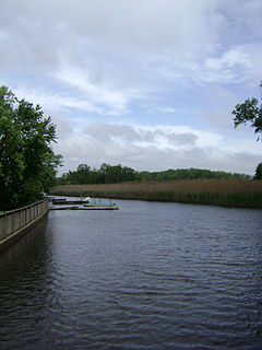
The Sacandaga River is a 64-mile-long (103 km) river in the northern part of New York in the United States. Its name comes from the Native American Sa-chen-da'-ga, meaning "overflowed lands".

The Wallkill River, a tributary of the Hudson, drains Lake Mohawk in Sparta, New Jersey, flowing from there generally northeasterly 88.3 miles (142.1 km) to Rondout Creek in New York, just downstream of Sturgeon Pool, near Rosendale, with the combined flows reaching the Hudson at Kingston.

Stony Clove Creek is a 10.3-mile-long (16.6 km) creek in the Catskill Mountains in New York. It is a tributary of Esopus Creek, which in turn is a tributary of the Hudson River. It joins the Esopus in the village of Phoenicia, and has two smaller tributaries up north of Phoenicia.

The Thornapple River is an 88.1-mile-long (141.8 km) tributary of Michigan's longest river, the Grand River. The Thornapple rises in Eaton County, Michigan and drains a primarily rural farming area in Central Michigan. It joins the Grand in Ada, Michigan, 10 miles (16 km) east of Grand Rapids.

Lake Erie Basin consists of Lake Erie and surrounding watersheds, which are typically named after the river, creek, or stream that provides drainage into the lake. The watersheds are located in the states of Indiana, Michigan, New York, Ohio, and Pennsylvania in the United States, and in the province of Ontario in Canada. The basin is part of the Great Lakes Basin and Saint Lawrence River Watershed, which feeds into the Atlantic Ocean. 80% of the lake's water flows in from the Detroit River, with only 9% coming from all of the remaining watersheds combined. A littoral zone serves as the interface between land and lake, being that portion of the basin where the lake is less than 15 feet (4.6 m) in depth.
Sparkill Creek, is a tributary of the Hudson River in Rockland County, New York and Bergen County, New Jersey in the United States. It flows through the Sparkill Gap in the Hudson Palisades, which was created by a fault line which provided the only sea-level break in the Palisades.

Butternut Creek is a stream in the greater Syracuse, New York area and a tributary of Limestone Creek, part of the Oneida Lake watershed. The creek is about 16 miles (26 km) long.

Davenport Center is a hamlet and census-designated place (CDP) in the town of Davenport, Delaware County, New York, United States. The population was 349 at the 2010 census.
Roods Creek is a river in Delaware County, New York. It begins just south of Cannonsville Reservoir and flows south into Crystal Lake. After exiting Crystal Lake it continues flowing south and then flows into Silver Lake. After exiting Silver Lake it continues southward before converging with the West Branch Delaware River east of the hamlet of Hale Eddy.

Middle Brook is a river in Delaware County, New York and Schoharie County, New York. It flows into Charlotte Creek northeast of Davenport.
Negro Brook is a river in Delaware County, New York and Otsego County, New York. It flows into Charlotte Creek north of Davenport.
Prosser Hollow Brook is a river in Delaware County, New York. It flows into Charlotte Creek west-southwest of Davenport Center.
Kortright Creek is a river in Delaware County, New York. It flows into Charlotte Creek west of Davenport Center.
Keyser Brook is a river in Delaware County, New York and Otsego County, New York. It flows into Charlotte Creek east-northeast of Davenport.

Bowmans Creek is a river in Montgomery County, New York. It begins west of the hamlet of Hessville and just south of the hamlet of Ripple Corners. It then flows in a mostly southeast direction for a few miles passing through the hamlet of Sprout Brook before flowing into the Canajoharie Creek just east of the hamlet of Sprout Brook.


