Little Aughwick Creek

Last updated

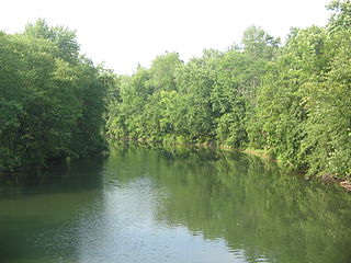
Little Aughwick Creek is a 10.8-mile-long (17.4 km) [1] tributary of Aughwick Creek in Fulton and Huntingdon counties, Pennsylvania in the United States. [2]

Tributary stream or river that flows into a main stem river or lake

A tributary or affluent is a stream or river that flows into a larger stream or main stem river or a lake. A tributary does not flow directly into a sea or ocean. Tributaries and the main stem river drain the surrounding drainage basin of its surface water and groundwater, leading the water out into an ocean.

Aughwick Creek is a 30.8-mile-long (49.6 km) tributary of the Juniata River in Huntingdon County, Pennsylvania in the United States.

Fulton County, Pennsylvania County in the United States

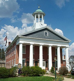
Fulton County is a county located in the U.S. state of Pennsylvania. As of the 2010 census, the population was 14,845, making it the fourth-least populous county in Pennsylvania. Its county seat is McConnellsburg. The county was created on April 19, 1850, from part of Bedford County and named for inventor Robert Fulton.

Little Aughwick Creek joins with Sideling Hill Creek near the community of Maddensville to form Aughwick Creek. [2]

Via Aughwick Creek and the Juniata River, it is a tributary of the Susquehanna River, flowing to Chesapeake Bay and the Atlantic Ocean.

Juniata River river in Pennsylvania, United States

The Juniata River is a tributary of the Susquehanna River, approximately 104 miles (167 km) long, in central Pennsylvania in the United States. The river is considered scenic along much of its route, having a broad and shallow course passing through several mountain ridges and steeply-lined water gaps. It formed an early 18th-century frontier region in Pennsylvania and was the site of Native American attacks against white settlements during the French and Indian War. The watershed of the river encompasses an area of approximately 3,400 square miles (8,800 km2), approximately one-eighth of the drainage area of the Susquehanna. Approximately two-thirds of the watershed is forested. It is the second largest tributary of the Susquehanna after the West Branch Susquehanna.

Susquehanna River river in the northeastern United States

The Susquehanna River is a major river located in the northeastern and mid-Atlantic United States. At 464 miles (747 km) long, it is the longest river on the East Coast of the United States that drains into the Atlantic Ocean. With its watershed, it is the 16th-largest river in the United States, and the longest river in the early 21st-century continental United States without commercial boat traffic.

Chesapeake Bay An estuary in the U.S. states of Maryland and Virginia

The Chesapeake Bay is an estuary in the U.S. states of Maryland and Virginia. The Bay is located in the Mid-Atlantic region and is primarily separated from the Atlantic Ocean by the Delmarva Peninsula with its mouth located between Cape Henry and Cape Charles. With its northern portion in Maryland and the southern part in Virginia, the Chesapeake Bay is a very important feature for the ecology and economy of those two states, as well as others. More than 150 major rivers and streams flow into the Bay's 64,299-square-mile (166,534 km2) drainage basin, which covers parts of six states and all of Washington, D.C.

See also

Related Research Articles

Bermudian Creek is a 24.9-mile-long (40.1 km) tributary of Conewago Creek in Adams and York counties in Pennsylvania in the United States.

Blacklog Creek is a 28.5-mile-long (45.9 km) tributary of Aughwick Creek in Huntingdon County, Pennsylvania, in the United States.

East Licking Creek is a 24.0-mile-long (38.6 km) tributary of Tuscarora Creek in central Pennsylvania in the United States.

Raystown Branch Juniata River river in the United States of America

The Raystown Branch Juniata River is the largest and longest tributary of the Juniata River in south-central Pennsylvania in the United States.

Little Conestoga Creek is a 21.1-mile-long (34.0 km) tributary of the Conestoga River in Pennsylvania. The Landis Mill Covered Bridge crosses the creek.

Little Conococheague Creek is a 12.4-mile-long (20.0 km) tributary stream of the Potomac River in the U.S. states of Maryland and Pennsylvania. The stream rises on Two Top Mountain, west of the Whitetail Ski Resort in Franklin County, Pennsylvania, and proceeds south into Washington County, Maryland. It empties into the Potomac about 2 miles (3 km) southeast of Big Spring, Maryland. The watershed of the creek is 18 square miles (47 km2) and includes Indian Springs Wildlife Management Area. Tributaries include Toms Run.

Lost Creek is a 17.5-mile-long (28.2 km) tributary of the Juniata River in central Pennsylvania in the United States.

Elk Creek is a 19.2-mile-long (30.9 km) tributary of Pine Creek in Centre County, Pennsylvania in the United States. Via Penns Creek, it is part of the Susquehanna River watershed.

Little Swatara Creek is a 26.0-mile-long (41.8 km) tributary of Swatara Creek in southeast Pennsylvania in the United States.

Little Clearfield Creek is a 14.5-mile-long (23.3 km) tributary of Clearfield Creek in Clearfield County, Pennsylvania in the United States.

Buffalo Creek is a 31.4-mile-long (50.5 km) tributary of the Juniata River in Perry County, Pennsylvania, in the United States.

Mill Creek is an 18.7-mile-long (30.1 km) tributary of the Tioga River in Tioga County, Pennsylvania in the United States.

Bald Eagle Creek (West Branch Susquehanna River tributary) tributary of the West Branch Susquehanna River in Pennsylvania, United States

Bald Eagle Creek is a 55.2-mile-long (88.8 km) tributary of the West Branch Susquehanna River mostly in Centre County, Pennsylvania, in the United States.

Cocolamus Creek is a 22.1-mile-long (35.6 km) tributary of the Juniata River in Juniata and Perry counties, Pennsylvania in the United States.

Little Chiques Creek is a 20.6-mile-long (33.2 km) tributary of Chiques Creek in Lancaster County, Pennsylvania in the United States.

Honey Creek is a 20.3-mile-long (32.7 km) tributary of Kishacoquillas Creek in Mifflin County, Pennsylvania in the United States.

Sideling Hill Creek is a 21.9-mile-long (35.2 km) tributary of Aughwick Creek in Huntingdon County, Pennsylvania in the United States. Via Aughwick Creek and the Juniata River, it is part of the Susquehanna River watershed.

Kishacoquillas Creek is a 24.0-mile-long (38.6 km) tributary of the Juniata River in Mifflin County, Pennsylvania in the United States.

Little Conewago Creek is a 24.9-mile-long (40.1 km) tributary of Conewago Creek in York County, Pennsylvania in the United States.

References

  1. U.S. Geological Survey. National Hydrography Dataset high-resolution flowline data. The National Map Archived 2012-04-05 at WebCite , accessed August 8, 2011
  2. 1 2 Gertler, Edward. Keystone Canoeing, Seneca Press, 2004. ISBN   0-9749692-0-6

Coordinates: 40°05′47″N77°57′30″W / 40.09642°N 77.95829°W / 40.09642; -77.95829

Geographic coordinate system Coordinate system

A geographic coordinate system is a coordinate system that enables every location on Earth to be specified by a set of numbers, letters or symbols. The coordinates are often chosen such that one of the numbers represents a vertical position and two or three of the numbers represent a horizontal position; alternatively, a geographic position may be expressed in a combined three-dimensional Cartesian vector. A common choice of coordinates is latitude, longitude and elevation. To specify a location on a plane requires a map projection.