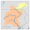
Raystown Branch Juniata River

Last updated
Raystown Branch Juniata River
Tributary to Juniata River
USACE Raystown Lake Dam.jpg
Raystown Lake Dam on the Raystown Branch Juniata River
USA Pennsylvania relief location map.svg
Red pog.svg
Location of the mouth of Raystown Branch Juniata River
Location
Country United States
State Pennsylvania
Counties Huntingdon County
Bedford County
Physical characteristics
Sourcedivide between Raystown Branch and Wills Creek
  locationabout 1 mile east of Macdonaldton, Pennsylvania
  coordinates 39°54′57″N078°53′00″W / 39.91583°N 78.88333°W / 39.91583; -78.88333 [1]
  elevation2,720 ft (830 m)
Mouth Juniata River
  location
Ardenheim, Pennsylvania
  coordinates
40°27′17″N077°58′39″W / 40.45472°N 77.97750°W / 40.45472; -77.97750 [1]
  elevation
600 ft (180 m)
Length62.14 mi (100.00 km) [2]
Basin size961.96 square miles (2,491.5 km2)
Discharge 
  location Ardenheim, Pennsylvania
  average1,233.99 cu ft/s (34.943 m3/s) at mouth with Juniata River [3]
Basin features
Progressiongenerally north
River system Juniata River
Tributaries 
  leftBreastwork Run
Shawnee Branch
Dunning Creek
Pipers Run
Yellow Creek
Dry Run
Ravers Run
Sugar Camp Run
Shy Beaver Creek
Coffee Run
James Creek
Hawns Run
  rightWambaugh Run
Cove Creek
Brush Creek
Tub Mill Run
French Run
Kimber Run
Six Mile Run
Shoup Run
Tatman Run
Great Trough Creek
WaterbodiesRaystown Lake

The Raystown Branch Juniata River is the largest and longest tributary of the Juniata River in south-central Pennsylvania in the United States. [4]

Contents

The Raystown Branch Juniata River begins along the Allegheny Front in Somerset County and flows 123 miles (198 km) to the confluence with the Juniata River near Huntingdon. [5] It passes through the boroughs of Bedford and Everett along its course.

Approximately 5.4 miles (8.7 km) upstream of the mouth, the United States Army Corps of Engineers Raystown Dam forms Raystown Lake, the largest lake in Pennsylvania. [4]

Bridges

Tributaries

(Heading downstream)

See also

Related Research Articles

Aughwick Creek is a 30.8-mile-long (49.6 km) tributary of the Juniata River in Huntingdon County, Pennsylvania in the United States.

Yellow Creek is a 20.9-mile-long (33.6 km) tributary of the Raystown Branch Juniata River in Bedford County, Pennsylvania, in the United States.

<span class="mw-page-title-main">Unami Creek</span> Tributary of Perkiomen Creek in southeastern Pennsylvania

Unami Creek is a 16.5-mile-long (26.6 km) tributary of Perkiomen Creek in Lehigh, Bucks, and Montgomery counties in eastern and southeastern Pennsylvania.

Bobs Creek is a tributary of Dunning Creek in south west/south central Pennsylvania in the United States.

Dunning Creek is a 27.8-mile-long (44.7 km) tributary of the Raystown Branch Juniata River in south west/south central Pennsylvania in the United States.

<span class="mw-page-title-main">Conodoguinet Creek</span> Stream in Pennsylvania, United States

Conodoguinet Creek is a 104-mile-long (167 km) tributary of the Susquehanna River in South central Pennsylvania in the United States. The name is Native American, and means "A Long Way with Many Bends".

Laurel Hill Creek is a 39.9-mile-long (64.2 km) tributary of the Casselman River that is located in Somerset County, Pennsylvania, in the United States. It is part of the Youghiogheny River watershed, flowing to the Monongahela River, the Ohio River, and ultimately the Mississippi River.

<span class="mw-page-title-main">Frankstown Branch Juniata River</span>

The Frankstown Branch Juniata River is a 46.0-mile-long (74.0 km) tributary of the Juniata River in Blair and Huntingdon counties, Pennsylvania, in the United States.

Codorus Creek is a 42.4-mile-long (68.2 km) tributary of the Susquehanna River in York County, Pennsylvania, in the United States.

<span class="mw-page-title-main">Standing Stone Creek</span> River in the United States of America

Standing Stone Creek is a 34.2-mile-long (55.0 km) tributary of the Juniata River in Huntingdon and Centre counties, Pennsylvania, in the United States.

<span class="mw-page-title-main">Fishing Creek (Bald Eagle Creek tributary)</span>

Fishing Creek is a 42.8-mile-long (68.9 km) tributary of Bald Eagle Creek in Clinton County, Pennsylvania, in the United States.

<span class="mw-page-title-main">Great Trough Creek</span>

Great Trough Creek is a tributary of the Raystown Branch Juniata River in Bedford, Fulton and Huntingdon counties in Pennsylvania in the United States. The creek is 33.2 miles (53.4 km) long, flows northeast for half its length then northwest, and its watershed is 85.4 square miles (221.2 km2) in area.

Cocolamus Creek is a 22.1-mile-long (35.6 km) tributary of the Juniata River in Juniata and Perry counties, Pennsylvania, in the United States.

Muddy Creek is a tributary of the Susquehanna River in York County, Pennsylvania, in the United States.

Sideling Hill Creek is a 21.9-mile-long (35.2 km) tributary of Aughwick Creek in Huntingdon County, Pennsylvania in the United States. Via Aughwick Creek and the Juniata River, it is part of the Susquehanna River watershed.

<span class="mw-page-title-main">New Baltimore Bridge</span> United States historic place

The New Baltimore Bridge is a historic covered bridge in Allegheny Township, Somerset County, Pennsylvania. Township Route 812 crosses the Raystown Branch Juniata River on the bridge. The Queenpost truss bridge was built in 1879 and is 86 feet 6 inches (26.37 m) in length and 12 feet (3.7 m) wide. It is one of 10 covered bridges in Somerset County.

<span class="mw-page-title-main">Diehls Covered Bridge</span> United States historic place

The Diehls Covered Bridge, also known as Turner's Bridge, is a historic wooden covered bridge located at Harrison Township in Bedford County, Pennsylvania. It is a 88.3-foot-long (26.9 m), Burr Truss bridge with a shallow gable roof, constructed in 1892. It crosses the Raystown Branch Juniata River. It is one of 15 historic covered bridges in Bedford County.

<span class="mw-page-title-main">Bridge in Snake Spring Township</span> United States historic place

Bridge in Snake Spring Township, also known as the Narrows Bridge, is a historic concrete arch bridge located at The Narrows in Snake Spring Township in Bedford County, Pennsylvania. It was built in 1934, and is a 580-foot-long (180 m), open spandrel concrete arch bridge with five arches. The roadway is skewed and carries US 30, the Lincoln Highway, over the Raystown Branch Juniata River.

<span class="mw-page-title-main">Corbin Bridge</span> United States historic place

Corbin Bridge, also known as Huntingdon County Bridge No. 20, is a historic suspension bridge spanning the Raystown Branch Juniata River and located at Juniata Township, Huntingdon County, Pennsylvania. It was built by the Reading Steel Products Inc. in 1937. It measures 322-foot-long (98 m) and has a 12.5-foot-wide (3.8 m) deck. It is the only road suspension bridge in Huntingdon County.

<span class="mw-page-title-main">Pennsylvania Canal Guard Lock and Feeder Dam, Raystown Branch</span> United States historic place

The Pennsylvania Canal Guard Lock and Feeder Dam, Raystown Branch, also known as the Raystown Branch Feeder Canal, is an historic, American canal structure that is located in Henderson Township in Huntingdon County, Pennsylvania. The property includes the remains of a guard lock and feeder dam.

References

  1. 1 2 "GNIS Detail - Raystown Branch Juniata River". geonames.usgs.gov. US Geological Survey. Retrieved 19 July 2019.
  2. "ArcGIS Web Application". epa.maps.arcgis.com. US EPA. Retrieved 19 July 2019.
  3. "Raystown Branch Juniata River Watershed Report". Waters Geoviewer. US EPA. Retrieved 19 July 2019.
  4. 1 2 Gertler, Edward. Keystone Canoeing, Seneca Press, 2004. ISBN   0-9749692-0-6
  5. U.S. Geological Survey. National Hydrography Dataset high-resolution flowline data. The National Map, accessed August 8, 2011
  6. "National Historic Landmarks & National Register of Historic Places in Pennsylvania" (Searchable database). CRGIS: Cultural Resources Geographic Information System.Note: This includes Susan M. Zacher (December 1977). "National Register of Historic Places Inventory Nomination Form: Diehls Covered Bridge" (PDF). Retrieved 2011-11-19.
  7. "National Historic Landmarks & National Register of Historic Places in Pennsylvania" (Searchable database). CRGIS: Cultural Resources Geographic Information System.Note: This includes J. Dain Davis (September 1982). "National Register of Historic Places Inventory Nomination Form: Bridge in Snake Spring Township" (PDF). Retrieved 2011-11-19.
  8. "National Historic Landmarks & National Register of Historic Places in Pennsylvania" (Searchable database). CRGIS: Cultural Resources Geographic Information System.Note: This includes Deborah L. Suciu (September 1989). "National Register of Historic Places Inventory Nomination Form: Corbin Bridge" (PDF). Retrieved 2011-11-05.