Ardenheim, Pennsylvania

Last updated

Ardenheim, Pennsylvania
Unincorporated community
US 22 wb entering Ardenheim PA, May 2024.jpg
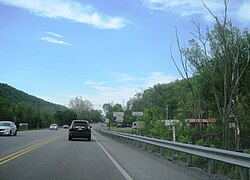
US 22 entering Ardenheim
USA Pennsylvania location map.svg
Red pog.svg
Ardenheim
Usa edcp location map.svg
Red pog.svg
Ardenheim
Coordinates: 40°27′51″N77°59′0″W / 40.46417°N 77.98333°W / 40.46417; -77.98333
Country United States
State Pennsylvania
County Huntingdon
Township Henderson
Elevation
610 ft (190 m)
Time zone UTC-5 (Eastern (EST))
  Summer (DST) UTC-4 (EDT)
ZIP codes
16652
GNIS feature ID1168377 [1]

Ardenheim is an unincorporated community in Henderson Township, Huntingdon County, Pennsylvania about 4 miles east of Huntingdon. This village is where the Raystown Branch and Frankstown Branch of the Juniata River meet. Ardenheim is located between the boroughs of Huntingdon and Mill Creek.

General information

Related Research Articles

<span class="mw-page-title-main">Bedford County, Pennsylvania</span> County in Pennsylvania, United States

Bedford County is a county in the Commonwealth of Pennsylvania. As of the 2020 census, the population was 47,577. The county seat is Bedford. The county is part of the Southwest Pennsylvania region of the state.

<span class="mw-page-title-main">Huntingdon County, Pennsylvania</span> County in Pennsylvania, United States

Huntingdon County is a county in the Commonwealth of Pennsylvania. As of the 2020 census, the population was 44,092. Its county seat is Huntingdon. The county was created on September 20, 1787, mainly from the northern part of Bedford County, plus an addition of territory on the east from Cumberland County. The county is part of the Southwest Pennsylvania region of the state.

<span class="mw-page-title-main">Centre County, Pennsylvania</span> County in Pennsylvania, United States

Centre County is a county in the Commonwealth of Pennsylvania, United States. As of the 2020 census, the population was 158,172. Its county seat is Bellefonte. Centre County comprises the State College, PA Metropolitan Statistical Area. The county is part of the Central Pennsylvania region of the state.

<span class="mw-page-title-main">Blair County, Pennsylvania</span> County in Pennsylvania, United States

Blair County is a county in the Commonwealth of Pennsylvania. As of the 2020 census, the population was 122,822. Its county seat is Hollidaysburg, and its largest city is Altoona. The county was created on February 26, 1846, from parts of Huntingdon and Bedford counties. The county is part of the Southwest Pennsylvania region of the state.

<span class="mw-page-title-main">Cass Township, Huntingdon County, Pennsylvania</span> Township in Pennsylvania, United States

Cass Township is a township in Huntingdon County, Pennsylvania, United States. The population was 1,014 at the 2020 census.

<span class="mw-page-title-main">Clay Township, Huntingdon County, Pennsylvania</span> Township in Pennsylvania, United States

Clay Township is a township in Huntingdon County, Pennsylvania, United States. The population was 872 at the 2020 census.

<span class="mw-page-title-main">Dublin Township, Huntingdon County, Pennsylvania</span> Township in Pennsylvania, United States

Dublin Township is a township in Huntingdon County, Pennsylvania, United States. The population was 1,182 at the 2020 census.

<span class="mw-page-title-main">Franklin Township, Huntingdon County, Pennsylvania</span> Township in Pennsylvania, United States

Franklin Township is a township in Huntingdon County, Pennsylvania, United States. The population was 492 at the 2020 census.

<span class="mw-page-title-main">Henderson Township, Huntingdon County, Pennsylvania</span> Township in Pennsylvania, United States

Henderson Township is a township which is located in Huntingdon County, Pennsylvania, United States. The population was 923 at the time of the 2020 census.

<span class="mw-page-title-main">Huntingdon, Pennsylvania</span> Borough in Pennsylvania, United States

Huntingdon is a borough in and county seat of Huntingdon County, Pennsylvania, United States. It is located along the Juniata River, approximately 32 miles (51 km) east of Altoona and 92 miles (148 km) west of Harrisburg. With a population of 6,827 at the 2020 census, it is the largest population center near Raystown Lake, a winding, 28-mile-long (45 km) flood-control reservoir managed by the U.S. Army Corps of Engineers.

<span class="mw-page-title-main">Springfield Township, Huntingdon County, Pennsylvania</span> Township in Pennsylvania, United States

Springfield Township is a township that is located in Huntingdon County, Pennsylvania, United States. The population was 694 at the time of the 2020 census.

<span class="mw-page-title-main">Abington Township, Montgomery County, Pennsylvania</span> Township in Pennsylvania, United States

Abington Township is a township in Montgomery County, Pennsylvania, United States. It is adjacent to Philadelphia's northern fringe. The population was 58,502 as of the 2020 census, making it the second most populous township in Montgomery County after Lower Merion Township. The population density is 3603.3 per square mile (1,377/km2), making it the second most densely populated township in Montgomery County after Cheltenham Township.

<span class="mw-page-title-main">Allenport, Huntingdon County, Pennsylvania</span> Census-designated place in Pennsylvania, United States

Allenport is an unincorporated community and census-designated place (CDP) in Huntingdon County, Pennsylvania, United States. It lies southeast of Mount Union on the Juniata River in Shirley Township. The population was 648 as of the 2010 census.

Robert Allison was an American politician and lawyer who served a single term in the United States House of Representatives, representing the 12th congressional district of Pennsylvania from 1831 to 1833 as a member of the Anti-Masonic Party.

McConnellstown is a census-designated place in Walker Township, Huntingdon County, Pennsylvania, United States. Due to its long name, the village is often nicknamed "Mactown". The population of McConnellstown was 1,194 as of the 2010 census.

<span class="mw-page-title-main">Huntingdon Valley, Pennsylvania</span> Village in Pennsylvania, United States

Huntingdon Valley is a village, as well as a suburban mailing address located in Lower Moreland Township, Upper Moreland Township and Abington Township all in Montgomery County, and in small sections of Upper Southampton Township and Lower Southampton Township in Bucks County, Pennsylvania, United States, bordering the Fox Chase, Bustleton, and Somerton sections of Philadelphia.

Ruffs Dale, also spelled Ruffsdale, is an unincorporated community in East Huntingdon Township, Westmoreland County, Pennsylvania United States. It is located approximately forty miles from Pittsburgh. Ruffs Dale has its own post office, with zip code 15679, located at 875 State Route 31.

Hesston is an unincorporated community in Penn Township of Huntingdon County, Pennsylvania, United States. Also located in Hesston is Raystown Lake. Hesston is the home of the Hesston Speedway. The community was originally called Pleasant Grove and Grafton, but renamed Hesston.

Alverton is an unincorporated community in East Huntingdon Township, Westmoreland County, Pennsylvania, United States. The community is located along Pennsylvania Route 981, 2.5 miles (4.0 km) west of Mount Pleasant. Alverton has a post office, with ZIP code 15612.

<span class="mw-page-title-main">Blairs Mills, Pennsylvania</span> Unincorporated community in Pennsylvania, United States

Blairs Mills is an unincorporated community in Huntingdon County, Pennsylvania, United States. The community is located near the eastern border of the county 21 miles (34 km) southeast of Huntingdon. Blairs Mills has a post office with ZIP code 17213.

References

  1. "Ardenheim, Pennsylvania". Geographic Names Information System . United States Geological Survey, United States Department of the Interior.