Shade Gap, Pennsylvania

Last updated
Shade Gap, Pennsylvania
Borough
Main Street nb in Shade Gap, PA (3), May 2024.jpg
Northbound Main Street in Shade Gap
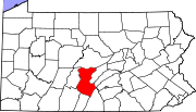
Huntingdon County Pennsylvania Incorporated and Unincorporated areas Shade Gap Highlighted.svg
Location of Shade Gap in Huntingdon County, Pennsylvania.
USA Pennsylvania location map.svg
Red pog.svg
Shade Gap
Usa edcp location map.svg
Red pog.svg
Shade Gap
Coordinates: 40°10′49″N77°51′58″W / 40.18028°N 77.86611°W / 40.18028; -77.86611
Country United States
State Pennsylvania
County Huntingdon
Government
  TypeBorough Council
Area
[1]
  Total0.03 sq mi (0.08 km2)
  Land0.03 sq mi (0.08 km2)
  Water0.00 sq mi (0.00 km2)
Elevation
[2]
1,007 ft (307 m)
Population
 (2010)
  Total105
  Estimate 
(2019) [3]
89
  Density2,781.25/sq mi (1,087.39/km2)
Time zone UTC-5 (Eastern (EST))
  Summer (DST) UTC-4 (EDT)
ZIP Code
17255
Area code 814
FIPS code 42-69456
GNIS feature ID 1215279 [2]
Local phone exchanges: 259

Shade Gap is a borough in Huntingdon County, Pennsylvania, United States. The population was 105 at the 2010 census. [4]

Contents

Geography

Shade Gap is located in southeastern Huntingdon County. It sits at the eastern base of Shade Mountain just south of that mountain's water gap where Shade Creek passes through. The borough is entirely surrounded by Dublin Township.

U.S. Route 522 passes just east of the borough, leading north 16 miles (26 km) to Mount Union and south 12 miles (19 km) to Interstate 76 near Fort Littleton. Pennsylvania Route 35 runs northeast along the base of Shade Mountain 37 miles (60 km) to Mifflin, and Pennsylvania Route 641 leads southeast over Tuscarora Mountain 9 miles (14 km) to Spring Run.

According to the U.S. Census Bureau, the borough of Shade Gap has a total area of 0.03 square miles (0.08 km2), all land. [4]

Demographics

Historical population
CensusPop.Note
1880 170
1890 20922.9%
1900 138−34.0%
1910 1433.6%
1920 136−4.9%
1930 130−4.4%
1940 15620.0%
1950 1570.6%
1960 140−10.8%
1970 18632.9%
1980 141−24.2%
1990 113−19.9%
2000 97−14.2%
2010 1058.2%
2019 (est.)89 [3] −15.2%
Sources: [5] [6] [7]

At the 2000 census, there were 97 people, 38 households, and 25 families residing in the borough. The population density was 2,103.7 inhabitants per square mile (812.2/km2). There were 43 housing units at an average density of 932.6 per square mile (360.1/km2). The racial makeup of the borough was 97.94% White and 2.06% African American. [6] There were 38 households, 31.6% had children under the age of 18 living with them, 52.6% were married couples living together, 10.5% had a female householder with no husband present, and 34.2% were non-families. 28.9% of households were made up of individuals, and 18.4% were one person aged 65 or older. The average household size was 2.55 and the average family size was 3.08.

In the borough, the population was spread out, with 25.8% under the age of 18, 5.2% from 18 to 24, 30.9% from 25 to 44, 19.6% from 45 to 64, and 18.6% 65 or older. The median age was 36 years. For every 100 females there were 86.5 males. For every 100 females age 18 and over, there were 84.6 males.

The median income for a household in the borough was $18,125, and the median family income was $23,438. Males had a median income of $23,125 versus $15,000 for females. The per capita income for the borough was $9,557. There were 13.0% of families and 19.5% of the population living below the poverty line, including 20.0% of under eighteens and 10.7% of those over 64.

See also

Related Research Articles

<span class="mw-page-title-main">Hopewell, Bedford County, Pennsylvania</span> Borough in Pennsylvania, United States

Hopewell is a borough in Bedford County, Pennsylvania, United States. The population was 189 at the 2020 census.

<span class="mw-page-title-main">Saxton, Pennsylvania</span> Borough in Pennsylvania, United States

Saxton is a borough in Bedford County, Pennsylvania, United States. The population was 726 at the 2020 census.
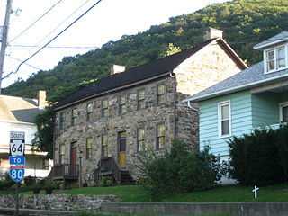
<span class="mw-page-title-main">East Side, Pennsylvania</span> Borough in Pennsylvania, United States

East Side is a borough in Carbon County, Pennsylvania. It is part of Northeastern Pennsylvania. The population was 317 at the 2010 census.

<span class="mw-page-title-main">Mill Hall, Pennsylvania</span> Borough in Pennsylvania, United States

Mill Hall is a borough in Clinton County, Pennsylvania, United States. The population was 1,613 at the 2010 census.

<span class="mw-page-title-main">Berrysburg, Pennsylvania</span> Borough in Pennsylvania, United States

Berrysburg is a borough in Dauphin County, Pennsylvania, United States. The population was 324 at the 2020 census. It is part of the Harrisburg metropolitan area.

<span class="mw-page-title-main">Broad Top City, Pennsylvania</span> Borough in Pennsylvania, United States

Broad Top City is a borough in Huntingdon County, Pennsylvania, United States. The population was 371 at the 2020 census, a decline from the figure of 452 tabulated in 2010.

<span class="mw-page-title-main">Cassville, Pennsylvania</span> Borough in Pennsylvania, United States

Cassville is a borough in Huntingdon County, Pennsylvania, United States. As of the 2020 census, the borough population was 138.

<span class="mw-page-title-main">Coalmont, Pennsylvania</span> Borough in Pennsylvania, United States

Coalmont is a borough in Huntingdon County, Pennsylvania, United States. The population was 91 at the 2020 census.

<span class="mw-page-title-main">Dublin Township, Huntingdon County, Pennsylvania</span> Township in Pennsylvania, United States

Dublin Township is a township in Huntingdon County, Pennsylvania, United States. The population was 1,182 at the 2020 census.

<span class="mw-page-title-main">Dudley, Pennsylvania</span> Borough in Pennsylvania, United States

Dudley is a borough in Huntingdon County, Pennsylvania, United States. The population was 185 at the 2020 census.

<span class="mw-page-title-main">Mapleton, Pennsylvania</span> Borough in Pennsylvania, United States

Mapleton is a borough in Huntingdon County, Pennsylvania, United States. The population was 441 at the 2010 census. It is located on the Juniata River, which is a tributary of the Susquehanna River.

<span class="mw-page-title-main">Marklesburg, Pennsylvania</span> Borough in Pennsylvania, United States

Marklesburg is a borough in Huntingdon County, Pennsylvania, United States. The population was 204 at the 2010 census.
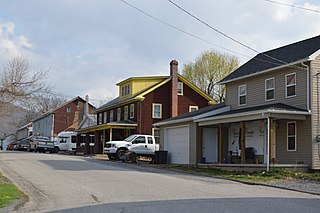
<span class="mw-page-title-main">Mill Creek, Pennsylvania</span> Borough in Pennsylvania, United States

Mill Creek is a borough in Huntingdon County, Pennsylvania, United States. The population was 328 at the 2010 census.

<span class="mw-page-title-main">Orbisonia, Pennsylvania</span> Borough in Pennsylvania, United States

Orbisonia is a borough in Huntingdon County, Pennsylvania, United States. The population was 428 at the 2010 census.

<span class="mw-page-title-main">Petersburg, Pennsylvania</span> Borough in Pennsylvania, United States

Petersburg is a borough in Huntingdon County, Pennsylvania, United States. It was a stop on the former Pennsylvania Railroad Main Line between Tyrone and Huntingdon and the junction point for the Petersburg Branch. The population was 480 at the 2010 census.

<span class="mw-page-title-main">Saltillo, Pennsylvania</span> Borough in Pennsylvania, United States

Saltillo is a borough in Huntingdon County, Pennsylvania, United States. The population was 346 at the 2010 census.

<span class="mw-page-title-main">Shirleysburg, Pennsylvania</span> Borough in Pennsylvania, United States

Shirleysburg is a borough in Huntingdon County, Pennsylvania, United States. The population was 150 at the 2010 census.

<span class="mw-page-title-main">Three Springs, Pennsylvania</span> Borough in Pennsylvania, United States

Three Springs is a borough in Huntingdon County, Pennsylvania, United States. The population was 444 at the 2010 census.

<span class="mw-page-title-main">Lack Township, Juniata County, Pennsylvania</span> Township in Pennsylvania, United States

Lack Township is a township that is located in Juniata County, Pennsylvania, United States. The population was 637 at the time of the 2020 census.

<span class="mw-page-title-main">Central City, Pennsylvania</span> Borough in Pennsylvania, United States

Central City is a borough in Somerset County, Pennsylvania, United States. The population was 998 at the 2020 census. It is part of the Johnstown, Pennsylvania, Metropolitan Statistical Area. It is east-northeast of Stoystown and northeast of Somerset.

References

  1. "2019 U.S. Gazetteer Files". United States Census Bureau. Retrieved July 28, 2020.
  2. 1 2 U.S. Geological Survey Geographic Names Information System: Shade Gap, Pennsylvania
  3. 1 2 "Population and Housing Unit Estimates". United States Census Bureau. May 24, 2020. Retrieved May 27, 2020.
  4. 1 2 "Geographic Identifiers: 2010 Census Summary File 1 (G001): Shade Gap borough, Pennsylvania". American Factfinder. U.S. Census Bureau. Archived from the original on February 13, 2020. Retrieved January 23, 2018.
  5. "Census of Population and Housing". U.S. Census Bureau. Retrieved 11 December 2013.
  6. 1 2 "U.S. Census website". United States Census Bureau . Retrieved 2008-01-31.
  7. "Incorporated Places and Minor Civil Divisions Datasets: Subcounty Resident Population Estimates: April 1, 2010 to July 1, 2012". Population Estimates. U.S. Census Bureau. Archived from the original on 11 June 2013. Retrieved 11 December 2013.