Allenport, Huntingdon County, Pennsylvania | |
|---|---|
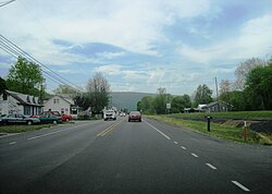 Northbound US 522 in Allenport | |
 Allenport  Allenport | |
| Coordinates: 40°22′25″N77°52′26″W / 40.37361°N 77.87389°W | |
| Country | United States |
| State | Pennsylvania |
| County | Huntingdon |
| Township | Shirley |
| Area | |
• Total | 1.04 sq mi (2.69 km2) |
| • Land | 0.97 sq mi (2.51 km2) |
| • Water | 0.069 sq mi (0.18 km2) |
| Elevation | 594 ft (181 m) |
| Population | |
• Total | 572 |
| • Density | 589.8/sq mi (227.71/km2) |
| Time zone | UTC-5 (Eastern (EST)) |
| • Summer (DST) | UTC-4 (EDT) |
| ZIP code | 17066 |
| Area code | 814 |
| FIPS code | 42-00980 |
| GNIS feature ID | 2629994 [2] |
Allenport is an unincorporated community and census-designated place (CDP) in Huntingdon County, Pennsylvania, United States. It lies southeast of Mount Union on the Juniata River in Shirley Township. The population was 648 as of the 2010 census. [4]
Contents
Allenport is the location of the Riverview Business Center, home of manufacturing facilities for Bonney Forge, FCI (formerly Berg), and Containment Solutions (formerly Fluid Containment).
