Allenport, Washington County, Pennsylvania

Last updated
Allenport
Allenport, Washington County, Pennsylvania Main St and Bridge St.jpg
Intersection of Main St and Bridge St
Nicknames: 
Newtown, The Port
Washington County Pennsylvania Incorporated and Unincorporated areas Allenport Highlighted.svg
Location of Allenport in Washington County, Pennsylvania.
USA Pennsylvania location map.svg
Red pog.svg
Allenport
Location of Allenport in Pennsylvania
Coordinates: 40°5′47″N79°50′43″W / 40.09639°N 79.84528°W / 40.09639; -79.84528
CountryUnited States
State Pennsylvania
County Washington
Established1816
Government
  MayorN/A
Area
[1]
  Total2.22 sq mi (5.75 km2)
  Land2.13 sq mi (5.51 km2)
  Water0.09 sq mi (0.24 km2)
Population
 (2020) [2]
  Total484
  Density227.44/sq mi (87.80/km2)
Time zone UTC-4 (EST)
  Summer (DST) UTC-5 (EDT)
Area code 724
FIPS code 42-00988
GNIS feature ID1215650

Allenport is a borough on the Monongahela River in Washington County, Pennsylvania, United States and part of the Pittsburgh metropolitan area since 1950. [3] The population was 483 at the 2020 census. [4]

Contents

Geography

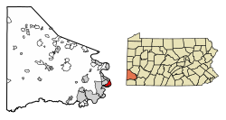
Allenport is located on State Route 88, approximately 3 miles (4.8 km) northeast of California, on the west bank of the Monongahela River.

According to the United States Census Bureau, the borough has a total area of 2.1 square miles (5.4 km2), of which 2.0 square miles (5.2 km2) is land and 0.2 square miles (0.5 km2) (7.51%) is water.

Government

The townspeople are represented by an elected mayor and borough council.

Demographics

The American Iron Oxide Company (AMROX) plant and the former Wheeling-Pittsburgh Steel plant American Iron Oxide Company (AMROX) plant in Allenport.jpg
The American Iron Oxide Company (AMROX) plant and the former Wheeling-Pittsburgh Steel plant
Historical population
CensusPop.Note
1880 163
1930 1,017
1940 1,0786.0%
1950 923−14.4%
1960 9816.3%
1970 762−22.3%
1980 735−3.5%
1990 595−19.0%
2000 549−7.7%
2010 537−2.2%
2020 484−9.9%
Sources: [5] [6] [2]

As of the census [7] of 2000, there were 549 people, 243 households, and 168 families living in the borough. The population density was 278.8 people per square mile (107.6 people/km2). There were 261 housing units at an average density of 132.5 per square mile (51.2/km2). The racial makeup of the borough was 99.27% White, 0.36% African American, and 0.36% from two or more races. Hispanic or Latino of any race were 0.36% of the population.

There were 243 households, out of which 19.8% had children under the age of 18 living with them, 55.6% were married couples living together, 9.9% had a female householder with no husband present, and 30.5% were non-families. 26.3% of all households were made up of individuals, and 16.0% had someone living alone who was 65 years of age or older. The average household size was 2.24 and the average family size was 2.69.

In the borough, the population was spread out, with 14.6% under the age of 18, 6.6% from 18 to 24, 29.0% from 25 to 44, 29.5% from 45 to 64, and 20.4% who were 65 years of age or older. The median age was 45 years. For every 100 females, there were 92.6 males. For every 100 females age 18 and over, there were 93.0 males.

The median income for a household in the borough was $28,462, and the median income for a family was $32,250. Males had a median income of $28,438 versus $26,563 for females. The per capita income for the borough was $17,702. About 6.5% of families and 7.8% of the population were below the poverty line, including 14.3% of those under age 18 and 3.7% of those age 65 or over.

Related Research Articles

<span class="mw-page-title-main">Dravosburg, Pennsylvania</span> Borough in Pennsylvania, United States

Dravosburg is a borough in Allegheny County, Pennsylvania, United States, and is part of the Pittsburgh Metro Area. The population was 1,612 at the 2020 census. Dravosburg is located along the Monongahela River.

<span class="mw-page-title-main">Forward Township, Allegheny County, Pennsylvania</span> Township of Allegheny County, Pennsylvania

Forward Township is a township in Allegheny County, Pennsylvania, United States. The population was 3,068 at the 2020 census. The township is named after Walter Forward, U.S. Secretary of the Treasury from 1841 to 1843.

<span class="mw-page-title-main">Munhall, Pennsylvania</span> Borough in Pennsylvania, United States

Munhall is a borough in Allegheny County, Pennsylvania, United States, on the west bank of the Monongahela River. The population was 10,774 at the 2020 census. It is a residential suburb of the Pittsburgh metropolitan area.

<span class="mw-page-title-main">Rankin, Pennsylvania</span> Borough in Pennsylvania, United States

Rankin is a borough in Allegheny County, Pennsylvania, United States, 8 miles (13 km) south of Pittsburgh on the Monongahela River. The borough was named after Thomas Rankin, a local landowner. Early in the 20th century, Rankin specialized in manufacturing steel and wire goods. The population increased from 3,775 in 1900 to 7,470 in 1940 and has since declined to 1,896 as of the 2020 census.

<span class="mw-page-title-main">Whitaker, Pennsylvania</span> Borough in Pennsylvania, United States

Whitaker is a borough in Allegheny County, Pennsylvania, United States, and is on the Monongahela River 3 miles (5 km) upriver from Pittsburgh. The population was 1,179 at the 2020 census.

<span class="mw-page-title-main">Brownsville Township, Fayette County, Pennsylvania</span> Township in Pennsylvania, United States

Brownsville Township is a township in Fayette County, Pennsylvania, United States. The population was 534 at the 2020 census, a decline from the figure of 683 tabulated in 2010. It is served by the Brownsville School District.

<span class="mw-page-title-main">Fayette City, Pennsylvania</span> Borough in Pennsylvania, United States

Fayette City is a borough in Fayette County, Pennsylvania, United States. The population was 502 at the 2020 census, a decline from the figure of 596 tabulated in 2010. It is served by the Belle Vernon Area School District. Some buildings in the town antedate 1820.

<span class="mw-page-title-main">Jefferson Township, Fayette County, Pennsylvania</span> Township in Pennsylvania, United States

Jefferson Township is a township in Fayette County, Pennsylvania, United States. The population was 2,008 at the 2020 census, a decline from the figure of 2,008 tabulated in 2010. It is named for former president Thomas Jefferson, and many of the township's streets are named after other U.S. presidents. Frazier School District serves the area.

<span class="mw-page-title-main">Masontown, Pennsylvania</span> Borough in Pennsylvania, United States

Masontown is a borough in Fayette County, Pennsylvania, United States. It is part of the Pittsburgh Metro Area. The population of the borough was 3,274 at the 2020 census. It is served by the Albert Gallatin Area School District. Masontown is a small crossroads for the rural portions of western Fayette County, and it contains a small shopping center and a grocery store within its business district.

<span class="mw-page-title-main">Point Marion, Pennsylvania</span> Borough in Pennsylvania, United States

Point Marion is a borough in Fayette County, Pennsylvania, United States. The population was 1,152 at the 2020 census, a decline from the figure of 1,159 tabulated in 2010. It is served by the Albert Gallatin Area School District.

<span class="mw-page-title-main">Coal Center, Pennsylvania</span> Borough in Pennsylvania, United States

Coal Center is a borough on the Monongahela River in Washington County, Pennsylvania, United States and part of the Pittsburgh metropolitan area since 1950. The population was 110 at the 2020 census.

<span class="mw-page-title-main">Dunlevy, Pennsylvania</span> Borough in Pennsylvania, United States

Dunlevy is a borough in Washington County, Pennsylvania, United States. The population was 369 at the 2020 census.

<span class="mw-page-title-main">Elco, Pennsylvania</span> Borough in Pennsylvania, United States

Elco is a borough in Washington County, Pennsylvania, United States. The population was 263 at the 2020 census.

<span class="mw-page-title-main">Ellsworth, Pennsylvania</span> Borough in Pennsylvania, United States

Ellsworth is a borough in Washington County, Pennsylvania, United States. The population was 947 at the 2020 census. The coal town was founded by James Ellsworth, who bought the land in 1890s, developed the Monongahela Railway, and sold the mines to Bethlehem Steel in the 1920s.

<span class="mw-page-title-main">Long Branch, Pennsylvania</span> Borough in Pennsylvania, United States

Long Branch is a borough in Washington County, Pennsylvania, United States. The population was 421 at the 2020 census.

<span class="mw-page-title-main">New Eagle, Pennsylvania</span> Borough in Pennsylvania, United States

New Eagle is a borough in Washington County, Pennsylvania, United States and is part of the Pittsburgh Metro Area. The population was 2,047 at the 2020 census.

<span class="mw-page-title-main">North Charleroi, Pennsylvania</span> Borough in Pennsylvania, United States

North Charleroi is a borough in Washington County, Pennsylvania, United States. The population was 1,302 at the 2020 census.

<span class="mw-page-title-main">Roscoe, Pennsylvania</span> Borough in Pennsylvania, United States

Roscoe is a borough in Washington County, Pennsylvania, United States. The population was 716 at the 2020 census.

<span class="mw-page-title-main">Speers, Pennsylvania</span> Borough in Pennsylvania, United States

Speers is a borough that is located in Washington County, Pennsylvania, United States. The population was 1,087 at the time of the 2020 census.

<span class="mw-page-title-main">Stockdale, Pennsylvania</span> Borough in Pennsylvania, United States

Stockdale is a borough that is located in Washington County, Pennsylvania, United States. The population was 424 at the time of the 2020 census.

References

  1. "ArcGIS REST Services Directory". United States Census Bureau. Retrieved October 12, 2022.
  2. 1 2 "Census Population API". United States Census Bureau. Retrieved Oct 12, 2022.
  3. "Archived copy". Archived from the original on 2016-01-13. Retrieved 2017-12-07.{{cite web}}: CS1 maint: archived copy as title (link)
  4. Bureau, US Census. "City and Town Population Totals: 2020-2021". Census.gov. US Census Bureau. Retrieved 21 July 2022.
  5. "Census of Population and Housing: Decennial Censuses". United States Census Bureau . Retrieved 2012-03-04.
  6. "Incorporated Places and Minor Civil Divisions Datasets: Subcounty Resident Population Estimates: April 1, 2010 to July 1, 2012". Population Estimates. U.S. Census Bureau. Archived from the original on 11 June 2013. Retrieved 11 December 2013.
  7. "U.S. Census website". United States Census Bureau . Retrieved 2008-01-31.