Marianna, Pennsylvania

Last updated
Marianna
Marianna Historic District (PA) 2nd St.jpg
Houses on Second Street
Washington County Pennsylvania Incorporated and Unincorporated areas Marianna Highlighted.svg
Location of Marianna in Washington County, Pennsylvania.
USA Pennsylvania location map.svg
Red pog.svg
Marianna
Location of Marianna in Pennsylvania
Coordinates: 40°0′56″N80°6′38″W / 40.01556°N 80.11056°W / 40.01556; -80.11056
CountryUnited States
State Pennsylvania
County Washington
Established1907
Government
  MayorHon. Anita J. Kadlecek
Area
[1]
  Total1.96 sq mi (5.07 km2)
  Land1.96 sq mi (5.07 km2)
  Water0.00 sq mi (0.00 km2)
Population
 (2020) [2]
  Total399
  Density203.99/sq mi (78.74/km2)
Time zone UTC-4 (EST)
  Summer (DST) UTC-5 (EDT)
ZIP code
15345 [3]
Area code 724

Marianna is a borough in Washington County, Pennsylvania, United States. The population was 399 at the 2020 census. [4]

Contents

History

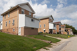
Marianna was built as a mining town for the Pittsburgh Buffalo Company in 1907 and was incorporated in 1910. At the time of its construction, the Marianna Mine was among the most modern and well equipped in the world. The town's brick homes were designed to offer indoor bathrooms, fenced yards and other amenities making living conditions very attractive for the time.

At 10:55 a.m. on the morning of Saturday, November 28, 1908, an explosion occurred in the mine which killed 154 men and left only one survivor. [5] [6] Although the mine was quickly refurbished by the Pittsburgh Buffalo Company, the colliery's fortunes flagged. By 1914, the mine was sold to the Union Coal and Coke Company and later to Bethlehem Steel which continued to extract coal until 1988, when the main conveyor caught fire. The fire was extinguished, but the mine closed anyway.

The Marianna Historic District was listed on the National Register of Historic Places in 1984. [7]

Geography

Marianna is located at 40°0′56″N80°6′38″W / 40.01556°N 80.11056°W / 40.01556; -80.11056 (40.015626, -80.110483). [8]

According to the United States Census Bureau, the borough has a total area of 2.0 square miles (5.2 km2), all land.

Demographics

Historical population
CensusPop.Note
1910 1,363
1920 1,124−17.5%
1930 1,76256.8%
1940 1,493−15.3%
1950 1,269−15.0%
1960 1,088−14.3%
1970 875−19.6%
1980 9073.7%
1990 616−32.1%
2000 6261.6%
2010 494−21.1%
2020 399−19.2%
2021 (est.)394 [4] −1.3%
Sources: [9] [10] [11] [2]

At the 2000 census there were 626 people in 236 households, including 157 families, in the borough. The population density was 320.3 inhabitants per square mile (123.7/km2). There were 259 housing units at an average density of 132.5 per square mile (51.2/km2). The racial makeup of the borough was 89.14% White, 8.79% African American, 0.80% Native American, and 1.28% from two or more races. [10] Of the 236 households 33.1% had children under the age of 18 living with them, 50.4% were married couples living together, 13.1% had a female householder with no husband present, and 33.1% were non-families. 29.2% of households were one person and 16.1% were one person aged 65 or older. The average household size was 2.65 and the average family size was 3.30.

The age distribution was 29.9% under the age of 18, 7.8% from 18 to 24, 28.1% from 25 to 44, 19.0% from 45 to 64, and 15.2% 65 or older. The median age was 33 years. For every 100 females there were 85.8 males. For every 100 females age 18 and over, there were 84.5 males.

The median household income was $28,333 and the median family income was $31,750. Males had a median income of $24,688 versus $20,893 for females. The per capita income for the borough was $11,925. About 14.2% of families and 19.3% of the population were below the poverty line, including 35.1% of those under age 18 and 7.8% of those age 65 or over.

Related Research Articles

<span class="mw-page-title-main">Buckner, Illinois</span> Village in Illinois, United States

Buckner is a village in Franklin County, Illinois, United States. The population was 409 at the 2020 census. The current mayor is Aaron Eubanks.

<span class="mw-page-title-main">Springdale, Pennsylvania</span> Borough in Pennsylvania, United States

Springdale is a borough in northeastern Allegheny County, Pennsylvania, United States, 18 miles (29 km) northeast of Pittsburgh along the Allegheny River. The population was 3,400 at the 2020 census. The borough became official in 1906, after breaking away from the township.

<span class="mw-page-title-main">Almedia, Pennsylvania</span> Census-designated place in Pennsylvania, United States

Almedia is a census-designated place (CDP) in Columbia County, Pennsylvania, United States. It is part of Northeastern Pennsylvania. The population was 1,078 at the 2010 census. It is part of the Bloomsburg-Berwick micropolitan area.

<span class="mw-page-title-main">Williamstown, Pennsylvania</span> Borough in Pennsylvania, United States

Williamstown is a borough in Dauphin County, Pennsylvania, United States. The borough is 38 miles (61 km) northeast of Harrisburg. Formerly, anthracite coal mines and hosiery mills were located in the borough. The population was 1,303 at the 2020 census.

<span class="mw-page-title-main">Fayette City, Pennsylvania</span> Borough in Pennsylvania, United States

Fayette City is a borough in Fayette County, Pennsylvania, United States. The population was 502 at the 2020 census, a decline from the figure of 596 tabulated in 2010. It is served by the Belle Vernon Area School District. Some buildings in the town antedate 1820.

<span class="mw-page-title-main">Perryopolis, Pennsylvania</span> Borough in Pennsylvania, United States

Perryopolis is a borough in Fayette County, Pennsylvania, United States. The borough is part of the Pittsburgh metropolitan area. The population was 1,705 at the 2020 census.

<span class="mw-page-title-main">Carmichaels, Pennsylvania</span> Borough in Pennsylvania, United States

Carmichaels is a borough in Greene County, Pennsylvania, United States. The population was 434 at the 2020 census, a decline from the figure of 483 tabulated in 2010.

<span class="mw-page-title-main">Clymer, Pennsylvania</span> Borough in Pennsylvania, United States

Clymer is a borough in Indiana County, Pennsylvania, United States. The population was 1,336 at the 2020 census. The community was named after William Bingham Clymer, grandson of George Clymer, one of the signers of the United States Declaration of Independence. William Clymer sold the land the borough is situated on to Thomas White in the 1830s. Most of Clymer's family died in a tragic sea accident in 1878, which made national news and inspired the name. It is surrounded by but separate from Cherryhill Township.

<span class="mw-page-title-main">Ernest, Pennsylvania</span> Borough in Pennsylvania, United States

Ernest is a borough in Indiana County, Pennsylvania, United States. The population was 422 at the 2020 census.

<span class="mw-page-title-main">Plumville, Pennsylvania</span> Borough in Pennsylvania, United States

Plumville is a borough in Indiana County, Pennsylvania, United States. The population was 257 at the 2020 census.

<span class="mw-page-title-main">Cressona, Pennsylvania</span> Borough in Pennsylvania, United States

Cressona is a borough in Schuylkill County, Pennsylvania. Formed in 1857 from part of North Manheim Township, it was founded by and named for John Chapman Cresson, a Philadelphia civil engineer and manager of the Schuylkill Navigation Company, president of the Mine Hill and Schuylkill Haven Railroad, and the chief engineer of Fairmount Park in Philadelphia.

<span class="mw-page-title-main">Gilberton, Pennsylvania</span> Borough in Pennsylvania, United States

Gilberton is a borough in Schuylkill County, Pennsylvania, United States, four miles (7 km) west by south of Mahanoy City. Its population was 583 at the 2020 census, a decline from the figure of 769 tabulated in 2010. Extensive deposits of anthracite coal are in the region, and coal-mining had been practiced by many of the 4,373 people who lived there in 1900. The coal-mining industry was thriving in 1910, and 5,401 people lived in Gilberton.

<span class="mw-page-title-main">Port Carbon, Pennsylvania</span> Borough in Pennsylvania, United States

Port Carbon is a borough of Schuylkill County, Pennsylvania, United States, located two miles (3 km) northeast of Pottsville. It is in a coal-mining area. In the past, ironworks had been a feature of the borough. In 1900, 2,168 people lived here and, in 1910, 2,678. The population was 1,815 at the 2020 census.

<span class="mw-page-title-main">Blossburg, Pennsylvania</span> Borough in Pennsylvania, United States

Blossburg is a borough in Tioga County, Pennsylvania, United States. The population was 1,536 at the 2020 census.

<span class="mw-page-title-main">Ellsworth, Pennsylvania</span> Borough in Pennsylvania, United States

Ellsworth is a borough in Washington County, Pennsylvania, United States. The population was 947 at the 2020 census. The coal town was founded by James Ellsworth, who bought the land in 1890s, developed the Monongahela Railway, and sold the mines to Bethlehem Steel in the 1920s.

<span class="mw-page-title-main">Roscoe, Pennsylvania</span> Borough in Pennsylvania, United States

Roscoe is a borough in Washington County, Pennsylvania, United States. The population was 716 at the 2020 census.

<span class="mw-page-title-main">Bolivar, Pennsylvania</span> Borough in Pennsylvania, United States

Bolivar is a borough in Westmoreland County, Pennsylvania, United States. The population was 436 at the 2020 census.

<span class="mw-page-title-main">Export, Pennsylvania</span> Borough in Pennsylvania, United States

Export is a borough in Westmoreland County, Pennsylvania, United States, surrounded entirely by the Municipality of Murrysville. The population was 893 at the 2020 census.

<span class="mw-page-title-main">Grant Town, West Virginia</span> Town in West Virginia, United States

Grant Town is a town in Marion County, West Virginia, in the eastern United States. The population was 690 at the 2020 census.

<span class="mw-page-title-main">Ellwood City, Pennsylvania</span> Borough in Pennsylvania, United States

Ellwood City is a borough primarily in Lawrence County, Pennsylvania, United States. With a small district extending into Beaver County, it lies along the Connoquenessing Creek just east of its confluence with the Beaver River. The population was 7,642 at the 2020 census. Ellwood City lies 30 miles (48 km) northwest of Pittsburgh and 8 miles (13 km) southeast of New Castle within the Pittsburgh metropolitan area.

References

  1. "ArcGIS REST Services Directory". United States Census Bureau. Retrieved October 12, 2022.
  2. 1 2 "Census Population API". United States Census Bureau. Retrieved Oct 12, 2022.
  3. "Marianna PA ZIP Code". zipdatamaps.com. 2023. Retrieved October 31, 2023.
  4. 1 2 Bureau, US Census. "City and Town Population Totals: 2020–2021". Census.gov. US Census Bureau. Retrieved July 22, 2022.
  5. Horton, Frederick (1913). Coal-mine accidents in the United States, 1896-1912 with monthly statistics for 1912. United States Bureau of Mines. p. 70.
  6. Jon Stevens. "Marianna: 152 Dead In One Horrible Instant". Washington Observer-Reporter . Retrieved 2017-04-25.
  7. "National Register Information System". National Register of Historic Places . National Park Service. July 9, 2010.
  8. "US Gazetteer files: 2010, 2000, and 1990". United States Census Bureau. 2011-02-12. Retrieved 2011-04-23.
  9. "Census of Population and Housing". U.S. Census Bureau. Retrieved 11 December 2013.
  10. 1 2 "U.S. Census website". United States Census Bureau . Retrieved 2008-01-31.
  11. "Incorporated Places and Minor Civil Divisions Datasets: Subcounty Resident Population Estimates: April 1, 2010 to July 1, 2012". Population Estimates. U.S. Census Bureau. Archived from the original on 11 June 2013. Retrieved 11 December 2013.