Coal Center, Pennsylvania

Last updated
Coal Center, Pennsylvania
Federal St, Coal Center, Pennsylvania.jpg
Federal St between Green and Apple
Washington County Pennsylvania Incorporated and Unincorporated areas Coal Center Highlighted.svg
Location of Coal Center in Washington County, Pennsylvania.
USA Pennsylvania location map.svg
Red pog.svg
Coal Center, Pennsylvania
Location of Coal Center in Pennsylvania
Coordinates: 40°4′11″N79°54′3″W / 40.06972°N 79.90083°W / 40.06972; -79.90083 Coordinates: 40°4′11″N79°54′3″W / 40.06972°N 79.90083°W / 40.06972; -79.90083
CountryUnited States
State Pennsylvania
County Washington
Established1814
Government
  MayorFrank Paterra
Area
[1]
  Total0.14 sq mi (0.36 km2)
  Land0.11 sq mi (0.29 km2)
  Water0.02 sq mi (0.06 km2)
Population
 (2020) [2]
  Total110
  Density964.91/sq mi (372.98/km2)
Time zone UTC-4 (EST)
  Summer (DST) UTC-5 (EDT)
Area code 724

Coal Center is a borough on the Monongahela River in Washington County, Pennsylvania, United States and part of the Pittsburgh metropolitan area since 1950. [3] The population was 110 at the 2020 census. [4]

Contents

History

Developed in 1814 as Greenfield, the Borough was incorporated under that name on April 9, 1834. Enlarged on March 21, 1874, it was renamed Coal Center in January 1883.

Geography

Coal Center is located at 40°4′11″N79°54′3″W / 40.06972°N 79.90083°W / 40.06972; -79.90083 (40.069810, -79.900783). [5]

According to the United States Census Bureau, the borough has a total area of 0.1 square miles (0.26 km2), of which 0.1 square miles (0.26 km2) is land and 0.04 square miles (0.10 km2) (14.29%) is water.

Climate

The climate in this area is characterized by hot, humid summers and generally mild to cool winters. According to the Köppen Climate Classification system, Coal Center has a humid subtropical climate, abbreviated "Cfa" on climate maps. [6]

Surrounding and adjacent neighborhoods

Coal Center has only one land border, surrounded by California to the south, southwest and west. Across the Monongahela River to the northeast, Coal Center runs adjacent with Newell in Fayette County.

Demographics

Dock on the Monongahela river Dock in Coal Center, Pennsylvania.jpg
Dock on the Monongahela river
Historical population
CensusPop.
1880 557
1890 5692.2%
1900 74230.4%
1910 81610.0%
1920 724−11.3%
1930 629−13.1%
1940 70512.1%
1950 584−17.2%
1960 419−28.3%
1970 317−24.3%
1980 255−19.6%
1990 184−27.8%
2000 134−27.2%
2010 1393.7%
2020 110−20.9%
2021 (est.)109 [4] −0.9%
Sources: [7] [8] [9] [10] [2]

As of the census [8] of 2000, there were 134 people, 59 households, and 32 families residing in the borough. The population density was 1,178.5 people per square mile (470.3/km2). There were 72 housing units at an average density of 633.2 per square mile (252.7/km2). The racial makeup of the borough was 96.27% White, and 3.73% from two or more races. Hispanic or Latino of any race were 1.49% of the population. 10.5% were of Polish, 10.5% Russian, 8.9% English, 8.9% German, 8.9% Irish, 8.1% Croatian and 6.5% Italian ancestry according to Census 2000.

There were 59 households, out of which 22.0% had children under the age of 18 living with them, 28.8% were married couples living together, 25.4% had a female householder with no husband present, and 44.1% were non-families. 25.4% of all households were made up of individuals, and 15.3% had someone living alone who was 65 years of age or older. The average household size was 2.27 and the average family size was 2.79.

In the borough the population was spread out, with 17.2% under the age of 18, 20.1% from 18 to 24, 20.1% from 25 to 44, 24.6% from 45 to 64, and 17.9% who were 65 years of age or older. The median age was 38 years. For every 100 females, there were 69.6 males. For every 100 females age 18 and over, there were 58.6 males.

The median income for a household in the borough was $23,125, and the median income for a family was $28,125. Males had a median income of $26,250 versus $11,042 for females. The per capita income for the borough was $13,827. There were 18.2% of families and 28.1% of the population living below the poverty line, including 30.8% of under eighteens and 20.0% of those over 64.

Related Research Articles

<span class="mw-page-title-main">Dravosburg, Pennsylvania</span> Borough in Pennsylvania, United States

Dravosburg /draːˈvoze:burg/ is a borough in Allegheny County, Pennsylvania, United States, and is part of the Pittsburgh Metro Area. The population was 1,612 at the 2020 census. Dravosburg is located along the Monongahela River.

<span class="mw-page-title-main">Elizabeth, Pennsylvania</span> Borough in Pennsylvania, United States

Elizabeth is a borough in Allegheny County, Pennsylvania, United States, on the east bank of the Monongahela River, where Pennsylvania Route 51 crosses, 15 miles (24 km) upstream (south) of Pittsburgh and close to the county line. The population was 1,398 at the 2020 census. The borough of Elizabeth is entirely contained within the 15037 USPS ZIP code. The local school district is the Elizabeth Forward School District. The borough is home to neighborhoods Walker Heights and Town Hill. Elizabeth Borough is the birthplace of Town Hill Hockey established in 1978.

<span class="mw-page-title-main">Forward Township, Allegheny County, Pennsylvania</span> Township of Allegheny County, Pennsylvania

Forward Township is a township in Allegheny County, Pennsylvania, United States. The population was 3,068 at the 2020 census. The township is named after Walter Forward, U.S. Secretary of the Treasury from 1841 to 1843.

<span class="mw-page-title-main">Rankin, Pennsylvania</span> Borough in Pennsylvania, United States

Rankin is a borough in Allegheny County, Pennsylvania, United States, 8 miles (13 km) south of Pittsburgh on the Monongahela River. The borough was named after Thomas Rankin, a local landowner. Early in the 20th century, Rankin specialized in manufacturing steel and wire goods. The population increased from 3,775 in 1900 to 7,470 in 1940, and has since declined to 1,896 as of the 2020 census.

<span class="mw-page-title-main">West Elizabeth, Pennsylvania</span> Borough in Pennsylvania, United States

West Elizabeth is a borough in Allegheny County, Pennsylvania, United States. The population was 403 at the 2020 census.

<span class="mw-page-title-main">Whitaker, Pennsylvania</span> Borough in Pennsylvania, United States

Whitaker is a borough in Allegheny County, Pennsylvania, United States, and is on the Monongahela River 3 miles (5 km) upriver from Pittsburgh. The population was 1,179 at the 2020 census.

<span class="mw-page-title-main">Fayette City, Pennsylvania</span> Borough in Pennsylvania, United States

Fayette City is a borough in Fayette County, Pennsylvania, United States. The population was 502 at the 2020 census, down from 596 at the 2010 census. It is served by the Belle Vernon Area School District. Some buildings in the town date to before 1820.

<span class="mw-page-title-main">Masontown, Pennsylvania</span> Borough in Pennsylvania, United States

Masontown is a borough in Fayette County, Pennsylvania, United States. It is part of the Pittsburgh Metro Area. The population of the borough was 3,274 at the 2020 census. It is served by the Albert Gallatin Area School District. Masontown is a small crossroads for the rural portions of western Fayette County, and it contains a small shopping center and a grocery store within its business district.

<span class="mw-page-title-main">Newell, Pennsylvania</span> Borough in Pennsylvania, United States

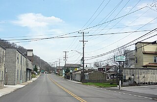
Newell is a borough in Fayette County, Pennsylvania, United States. The population was 512 at the time of the 2020 census.

<span class="mw-page-title-main">Point Marion, Pennsylvania</span> Borough in Pennsylvania, United States

Point Marion is a borough in Fayette County, Pennsylvania, United States. The population was 1,152 at the 2020 census, down from 1,159 at the 2010 census. It is served by the Albert Gallatin Area School District.

<span class="mw-page-title-main">Carmichaels, Pennsylvania</span> Borough in Pennsylvania, United States

Carmichaels is a borough in Greene County, Pennsylvania, United States. The population was 434 at the 2020 census, a decline from the figure of 483 tabulated in 2010.

<span class="mw-page-title-main">Rices Landing, Pennsylvania</span> Borough in Pennsylvania, United States

Rices Landing is a borough in Greene County, Pennsylvania, United States. The population was 426 at the 2020 census.

<span class="mw-page-title-main">Ursina, Pennsylvania</span> Borough in Pennsylvania, United States

Ursina is a borough in Somerset County, Pennsylvania, United States. It is part of the Johnstown, Pennsylvania, Metropolitan Statistical Area. The population was 244 at the 2020 census.

<span class="mw-page-title-main">California, Pennsylvania</span> Borough in Pennsylvania, United States

California is a borough on the Monongahela River in Washington County, Pennsylvania, United States, and part of the Pittsburgh metropolitan area since 1950. The population was 5,479 as of the 2020 census and was estimated at 5,453 in 2021. California is the home of Pennsylvania Western University or PennWest. Founded in 1849, the borough was named for the territory of California following the Gold Rush. The borough has had two notably young mayors—Democrat Peter Daley, who was 22 at his election, and Republican Casey Durdines, who was 20 at his election.

<span class="mw-page-title-main">Charleroi, Pennsylvania</span> Borough in Pennsylvania, United States

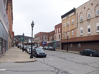
Charleroi is a borough in Washington County, Pennsylvania, United States, along the Monongahela River, 21 miles south of Pittsburgh. Charleroi was settled by Walloons in 1890 and incorporated in 1891. The 2020 census recorded a population of 4,210.

<span class="mw-page-title-main">Dunlevy, Pennsylvania</span> Borough in Pennsylvania, United States

Dunlevy is a borough in Washington County, Pennsylvania, United States. The population was 369 at the 2020 census.

<span class="mw-page-title-main">New Eagle, Pennsylvania</span> Borough in Pennsylvania, United States

New Eagle is a borough in Washington County, Pennsylvania, United States and is part of the Pittsburgh Metro Area. The population was 2,047 at the 2020 census.

<span class="mw-page-title-main">North Charleroi, Pennsylvania</span> Borough in Pennsylvania, United States

North Charleroi is a borough in Washington County, Pennsylvania, United States. The population was 1,302 at the 2020 census.

<span class="mw-page-title-main">Roscoe, Pennsylvania</span> Borough in Pennsylvania, United States

Roscoe is a borough in Washington County, Pennsylvania, United States. The population was 716 at the 2020 census.

<span class="mw-page-title-main">Stockdale, Pennsylvania</span> Borough in Pennsylvania, United States

Stockdale is a borough in Washington County, Pennsylvania, United States. The population was 424 at the 2020 census.

References

  1. "ArcGIS REST Services Directory". United States Census Bureau. Retrieved October 12, 2022.
  2. 1 2 "Census Population API". United States Census Bureau. Retrieved Oct 12, 2022.
  3. "Archived copy". Archived from the original on 2016-01-13. Retrieved 2017-12-06.{{cite web}}: CS1 maint: archived copy as title (link)
  4. 1 2 Bureau, US Census. "City and Town Population Totals: 2020-2021". Census.gov. US Census Bureau. Retrieved 22 July 2022.
  5. "US Gazetteer files: 2010, 2000, and 1990". United States Census Bureau. 2011-02-12. Retrieved 2011-04-23.
  6. Climate Summary for Coal Center, Pennsylvania
  7. "Census of Population and Housing". U.S. Census Bureau. Retrieved 11 December 2013.
  8. 1 2 "U.S. Census website". United States Census Bureau . Retrieved 2008-01-31.
  9. "Incorporated Places and Minor Civil Divisions Datasets: Subcounty Resident Population Estimates: April 1, 2010 to July 1, 2012". Population Estimates. U.S. Census Bureau. Archived from the original on 11 June 2013. Retrieved 11 December 2013.
  10. "Census of Population and Housing". Census.gov. Retrieved June 4, 2016.