Long Branch | |
---|---|
Coordinates: 40°5′30″N79°52′59″W / 40.09167°N 79.88306°W Coordinates: 40°5′30″N79°52′59″W / 40.09167°N 79.88306°W | |
Country | United States |
State | Pennsylvania |
County | Washington |
Established | 1893 |
Government | |
• Mayor | Joseph de Blassio, Jr. |
Area | |
• Total | 3.19 sq mi (8.26 km2) |
• Land | 3.19 sq mi (8.26 km2) |
• Water | 0.00 sq mi (0.00 km2) |
Population | |
• Total | 421 |
• Density | 131.97/sq mi (50.95/km2) |
Time zone | UTC-4 (EST) |
• Summer (DST) | UTC-5 (EDT) |
Area code | 724 |
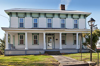
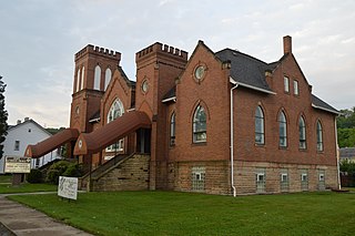
Long Branch is a borough in Washington County, Pennsylvania, United States. The population was 421 at the 2020 census. [3]
Long Branch is located at 40°5′30″N79°52′59″W / 40.09167°N 79.88306°W (40.091561, -79.882983). [4]
According to the United States Census Bureau, the borough has a total area of 3.3 square miles (8.5 km2), all of it land.
Long Branch has seven borders, including Twilight and Speers to the north, Dunlevy to the northeast, Allenport to the east and south, Elco to the southwest, California to the west, and Fallowfield Township in the northwestern corner.
Historical population | |||
---|---|---|---|
Census | Pop. | %± | |
1900 | 273 | — | |
1910 | 273 | 0.0% | |
1920 | 345 | 26.4% | |
1930 | 329 | −4.6% | |
1940 | 386 | 17.3% | |
1950 | 450 | 16.6% | |
1960 | 517 | 14.9% | |
1970 | 582 | 12.6% | |
1980 | 610 | 4.8% | |
1990 | 482 | −21.0% | |
2000 | 539 | 11.8% | |
2010 | 447 | −17.1% | |
2020 | 421 | −5.8% | |
2021 (est.) | 419 | [3] | −0.5% |
Sources: [5] [6] [7] [2] |
At the 2000 census there were 539 people, 204 households, and 159 families living in the borough. The population density was 162.9 people per square mile (62.9/km2). There were 216 housing units at an average density of 65.3 per square mile (25.2/km2). The racial makeup of the borough was 97.59% White, 1.67% African American, 0.19% Native American, 0.19% from other races, and 0.37% from two or more races. Hispanic or Latino of any race were 0.37%. [6]
Of the 204 households 26.0% had children under the age of 18 living with them, 69.1% were married couples living together, 6.4% had a female householder with no husband present, and 21.6% were non-families. 19.6% of households were one person and 6.4% were one person aged 65 or older. The average household size was 2.64 and the average family size was 3.03.
The age distribution was 22.3% under the age of 18, 6.1% from 18 to 24, 27.5% from 25 to 44, 27.5% from 45 to 64, and 16.7% 65 or older. The median age was 42 years. For every 100 females, there were 104.9 males. For every 100 females age 18 and over, there were 101.4 males.
The median household income was $35,972 and the median family income was $40,208. Males had a median income of $40,208 versus $21,250 for females. The per capita income for the borough was $20,936. About 7.7% of families and 10.7% of the population were below the poverty line, including 14.5% of those under age 18 and 6.2% of those age 65 or over.
Atwood is a borough in Armstrong County, Pennsylvania, United States. The population was 107 at the 2010 census.
Athens Township is a township in Crawford County, Pennsylvania, United States. The population was 638 at the 2020 census.
Steuben Township is a township in Crawford County, Pennsylvania, United States. The population was 776 at the 2020 census, down from 804 at the 2010 census, down from 908 in 2000.
Troy Township is a township in Crawford County, Pennsylvania, United States. The population was 1,060 at the 2020 census, down from 1,235 at the 2010 census.
Dudley is a borough in Huntingdon County, Pennsylvania, United States. The population was 185 at the 2020 census.
Jackson Township is a township in Huntingdon County, Pennsylvania, United States. The population was 865 at the 2020 census. Greenwood Furnace State Park is a Pennsylvania state park in Jackson Township.
Gaskill Township is a township in Jefferson County, Pennsylvania, United States. The population was 675 at the 2020 census. It was named for Charles C. Gaskill, agent of the Holland Land Company.
Henderson Township is a township in Jefferson County, Pennsylvania, United States. The population was 1,937 at the 2020 census. It was named for Jefferson County Associate Judge Joseph Henderson.
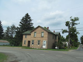
Jackson Township is a township in Venango County, Pennsylvania, United States. The population was 909 at the 2020 census, a decrease from 1,147 in 2010, which represented, in turn, a decline from 1,168 as of the 2000 census.
Plum Township is a township in Venango County, Pennsylvania, United States. The population was 904 at the 2020 census, a decrease from 1,056 in 2010, which was, in turn a decline from the figure of 1,060 as of the 2000 census.
Dunlevy is a borough in Washington County, Pennsylvania, United States. The population was 369 at the 2020 census.
Elco is a borough in Washington County, Pennsylvania, United States. The population was 263 at the 2020 census.
Twilight is a borough in Washington County, Pennsylvania, United States. The population was 216 at the 2020 census.
Arona is a borough in Westmoreland County, Pennsylvania, United States. The population was 253 at the 2020 census.
East Vandergrift is a borough in Westmoreland County in the U.S. state of Pennsylvania. The population was 601 at the 2020 census.
Hunker is a borough in Westmoreland County, Pennsylvania, United States, and since 1950 has been part of the Pittsburgh metropolitan area. The population was 307 at the 2020 census.
Madison is a borough in Westmoreland County, Pennsylvania, United States. The population was 397 at the 2010 census. The borough was named for James Madison, 4th President of the United States.
North Belle Vernon is a borough in Westmoreland County, Pennsylvania, United States. The population was 1,971 at the 2010 census.
Penn is a borough in Westmoreland County, Pennsylvania, United States. The population was 475 at the 2010 census. The borough was named for Pennsylvania founder William Penn.
West Leechburg is a borough in Westmoreland County, Pennsylvania, United States, along the Kiskiminetas River. The population was 1,294 at the 2010 census.