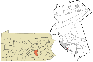
Hiller is an unincorporated community and census-designated place in Fayette County, Pennsylvania, United States. As of the 2010 census, it had a population of 1,155, down from 1,234 at the 2000 census.

Burgettstown is a borough in northwestern Washington County, Pennsylvania, United States. The population was 1,424 according to the 2020 census. It is part of the Pittsburgh metropolitan area.

McDonald is a borough in Allegheny and Washington counties in the U.S. state of Pennsylvania, 18 miles (29 km) southwest of Pittsburgh. The population was 2,056 at the 2020 census. Of this, 1,661 were in Washington County, and 395 were in Allegheny County.
Lynnwood-Pricedale is a census-designated place (CDP) in Fayette and Westmoreland counties in the Pennsylvania. The population was 2,031 at the 2010 census, down from 2,168 at the 2000 census. The community of Lynwood is located in Fayette County's Washington Township, while Pricedale is part of Westmoreland County's Rostraver Township.

Arnold City is an unincorporated community and census-designated place in Washington Township, Fayette County, Pennsylvania, United States. It is located approximately 3 miles (5 km) east of the borough of Belle Vernon, in far northwestern Fayette County. As of the 2010 census, the population of Arnold City was 498.
Fredericktown is a census-designated place located in East Bethlehem Township, Washington County in the state of Pennsylvania. The community was part of the Fredericktown-Millsboro CDP for the 2000 census, but was split into two separate CDPs for the 2010 census, the other community being Millsboro. Fredericktown is located in far southern Washington County, along Pennsylvania Route 88, which travels along the Monongahela River. As of the 2022 American Community Survey, the population was estimated to be 296.
Millsboro is a census-designated place located in East Bethlehem Township, Washington County, Pennsylvania. The community was part of the Fredericktown-Millsboro CDP for the 2000 census but was split into two separate CDPs for the 2010 census, the other community being Fredericktown. Millsboro is located in far southern Washington County, along Pennsylvania Route 88, which travels along the Monongahela River. As of the 2010 census the population was 666 residents.
Lemont Furnace is an unincorporated community and census-designated place in North Union Township, Fayette County, Pennsylvania, United States. It is located 3 miles (5 km) northeast of the city of Uniontown and approximately 60 miles (97 km) southeast of Pittsburgh. The community is part of the Pittsburgh metropolitan area. At the 2010 census, the population of Lemont Furnace was 827.
Hickory is a census-designated place located in Mount Pleasant Township, Washington County in the state of Pennsylvania. As of the 2010 census the population was 740 residents.

Queens Gate is a census-designated place (CDP) in York County, Pennsylvania, United States. The population was 1,464 at the 2010 census. The area was part of the Tyler Run-Queens Gate CDP at the 2000 census.

Chase is a census-designated place (CDP) in Jackson Township, Luzerne County, Pennsylvania, United States. The CDP population was 978 at the 2010 census.

Mocanaqua is an unincorporated community and census-designated place (CDP) in Conyngham Township, Luzerne County, Pennsylvania, United States. The population was 646 at the 2010 census.

Muse is a census-designated place located in Cecil Township, Washington County, Pennsylvania. The community is located in northern Washington County north of the borough of Canonsburg. As of the 2010 census the population was 2,504 residents.

Enhaut is an unincorporated community and census-designated place (CDP) located in Swatara Township, Dauphin County, Pennsylvania, United States. The community was formerly part of the census-designated place of Bressler-Enhaut-Oberlin, before splitting into three separate CDPs for the 2010 census. As of the 2010 census, the population in Enhaut was 1,007.
Grazierville is a census-designated place in Snyder Township, Blair County, Pennsylvania, United States. It is located near I-99 and is approximately one mile to the south of the borough of Tyrone. As of the 2010 census, the population was 665 residents.

Chalk Hill is an unincorporated community and census-designated place in Wharton Township, Fayette County, Pennsylvania, United States. It is located along U.S. Route 40, approximately 8 miles (13 km) southeast of the city of Uniontown. As of the 2010 census, the population was 141.
Naomi is an unincorporated community and census-designated place (CDP) in Washington Township, Fayette County, Pennsylvania, United States. As of the 2010 census, the population was 69.
Cross Creek is a census-designated place located in Cross Creek Township, Washington County in the state of Pennsylvania. The community is located in northern Washington County about 2 miles southwest of the community of Atlasburg. As of the 2010 census the population was 137 residents.

Elrama is a census-designated place located in Union Township, Washington County in the state of Pennsylvania. The community is located in the eastern tip of Union Township in Washington County, near the Monongahela River, along Pennsylvania Route 837. As of the 2020 census, the population was 285 residents.
Lawrence is a census-designated place located in Cecil Township, Washington County in the state of Pennsylvania. The community is a Pittsburgh suburb located in northern Washington County near the Allegheny County line. As of the 2010 census the population was 540 residents.


