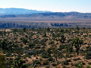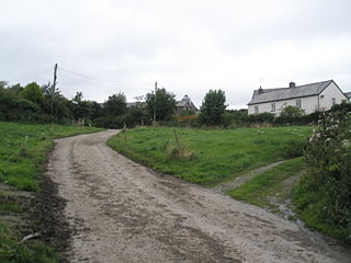
Adams Township in Butler County, Pennsylvania, United States, is a township that had population of 14,841 at the 2020 census.

Franklin Township is a township in Butler County, Pennsylvania, United States. The population was 2,596 at the 2020 census.

Ultzama is a municipality located in the province and autonomous community of Navarre, northern Spain. Ultzama is also the name of the river from which the valley takes its name. It is located 22 km North of Pamplona, the capital city of Navarre.
Coldwater River Provincial Park is a provincial park in British Columbia, Canada, located at the confluence of the Coldwater River with Cullet Creek, 50 km south of Merritt on BC Highway 5.
Garden Bay Marine Provincial Park is a provincial park in British Columbia, Canada at the northwest end of the Sechelt Peninsula on the lower Sunshine Coast, near the community of Madeira Park. Established in 1969, it contains approximately 163 ha.
Okeover Arm Provincial Park is a provincial park in British Columbia, Canada, located on the west side of Okeover Inlet facing Desolation Sound, on the east side of the Malaspina Peninsula.
Stuart River Provincial Park is a provincial park in British Columbia, Canada. It is located in two sections north and northwest of Vanderhoof along the Stuart River southeast of Stuart Lake and the city of Fort St. James. The upper section is located at 54°13′20″N124°00′00″W and comprises c.7391 ha. while the lower, eastern section is centred at 54°03′00″N123°37′00″W and comprises c.3390 ha. and is within the Greater Prince George area. The upper site, which is located around the confluence of the Stuart and Nechako Rivers, includes the site of Chinlac, a Dakelh village whose inhabitants were massacred and enslaved by the Tsilhqot'in of Anahim Lake c. 1745.
The Stikine Ranges are a group of mountain ranges and mountainous plateaus in northwestern British Columbia, Canada. They are the northernmost subdivision of the Cassiar Mountains and among the least explored and most undeveloped parts of the province.
The High Bar First Nation is a First Nations government of the Secwepemc (Shuswap) Nation, located in the Fraser Canyon-Cariboo region of the Central Interior of the Canadian province of British Columbia. It was created when the government of the then-Colony of British Columbia established an Indian reserve system in the 1860s. It is one of three Secwepemc bands that is not a member of either the Shuswap Nation Tribal Council or the Northern Shuswap Tribal Council. The High Bar people are also partly Tsilhqot'in and have links with some Chilcotin First Nations.
The Esk'etemc First Nation, also known as the Alkali Lake Indian Band, is a First Nations government of the Secwepemc (Shuswap) people, located at Alkali Lake in the Cariboo region of the Central Interior of the Canadian province of British Columbia. It was created when the government of the then-Colony of British Columbia established an Indian reserve system in the 1860s. It is one of three Secwepemc bands that is not a member of either the Shuswap Nation Tribal Council or the Northern Shuswap Tribal Council.
The Kluskus First Nation is the band government of the Lhoosk’uz, a Dakelh people whose main reserve located on the Chilcotin Plateau 130 km west of the city of Quesnel, British Columbia, Canada. The First Nation is a member of the Carrier-Chilcotin Tribal Council, which includes both Tsilhqot'in and Carrier (Dakelh) communities.
The Tlʼetinqox-tʼin Government Office is a First Nations government located in the Chilcotin District in the western Central Interior region of the Canadian province of British Columbia. Governing a reserve communities near Alexis Creek known as Anaham Reserve First Nations or Anaham, it is a member of the Tsilhqotʼin Tribal Council aka known as the Tsilhqotʼin National Government. The main reserve is officially known as Anahim's Flat No. 1, and is more commonly as Anaham. Other reserves are Anahim's Meadow No. 2 and 2A, and Anahim Indian Reserves Nos. 3 through 18. Anaham, or Anahim and Alexis were chiefs of the Tsilhqotʼin during the Chilcotin War of 1864, although they and their people did not take part in the hostilities.

The Beaver Dam Wash is a seasonal stream near the southwestern Utah-Nevada border in the United States. At its southern end in northern Arizona, near the point where it empties into the Virgin River, the stream flows throughout the year. Part of the wash is in the Beaver Dam Wash National Conservation Area, managed by the Bureau of Land Management. The wash was so named on account of beaver dams which once were built on its course.

The Borden Peninsula is a peninsula on northern Baffin Island, in Nunavut, Canada. It lies some 80 km south of Devon Island, from which it is separated by Lancaster Sound. Northeastern Borden Peninsula is home to Sirmilik National Park.
The Taku River Tlingit First Nation are the band government of the Inland Tlingit in far northern British Columbia, Canada and also in Yukon. They comprise two ḵwaan (tribes) of the Tlingit people, who are otherwise coastal, the Áa Tlein Ḵwáan of the Atlin Lake area and the Deisleen Ḵwáan of Teslin Lake, whose main focus is the Teslin Tlingit Council in Teslin, Yukon. Their band offices are in Atlin, British Columbia.

Oil Pollution Act of 1961, 33 U.S.C. Chapter 20 §§ 1001–1011, established judicial definitions and coastal prohibitions for the United States maritime industry. The Act invoked the accords of the International Convention for the Prevention of the Pollution of the Sea by Oil, 1954. The international agreement provided provisions to control the discharge of fossil fuel pollutants from nautical vessels on the high seas.
The Nicolet State Trail is an 89-mile state designated trail running through Nicolet National Forest in Florence, Forest, and Oconto Counties in Wisconsin.


