New Eagle, Pennsylvania

Last updated

New Eagle
New Eagle Pennsylvania Main St.jpg
Main St (PA 88), near intersection with Maple St, looking east.
Washington County Pennsylvania Incorporated and Unincorporated areas New Eagle Highlighted.svg
Location of New Eagle in Washington County, Pennsylvania.
USA Pennsylvania location map.svg
Red pog.svg
New Eagle
Location of New Eagle in Pennsylvania
Coordinates: 40°12′27″N79°57′11″W / 40.20750°N 79.95306°W / 40.20750; -79.95306
CountryUnited States
State Pennsylvania
County Washington
Established1901
Government
  MayorCharles M. Fine
Area
[1]
  Total
1.11 sq mi (2.89 km2)
  Land1.02 sq mi (2.63 km2)
  Water0.10 sq mi (0.25 km2)
Population
 (2020) [2]
  Total
2,049
  Density2,016.73/sq mi (778.50/km2)
Time zone UTC-4 (EST)
  Summer (DST) UTC-5 (EDT)
ZIP code
15067 [3]
Area code 724

New Eagle is a borough in Washington County, Pennsylvania, United States and is part of the Pittsburgh Metro Area. The population was 2,047 at the 2020 census. [4]

Contents

History

New Eagle, originally called Riverview, adjoins the City of Monongahela and was laid out in 1901 by J. S. Markell in Carroll Township and incorporated as the Borough of New Eagle on September 9, 1912. New Eagle is the birthplace of Pro Football Hall of Fame quarterback Joe Montana.

Geography

New Eagle is located at 40°12′27″N79°57′11″W / 40.20750°N 79.95306°W / 40.20750; -79.95306 (40.207526, -79.953045). [5]

According to the United States Census Bureau, the borough has a total area of 1.1 square miles (2.8 km2), of which 1.0 square mile (2.6 km2) is land and 0.1 square miles (0.26 km2) (8.04%) is water.

Surrounding and adjacent neighborhoods

New Eagle has three land borders, including Monongahela to the east, Carroll Township to the south and west, and Union Township to the northwest. Across the Monongahela River in Allegheny County to the north, New Eagle runs adjacent with Forward Township in Allegheny County.

Demographics

Municipal Bldg New Eagle Pennsylvania Municipal Bldg.jpg
Municipal Bldg
Historical population
CensusPop.Note
1920 1,572
1930 1,79314.1%
1940 1,9368.0%
1950 2,31619.6%
1960 2,67015.3%
1970 2,497−6.5%
1980 2,6174.8%
1990 2,172−17.0%
2000 2,2624.1%
2010 2,184−3.4%
2020 2,047−6.3%
2021 (est.)2,033 [4] −0.7%
Sources: [6] [7] [8] [2]

As of the census [7] of 2000, there were 2,262 people, 962 households, and 650 families residing in the borough. The population density was 2,189.4 people per square mile (845.3 people/km2). There were 1,068 housing units at an average density of 1,033.7 per square mile (399.1/km2). The racial makeup of the borough was 96.99% White, 1.11% African American, 0.13% Native American, 0.49% Asian, 0.09% Pacific Islander, 0.13% from other races, and 1.06% from two or more races. Hispanic or Latino of any race were 0.09% of the population.

There were 962 households, out of which 26.1% had children under the age of 18 living with them, 51.6% were married couples living together, 12.3% had a female householder with no husband present, and 32.4% were non-families. 27.3% of all households were made up of individuals, and 13.7% had someone living alone who was 65 years of age or older. The average household size was 2.35 and the average family size was 2.86.

In the borough the population was spread out, with 21.6% under the age of 18, 6.4% from 18 to 24, 27.9% from 25 to 44, 24.0% from 45 to 64, and 20.1% who were 65 years of age or older. The median age was 41 years. For every 100 females, there were 90.1 males. For every 100 females age 18 and over, there were 87.2 males.

The median income for a household in the borough was $30,494, and the median income for a family was $35,500. Males had a median income of $33,100 versus $22,786 for females. The per capita income for the borough was $15,636. About 7.8% of families and 9.5% of the population were below the poverty line, including 15.6% of those under age 18 and 3.1% of those age 65 or over.

Notable people

Related Research Articles

<span class="mw-page-title-main">Dravosburg, Pennsylvania</span> Borough in Pennsylvania, United States

Dravosburg is a borough in Allegheny County, Pennsylvania, United States, and is part of the Pittsburgh Metro Area. The population was 1,612 at the 2020 census. Dravosburg is located along the Monongahela River.

<span class="mw-page-title-main">Elizabeth, Pennsylvania</span> Borough in Pennsylvania, United States

Elizabeth is a borough in Allegheny County, Pennsylvania, United States, on the east bank of the Monongahela River, where Pennsylvania Route 51 crosses, 15 miles (24 km) upstream (south) of Pittsburgh and close to the county line. The population was 1,398 at the 2020 census. The borough of Elizabeth is entirely contained within the 15037 USPS ZIP code. The local school district is the Elizabeth Forward School District. The borough is home to neighborhoods Walker Heights and Town Hill.

<span class="mw-page-title-main">Forward Township, Allegheny County, Pennsylvania</span> Township of Allegheny County, Pennsylvania

Forward Township is a township in Allegheny County, Pennsylvania, United States. The population was 3,068 at the 2020 census. The township is named after Walter Forward, U.S. Secretary of the Treasury from 1841 to 1843.

<span class="mw-page-title-main">Glassport, Pennsylvania</span> Borough in Allegheny County, Pennsylvania

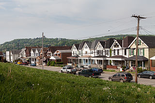
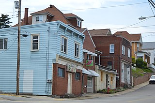
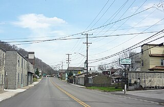
Glassport is a borough in Allegheny County, Pennsylvania, United States, approximately 10 miles (16 km) south of Pittsburgh and the confluence of the Monongahela and Allegheny rivers where they form the Ohio River. Glassport lies along the east side of the Monongahela River in the "Mon Valley", where many blue-collar municipalities have suffered severe economic decline in the wake of the loss of steel-making throughout the Greater Pittsburgh area. In 1910, the population of Glassport was 5,540. By 1940, it had risen to 8,748, but has since declined to 4,475 as of the 2020 census.

<span class="mw-page-title-main">Lincoln, Pennsylvania</span> Borough in Pennsylvania, United States

Lincoln is a borough in Allegheny County, Pennsylvania, United States. The population was 932 at the 2020 United States Census.

<span class="mw-page-title-main">Mount Oliver, Pennsylvania</span> Borough in Pennsylvania, United States

Mount Oliver is a borough in Allegheny County, Pennsylvania, United States. The population was 3,394 at the 2020 census. It is a largely residential area situated atop a crest about 3 miles (5 km) west of the Monongahela River. The borough is surrounded entirely by the city of Pittsburgh, having resisted annexation attempts by the city.

<span class="mw-page-title-main">Munhall, Pennsylvania</span> Borough in Pennsylvania, United States

Munhall is a borough in Allegheny County, Pennsylvania, United States, on the west bank of the Monongahela River. The population was 10,774 at the 2020 census. It is a residential suburb of the Pittsburgh metropolitan area.

<span class="mw-page-title-main">Port Vue, Pennsylvania</span> Borough in Pennsylvania, United States

Port Vue is a borough in Allegheny County, Pennsylvania, United States. The population was 3,680 at the 2020 census.

<span class="mw-page-title-main">West Elizabeth, Pennsylvania</span> Borough in Pennsylvania, United States

West Elizabeth is a borough in Allegheny County, Pennsylvania, United States. The population was 403 at the 2020 census.

<span class="mw-page-title-main">Whitaker, Pennsylvania</span> Borough in Pennsylvania, United States

Whitaker is a borough in Allegheny County, Pennsylvania, United States, and is on the Monongahela River 3 miles (5 km) upriver from Pittsburgh. The population was 1,179 at the 2020 census.

<span class="mw-page-title-main">Brownsville Township, Pennsylvania</span> Township in Pennsylvania, United States

Brownsville Township is a township in Fayette County, Pennsylvania, United States. The population was 536 at the 2020 census, a decline from the figure of 683 tabulated in 2010. It is served by the Brownsville School District.

<span class="mw-page-title-main">Jefferson Township, Fayette County, Pennsylvania</span> Township in Pennsylvania, United States

Jefferson Township is a township in Fayette County, Pennsylvania, United States. The population was 2,007 at the 2020 census, a decline from the figure of 2,008 tabulated in 2010. It is named for former president Thomas Jefferson, and many of the township's streets are named after other U.S. presidents. Frazier School District serves the area.

<span class="mw-page-title-main">Newell, Pennsylvania</span> Borough in Pennsylvania, United States

Newell is a borough in Fayette County, Pennsylvania, United States. The population was 512 at the time of the 2020 census.

<span class="mw-page-title-main">Monongahela Township, Pennsylvania</span> Township in Pennsylvania, United States

Monongahela Township is a township in Greene County, Pennsylvania, United States. The population was 1,487 at the 2020 census, down from 1,572 at the 2010 census.

<span class="mw-page-title-main">Centerville, Washington County, Pennsylvania</span> Borough in Washington County, Pennsylvania, United States

Centerville is a borough in Washington County, Pennsylvania, United States. The population was 3,254 at the 2020 census.

<span class="mw-page-title-main">Dunlevy, Pennsylvania</span> Borough in Pennsylvania, United States

Dunlevy is a borough in Washington County, Pennsylvania, United States. The population was 369 at the 2020 census.

<span class="mw-page-title-main">North Charleroi, Pennsylvania</span> Borough in Pennsylvania, United States

North Charleroi is a borough in Washington County, Pennsylvania, United States. The population was 1,302 at the 2020 census.

<span class="mw-page-title-main">Roscoe, Pennsylvania</span> Borough in Pennsylvania, United States

Roscoe is a borough in Washington County, Pennsylvania, United States. The population was 716 at the 2020 census.

<span class="mw-page-title-main">St. Clair Township, Pennsylvania</span> Township in Pennsylvania, United States

St. Clair Township is a township in Westmoreland County, Pennsylvania, United States. The population was 1,339 at the 2020 census. It is also one of three communities within the county to utilise the 814 area code, alongside New Florence and Seward.

<span class="mw-page-title-main">Wilkins Township, Pennsylvania</span> Township in Pennsylvania, United States

Wilkins Township is a township in Allegheny County, Pennsylvania, United States. The population was 6,357 at the 2010 census. It is served by Pennsylvania's 12th congressional district, the 43rd District of the Pennsylvania State Senate, and the 34th District of the Pennsylvania State House of Representatives.

References

  1. "ArcGIS REST Services Directory". United States Census Bureau. Retrieved October 12, 2022.
  2. 1 2 "Census Population API". United States Census Bureau. Retrieved October 12, 2022.
  3. "New Eagle PA ZIP Code". zipdatamaps.com. 2023. Retrieved May 13, 2023.
  4. 1 2 "City and Town Population Totals: 2020-2021". Census.gov. US Census Bureau. Retrieved July 22, 2022.
  5. "US Gazetteer files: 2010, 2000, and 1990". United States Census Bureau. February 12, 2011. Retrieved April 23, 2011.
  6. "Census of Population and Housing". U.S. Census Bureau. Retrieved December 11, 2013.
  7. 1 2 "U.S. Census website". United States Census Bureau . Retrieved January 31, 2008.
  8. "Incorporated Places and Minor Civil Divisions Datasets: Subcounty Resident Population Estimates: April 1, 2010 to July 1, 2012". Population Estimates. U.S. Census Bureau. Archived from the original on June 11, 2013. Retrieved December 11, 2013.