Claymont is a census-designated place (CDP) in New Castle County, Delaware. The estimated 2017 population of the 19703 ZIP code, which Claymont encompasses, was 15,292.
Upper Makefield Township is a township in Bucks County, Pennsylvania, United States. The population was 8,190 at the 2010 census. It has the eighth highest per capita income among Pennsylvania townships. Its multimillion-dollar homes, top-notch public schools and easy commute to New York City, Princeton and Philadelphia led to its ranking as Best Place to Live in the Suburbs in Philadelphia Magazine's Best Places to Live list. Additionally, it has been listed as the Philadelphia area's second-most expensive suburb and the 287th richest neighborhood in the United States, with a mean household income of $306,081. The area has also been listed an alternative to the Hamptons for the summer by New York Magazine.

Connellsville is a city in Fayette County, Pennsylvania, United States, 36 miles (58 km) southeast of Pittsburgh and 50 miles (80 km) away via the Youghiogheny River, a tributary of the Monongahela River. It is part of the Pittsburgh Metro Area. The population was 7,637 at the 2010 census, a decline from the figure of 9,146 tabulated in 2000.

U.S. Route 322 is a 494 mi (795.0 km) long, east–west United States Highway, traversing Ohio, Pennsylvania, and New Jersey. The road is a spur of US 22 and one of the original highways from 1926. A portion of it at one time was concurrent with the Lakes-to-Sea Highway.

U.S. Route 422 (US 422) is a 271-mile (436 km) long spur route of US 22 split into two segments in the U.S. states of Ohio and Pennsylvania. The western segment of US 422 runs from downtown Cleveland, Ohio, east to Ebensburg, Pennsylvania. The eastern segment, located entirely within Pennsylvania, runs from Hershey east to King of Prussia, near Philadelphia. US 422 Business serves as a business route into each of four towns along the way.

Pennsylvania Route 313 is a mostly 2-lane, 18-mile-long (29 km) state highway entirely within Bucks County, Pennsylvania. The western end of PA 313 is at an intersection with PA 309 and PA 663 in Quakertown. The eastern end is at an intersection with PA 263 in the Doylestown Township community of Furlong. PA 313 is signed an east–west road, although it runs almost purely northwest–southeast through most of its course. It is a major arterial road in central and northern Bucks County as it connects several communities including Quakertown, Dublin, and Doylestown.
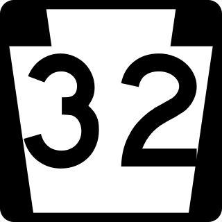
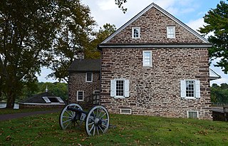
Pennsylvania Route 32 is a scenic two-lane highway that runs along the west side of the Delaware River in Bucks County, Pennsylvania. Signed north-south, it runs from U.S. Route 1 in Falls Township outside of Morrisville northwest to PA 611 in the village of Kintnersville in Nockamixon Township. PA 32 passes through Washington Crossing Historic Park, a Revolutionary War-themed historical park on the site of George Washington's crossing on the night of December 25–26, 1776. It also passes through the boroughs of Morrisville, Yardley, and New Hope.

Transportation in Pittsburgh, Pennsylvania is different than in many other major American cities. A large metropolitan area that is surrounded by rivers and hills, Pittsburgh has an infrastructure system that has been built out over the years to include roads, tunnels, bridges, railroads, inclines, bike paths, and stairways; however, the hills and rivers still form many barriers to transportation within the city.

Pennsylvania Route 3 is a 24.3-mile (39.1 km) state highway located in the southeastern portion of Pennsylvania. The route runs from U.S. Route 322 Business in West Chester east to PA 611 in Philadelphia. The route begins in downtown West Chester and heads east out of the borough as a one-way pair of streets. Between West Chester and Upper Darby, PA 3 follows a four-lane divided highway named West Chester Pike through suburban areas. Along this stretch, the route passes through Edgmont, Newtown Square, Broomall, and Havertown. The route has an interchange with Interstate 476 (I-476) between Broomall and Havertown. Upon reaching Upper Darby, PA 3 heads into Philadelphia along Market Street. In Philadelphia, the route follows multiple one-way pairs, running along Chestnut Street eastbound and Walnut Street westbound in West Philadelphia before heading into Center City Philadelphia along Market Street eastbound and John F. Kennedy Boulevard westbound and ending at Philadelphia City Hall.
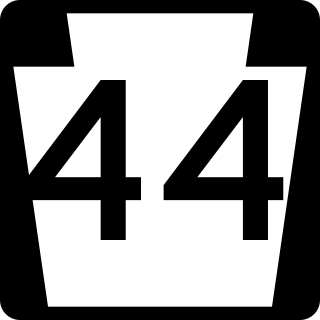
Pennsylvania Route 44 is a 149.24 mi (240.18 km)-long state highway in the U.S. state of Pennsylvania. The route, which is signed north-south, is designated from Interstate 80 (I-80) and PA 42 in Buckhorn northwest to the New York state line near New York State Route 417 in Ceres Township.
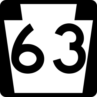
Pennsylvania Route 63 (PA 63) is a 37.4-mile-long (60.2 km) state highway located in the Philadelphia, Pennsylvania, area. The western terminus of the route is at PA 29 in Green Lane, Montgomery County. The eastern terminus is at Interstate 95 (I-95) in Bensalem Township, Bucks County. PA 63 runs northwest to southeast for most of its length. The route heads through a mix of suburban and rural areas of northern Montgomery County as a two-lane road, passing through Harleysville, before coming to an interchange with I-476 in Kulpsville. From this point, PA 63 continues through predominantly suburban areas of eastern Montgomery County as a two- to four-lane road, passing through Lansdale, Maple Glen, Willow Grove, and Huntingdon Valley. Upon entering Northeast Philadelphia, the route follows Red Lion Road and U.S. Route 1 (US 1) before heading southeast on a freeway called Woodhaven Road to I-95.

Pennsylvania Route 73 (PA 73) is a 62.32-mile (100.29 km) long east–west state highway in southeastern Pennsylvania. It runs from PA 61 near Leesport southeast to the New Jersey state line on the Tacony–Palmyra Bridge over the Delaware River in Philadelphia, where the road continues south as New Jersey Route 73. The route passes through rural areas of Berks County, crossing U.S. Route 222 (US 222) in Maiden Creek before heading southeast through Oley and Boyertown. PA 73 continues into Montgomery County and intersects PA 100 in Gilbertsville and PA 29 in Schwenksville before it heads into the northwest suburbs of Philadelphia. The route passes through Skippack and intersects US 202 in Center Square, PA 309 in Springfield Township, and PA 611 near Jenkintown. PA 73 continues through Northeast Philadelphia on Cottman Avenue, crossing US 1 and US 13 before coming to an interchange with Interstate 95 (I-95) near the Tacony–Palmyra Bridge.

U.S. Route 19 (US 19) is a part of the United States Numbered Highway System that runs from Memphis, Florida, to Erie, Pennsylvania. In Virginia, the highway runs 88.89 miles (143.05 km) between two pairs of twin cities: Bristol, Tennessee, and Bristol, Virginia, at the Virginia–Tennessee state line, and Bluefield, Virginia, and Bluefield, West Virginia, at the Virginia–West Virginia state line. Between its endpoints, US 19 has lengthy concurrencies with US 11, US 58 Alternate, and US 460 during its course connecting Abingdon, Lebanon, and Tazewell within Washington, Russell, and Tazewell counties in Southwest Virginia.

Pennsylvania Route 741 is a 26.3-mile-long (42.3 km) state highway that runs through western and southern Lancaster County in the U.S. state of Pennsylvania. The western terminus is along Rohrerstown Road north of an intersection with Commercial Avenue near East Petersburg. The eastern terminus is at PA 41 in Gap. PA 741 heads south from East Petersburg and runs through the western suburbs of Lancaster. The route turns southeast and passes through Millersville before it turns east at New Danville. PA 741 forms a concurrency with U.S. Route 222 between Willow Street and Lampeter before it continues east through farmland in the Pennsylvania Dutch Country that is home to several Amish families, passing through Strasburg before reaching Gap.

U.S. Route 11 (US 11) is a part of the United States Numbered Highway System that runs from New Orleans, Louisiana, to Rouses Point, New York. In Maryland, the federal highway runs 12.83 miles (20.65 km) from the West Virginia state line at the Potomac River in Williamsport north to the Pennsylvania state line near Maugansville. US 11 is the primary north–south surface highway in central Washington County, connecting Hagerstown with Williamsport to the south and Hagerstown Regional Airport to the north. The federal highway was once a major long-distance highway, but that role has been assumed by Interstate 81 (I-81), which parallels US 11 not only in Maryland but for most of its course from Tennessee to Upstate New York. US 11 is maintained by the Maryland State Highway Administration except for the municipally-maintained portions within the corporate limits of Williamsport and Hagerstown.
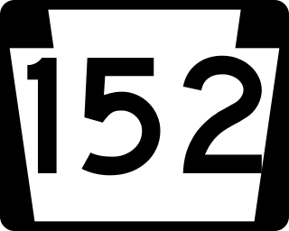
Pennsylvania Route 152 (PA 152) is a 25.3-mile-long (40.7 km) state highway located in the U.S. state of Pennsylvania. The route travels north–south from an interchange with PA 309 located in the Cedarbrook neighborhood of Cheltenham Township in Montgomery County north to another interchange with PA 309 located northeast of Telford in Bucks County. PA 152 is known as Limekiln Pike for most of its length. From the southern terminus, the route passes through suburban areas to the north of Philadelphia, serving Dresher, Maple Glen, and Chalfont. North of Chalfont, PA 152 runs through rural suburbs of Philadelphia before reaching Silverdale. Past here, the road continues northwest through Perkasie, where it turns southwest and passes through Sellersville before reaching its northern terminus.

Pennsylvania Route 117 is a 12.6-mile-long (20.3 km) state route in Lebanon County, Pennsylvania. Its southern terminus is at an interchange with U.S. Route 322 /PA 72 in Cornwall. Its northern terminus is at US 422 in Palmyra. PA 117 heads west from US 322/PA 72 through forested areas, passing through Mount Gretna before forming a short concurrency with PA 241 in Colebrook. From here, the route heads northwest and intersects US 322 near Campbelltown. PA 117 continues north through agricultural areas to Palmyra, where it reaches its northern terminus. The route is a two-lane undivided road its entire length. PA 117 was originally designated in 1928 between PA 5 in Campbelltown and US 22 in Palmyra along Palmyra Road and South Railroad Street. PA 820 was designated between PA 241 in Colebrook and PA 5 near Campbelltown while PA 853 was designated between Mount Gretna and PA 72 west of Cornwall. PA 117 was moved to its current alignment by 1946, replacing all of PA 820 and PA 853.

Pennsylvania Route 271 is a north–south state route located in Western Pennsylvania. Its southern terminus is at PA 711 in Oak Grove in Ligonier Township, and its northern terminus is at U.S. Route 219 (US 219) in Northern Cambria. The route was designated on May 27, 1935 in coordination with the release of a new state road map.

Pennsylvania Route 286 is a 69-mile-long (111 km), east–west state highway located in Allegheny, Westmoreland, Indiana, and Clearfield counties in Pennsylvania.
Stanton is an unincorporated community in New Castle County, Delaware, United States, near the confluence of the Red Clay and White Clay Creeks. It is located in the southern end of Mill Creek Hundred.


