
Washington County is a county in the Commonwealth of Pennsylvania, United States. As of the 2020 census, the population was 209,349. Its county seat is Washington. The county is part of the Greater Pittsburgh region of the state. The county is home to Washington County Airport, three miles (4.8 km) southwest of Washington.

Elizabeth is a borough in Allegheny County, Pennsylvania, United States, on the east bank of the Monongahela River, where Pennsylvania Route 51 crosses, 15 miles (24 km) upstream (south) of Pittsburgh and close to the county line. The population was 1,398 at the 2020 census. The borough of Elizabeth is entirely contained within the 15037 USPS ZIP code. The local school district is the Elizabeth Forward School District. The borough is home to neighborhoods Walker Heights and Town Hill.
Atglen is a borough in Chester County, Pennsylvania, United States. According to the 2020 census, its population is 1,311.
East Fallowfield Township is a township in Chester County, Pennsylvania, United States. The population was 7,626 at the 2020 census.

West Fallowfield Township is a township that is located in Chester County, Pennsylvania, United States. The population was 2,566 at the time of the 2010 census. The township includes the unincorporated village of Cochranville.
California is a borough on the Monongahela River in Washington County, Pennsylvania, United States. The population was 5,479 as of the 2020 census. It is part of the Pittsburgh metropolitan area. Founded in 1849, the borough was named for the territory of California following the gold rush. It is the home of Pennsylvania Western University, California.

Chartiers Township is a township in Washington County, Pennsylvania, United States. The population was 8,632 at the 2020 census. Along with the borough of Houston, the township makes up the Chartiers-Houston School District. It is part of the Pittsburgh metropolitan area.

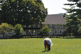
Fallowfield Township is a township in Washington County, Pennsylvania, United States. The population was 4,098 at the 2020 census.

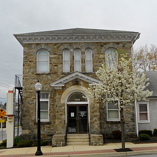
North Charleroi is a borough in Washington County, Pennsylvania, United States. The population was 1,302 at the 2020 census.

West Pike Run Township is a township in Washington County, Pennsylvania, United States. The population was 1,542 at the 2020 census.

Bell Township is a township in Westmoreland County, Pennsylvania, United States. The population was 2,080 at the 2020 decennial census.

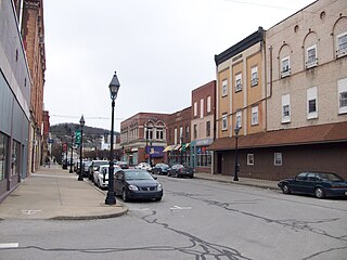
Monessen is a city in southwestern Westmoreland County, Pennsylvania, United States, located along the Monongahela River. The population was 6,876 at the 2020 census.

Rostraver Township is a township in Westmoreland County, Pennsylvania, United States. The population was 11,374 at the 2020 census.
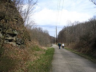
The Montour Trail is a multi-use recreational rail trail near Pittsburgh, Pennsylvania. It was formerly the Montour Railroad.
Jenners is an unincorporated community in Jenner Township, Somerset County, Pennsylvania, United States. It is part of the Johnstown, Pennsylvania Metropolitan Statistical Area. Other nearby unincorporated communities within Jenner Township include Jenner Crossroad, Ferrellton, Acosta, Gray and Ralphton. Also nearby but with separate municipal governments are the boroughs of Jennerstown and Boswell. Jenners is also part of the North Star School District. The Jenners area code is: 814; the zip code: 15546.
Old York Road, originally York Road, with reference to New York, is a roadway that was built during the 18th century to connect Philadelphia with New York City.

Acme is an unincorporated community in Donegal, Mount Pleasant and Bullskin townships in Pennsylvania, United States. The Acme ZIP code of 15610 extends well beyond the more densely populated part of the area, into rural parts of Donegal Township in Westmoreland County and Bullskin Township in Fayette County.
Ercildoun, population about 100, is an unincorporated community in East Fallowfield Township, Chester County, Pennsylvania, United States. The hamlet was founded by Quakers and was an early center of the abolitionist movement. In 1985 the entire hamlet, including 31 properties, was listed as a historic district on the National Register of Historic Places. Of these properties two were vacant land, 14 were significant buildings, ten were contributing buildings, and five buildings, built in the 1950s, were non-contributing. The Lukens Pierce House, an octagon house listed separately on the U.S. National Register of Historic Places, is located about half a mile northwest of the hamlet. Ercildoun is one of about ten hamlets in the township, which has no cities or towns, but has 31 sites listed on the National Register. It is one of the larger hamlets, located near the center of the township, and historically among the best known. The city of Coatesville is about 3 miles north.
Boquet is an unincorporated community in Penn Township, Westmoreland County, Pennsylvania, United States.

Mortonville is an unincorporated area and historic hamlet in Chester County, Pennsylvania, United States, situated on the eastern bank of the West Branch Brandywine Creek. It consists of approximately one-half dozen structures, two of which are on the National Register of Historic Places: the Mortonville Hotel, and the 12.5-foot-long (3.8 m) "Bridge in East Fallowfield Township" which crosses a mill race a few feet east of a larger bridge. The larger bridge, known as the Mortonville Bridge, was also listed on the NRHP until 2010, when it was delisted following a renovation. The two bridges are in East Fallowfield Township, while most other structures are in Newlin Township.


