"},"population_total":{"wt":"4159"},"population_density_km2":{"wt":"839.43"},"population_density_sq_mi":{"wt":"2174.07\n"},"timezone":{"wt":"[[Eastern Time Zone|Eastern (EST)]]"},"utc_offset":{"wt":"-5"},"timezone_DST":{"wt":"EDT"},"utc_offset_DST":{"wt":"-4"},"elevation_footnotes":{"wt":""},"elevation_m":{"wt":"230"},"elevation_ft":{"wt":"755"},"coordinates":{"wt":"{{coord|40|12|02|N|79|55|42|W|region:US-PA|display=inline,title}}"},"postal_code_type":{"wt":"[[ZIP Code]]"},"postal_code":{"wt":"15063"},"area_code":{"wt":"[[Area code 724|724]]"},"blank_name":{"wt":"[[Federal Information Processing Standards|FIPS code]]"},"blank_info":{"wt":"42-50408"},"blank1_name":{"wt":""},"blank1_info":{"wt":""},"website":{"wt":"{{URL|http://cityofmonongahela-pa.gov}}"},"footnotes":{"wt":""},"pop_est_as_of":{"wt":""},"pop_est_footnotes":{"wt":""},"population_est":{"wt":""}},"i":0}}]}" id="mwBw">City in Pennsylvania, United States
Monongahela, Pennsylvania | |
---|---|
![]() | |
Nickname: Mon City | |
![]() Location of Monongahela in Washington County, Pennsylvania. | |
Coordinates: 40°12′02″N79°55′42″W / 40.20056°N 79.92833°W | |
Country | United States |
State | Pennsylvania |
County | Washington |
Established | 1770 |
Government | |
• Mayor | Greg Garry [1] |
Area | |
• Total | 2.09 sq mi (5.40 km2) |
• Land | 1.91 sq mi (4.95 km2) |
• Water | 0.17 sq mi (0.45 km2) |
Elevation | 755 ft (230 m) |
Population | |
• Total | 4,159 |
• Density | 2,174.07/sq mi (839.43/km2) |
Time zone | UTC-5 (Eastern (EST)) |
• Summer (DST) | UTC-4 (EDT) |
ZIP Code | 15063 |
Area code | 724 |
FIPS code | 42-50408 |
Website | cityofmonongahela-pa |
Monongahela, [4] referred to locally as Mon City, is a third class city in Washington County, Pennsylvania, United States. The population was 4,149 at the 2020 census. [5] It is part of the Pittsburgh metropolitan area, about 17 miles (27 km) south of Pittsburgh proper.
The city of Monongahela sits at a location where several locally important Pennsylvania state routes meet: a concurrency between Pennsylvania routes 88, 136, and 837 makes up most of the length of the city's Main Street, and the city's Park Avenue carries Pennsylvania route 481 to its northern terminus at Main Street.
Monongahela is one of just two cities in Washington County, and is the second smallest city in Pennsylvania (after Parker). The town is served by the Ringgold School District.
Monongahela was founded in 1769 on a tract of land near the confluence of Pigeon Creek and the Monongahela River. It is the oldest settlement in the Monongahela River Valley and most likely the oldest in Washington County. [6] The word Monongahela is Native American in origin, meaning "falling banks". The Monongahela tribe was also indigenous to the area prior to the settlement of the city.
The original tract of land was actually owned by three different men, who named their land areas Eden, Paradise, and Gloucester. Joseph Parkison, who operated a ferry on the west bank of the Monongahela River, is recognized as the founder of the city. Parkison built the town's first post office, and in 1782 the town was officially recognized as Parkison's Ferry. Adam Wickerham took claim to 130 acres (0.53 km2) on the Parkison Ferry tract on July 1, 1788. On this tract he laid out Georgetown in 1807. Georgetown was made part of Williamsport by Wickerham on February 23, 1816. In 1833, the first borough officers were elected for Williamsport. On April 1, 1837, Williamsport was given the name Monongahela City and in 1893 shortened to Monongahela.
The city contains a number of streets which are named in honor of prominent Civil War figures including: Lincoln, Grant, Sherman, Stanton, Meade, Hancock, Thomas, Howard, Geary, and Sheridan.
The Edward G. Acheson House, Bethel African Methodist Episcopal Church of Monongahela City, David Longwell House, and Monongahela Cemetery are listed on the National Register of Historic Places. [7]
Monongahela is located at 40°12′2″N79°55′42″W / 40.20056°N 79.92833°W (40.200462, -79.928394). [8]
According to the United States Census Bureau, the city has a total area of 2.1 square miles (5.4 km2), of which 1.9 square miles (4.9 km2) is land and 0.2 square miles (0.52 km2) (9.86%) is water.
The city receives 37.65 inches (956 mm) of rainfall annually and has a mean annual temperature of 63 °F (17 °C).
Monongahela has two land borders, with Carroll Township to the east and south, and New Eagle to the west. Across the Monongahela River, the Allegheny County municipality of Forward Township runs adjacent to the city.
![]() | This section needs to be updated.(April 2023) |
Census | Pop. | Note | %± |
---|---|---|---|
1840 | 752 | — | |
1850 | 977 | 29.9% | |
1860 | 999 | 2.3% | |
1870 | 1,078 | 7.9% | |
1880 | 2,904 | 169.4% | |
1890 | 4,096 | 41.0% | |
1900 | 5,173 | 26.3% | |
1910 | 7,598 | 46.9% | |
1920 | 8,688 | 14.3% | |
1930 | 8,675 | −0.1% | |
1940 | 8,825 | 1.7% | |
1950 | 8,922 | 1.1% | |
1960 | 8,388 | −6.0% | |
1970 | 7,113 | −15.2% | |
1980 | 5,950 | −16.4% | |
1990 | 4,928 | −17.2% | |
2000 | 4,761 | −3.4% | |
2010 | 4,300 | −9.7% | |
2020 | 4,149 | −3.5% | |
2021 (est.) | 4,121 | [5] | −0.7% |
Sources: [9] [10] [11] [3] |
As of the census [10] of 2000, there were 4,761 people, 2,139 households, and 1,264 families residing in the town. The population density was 2,472.4 inhabitants per square mile (954.6/km2). There were 2,382 housing units at an average density of 1,237.0 units per square mile (477.6 units/km2). The racial makeup of the city was 94.94% White, 3.26% African American, 0.08% Native American, 0.19% Asian, 0.42% from other races, and 1.11% from two or more races. Hispanic or Latino of any race were 0.71% of the population.
There were 2,139 households, out of which 23.0% had children under the age of 18 living with them, 42.0% were married couples living together, 12.8% had a female householder with no husband present, and 40.9% were non-families. 36.3% of all households were made up of individuals, and 19.6% had someone living alone who was 65 years of age or older. The average household size was 2.20 and the average family size was 2.87.
In the city, the population was spread out, with 20.1% under the age of 18, 6.9% from 18 to 24, 27.4% from 25 to 44, 22.6% from 45 to 64, and 23.0% who were 65 years of age or older. The median age was 42 years. For every 100 females, there were 85.3 males. For every 100 females age 18 and over, there were 80.6 males.
The median income for a household in the city was $29,060, and the median income for a family was $36,528. Males had a median income of $31,250 versus $23,911 for females. The per capita income for the city was $16,903. About 11.1% of families and 13.6% of the population were below the poverty line, including 25.9% of those under age 18 and 7.2% of those age 65 or over.
Monongahela is home to several parks, playgrounds and a museum. Chess Park, located near the center of the city, hosts community events throughout the year. The Mounds Park, built on the site of an ancient Indian Burial Ground, is a local playground and sports complex. On the banks of the Monongahela River is the Aquatorium, a waterfront venue that hosts the annual Fourth of July celebration and an annual summer concert series. The Monongahela Area Historical Society Museum located on Main Street serves as a community archive and has local historical artifacts on display.
Whiskey Point, a bluff overlooking the Monongahela River located within the city, was an important meeting place during the Whiskey Rebellion. The Pennsylvania State Historical Marker located here reads: "The bluff at Main St. and Park Ave. was the site on Aug. 14, 1794, of a meeting of 226 whiskey rebels. Albert Gallatin's eloquence turned the tide, resulting in peaceful ending of the Whiskey Rebellion and the possibility of civil strife." Today, “Monongahela Rye” (also called Pennsylvania Rye) is a style of rye whiskey characterized by its mash bill containing 95% or more rye, thereby making for a spicier whiskey, barrel-aging notwithstanding. [12] While regionally recognized, this term has no legal binding.
Many buildings in Monongahela, such as the Longwell House and the Bethel A.M.E Church, were used by freed slaves as stops on the Underground Railroad.
There are twenty churches representing fifteen denominations located in Monongahela, including The Church of Jesus Christ (Bickertonite), which has its worldwide headquarters in Monongahela.
Park Avenue in Monongahela was home to numerous notable residents. NFL Hall of Fame quarterback Joe Montana grew up on the road. Other notable residents have included Carl E. Vuono, four-star general and Chief of Staff of the U.S. Army; Jim Jimirro, founder of the Disney Channel; Fred Cox, all-time leading scorer for the Minnesota Vikings and inventor of the Nerf ball; Dr. Ronald V. Pellegrini, a world-renowned cardiothoracic surgeon based in Pittsburgh; National Book Award winner, Dierdre Bair; and former Pittsburgh Pirate pitcher, Ron Necciai, who is the only professional baseball player to strike out 27 batters in one game. [13] [14] [15]
A 90-minute documentary about Park Avenue's notable residents, titled "One Extraordinary Street" was produced by Laura M. Magone and released in 2008. Magone, a graduate of Duquesne University and a Monongahela native, spent several years interviewing persons who lived on Park Avenue in an attempt to determine if there was a common thread that may have contributed to their many successes. [14] The film also includes cameo appearances by Stan Musial and retired four-star general Colin Powell. [13]
As of February 2020, the current mayor of Monongahela is Greg Garry. [16]
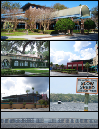
Orange Park is a town in Clay County, Florida, United States. As a suburb of Jacksonville in neighboring Duval County, it is formally a part of the Jacksonville, Florida Metropolitan Statistical Area. The population was 9,089 at the 2020 census, up from 8,412 from the 2010 census. The name "Orange Park" is additionally applied to a wider area of northern Clay County outside the town limits, covering such communities as Lakeside, Bellair-Meadowbrook Terrace and Oakleaf Plantation.
Clairton is a city in Allegheny County, Pennsylvania, United States. It is located along the Monongahela River and is part of the Pittsburgh metropolitan area. The population was 6,181 at the 2020 census. Under Pennsylvania legal classifications for local governments, Clairton is considered a third-class city. It is home to Clairton Works operated by U.S. Steel, the largest coke manufacturing facility in the United States.
Elizabeth Township is a township in Allegheny County, Pennsylvania, United States. The population was 12,972 at the 2020 census. Elizabeth Township – along with Pitt, Plum, Versailles, St. Clair, Moon, and Mifflin – was one of the original seven townships of Allegheny County.
Forward Township is a township in Allegheny County, Pennsylvania, United States. The population was 3,068 at the 2020 census. The township is named after Walter Forward, U.S. Secretary of the Treasury from 1841 to 1843.
Homestead is a borough in Allegheny County, Pennsylvania, United States, along the Monongahela River 7 miles (11 km) southeast of downtown Pittsburgh. The borough is known for the Homestead strike of 1892, an important event in the history of labor relations in the United States. The population was 2,884 at the 2020 census. It is part of the Pittsburgh metropolitan area.
North Braddock is a borough in Allegheny County, Pennsylvania, United States, along the Monongahela River. The 2020 census had the borough population at 4,320. It is a suburb 11 miles (18 km) east of Pittsburgh. Organized from a part of Braddock Township in 1897, the borough prides itself in being the "Birthplace of Steel" as the home of Andrew Carnegie's Edgar Thomson Steel Works that opened in 1875.
South Waverly is a borough in Bradford County, Pennsylvania, United States. It is part of Northeastern Pennsylvania. The population was 1,070 at the 2020 census. South Waverly is part of the Penn-York Valley, a group of four contiguous communities in New York and Pennsylvania: Waverly, New York, South Waverly, Sayre, and Athens, with a combined population near 30,000.
Connellsville is a city in Fayette County, Pennsylvania, United States, 36 miles (58 km) southeast of Pittsburgh and 50 miles (80 km) away via the Youghiogheny River, a tributary of the Monongahela River. It is part of the Pittsburgh metropolitan area. The population was 7,031 at the 2020 census.
Franklin Township is a township in Fayette County, Pennsylvania, United States. The population was 2,380 at the 2020 census, a decline from the figure of 2,528 tabulated in 2010. The township is served by the Uniontown Area School District.
Jefferson Township is a township in Fayette County, Pennsylvania, United States. The population was 2,007 at the 2020 census, a decline from the figure of 2,008 tabulated in 2010. It is named for former president Thomas Jefferson, and many of the township's streets are named after other U.S. presidents. Frazier School District serves the area.
Newell is a borough in Fayette County, Pennsylvania, United States. The population was 512 at the time of the 2020 census.
Ohiopyle is a borough in Fayette County, Pennsylvania, United States. The population was 38 at the 2020 census. While Ohiopyle has a tiny year-round population, it is often filled with tourists on the weekend, who come for the outdoor recreation opportunities at the surrounding Ohiopyle State Park, as well as the Great Allegheny Passage bicycle trail which connects with the Chesapeake and Ohio Canal towpath trail to form a continuous 335-mile off-road trail from Pittsburgh, Pennsylvania to Washington, D.C. The borough of Ohiopyle is served by the Uniontown Area School District.
Springhill Township is a township in Fayette County, Pennsylvania, United States. The population was 2,726 at the 2020 census. The Albert Gallatin Area School District serves the region.
Center Township is a township in Greene County, Pennsylvania, United States. The population was 1,114 at the 2020 census, down from 1,267 at the 2010 census.
Monongahela Township is a township in Greene County, Pennsylvania, United States. The population was 1,483 at the 2020 census, down from 1,572 at the 2010 census.
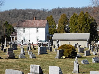
Richhill Township is a township in Greene County, Pennsylvania, United States. The population was 773 at the 2020 census, down from 896 at the 2010 census. Ryerson Station State Park is a Pennsylvania state park on Duke Lake in the township.
Brady Township is a township in Lycoming County, Pennsylvania, United States. The population was 502 at the 2020 census. It is part of the Williamsport Metropolitan Statistical Area.
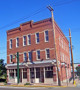
Charleroi is a borough in Washington County, Pennsylvania, United States, along the Monongahela River, 21 miles south of Pittsburgh.
North Charleroi is a borough in Washington County, Pennsylvania, United States. The population was 1,302 at the 2020 census.
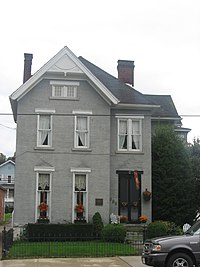
Park Avenue, located in Monongahela, Pennsylvania, is a street of both historical and cultural relevancy. Several notable figures as well as the Meeting at Whiskey Point have come from this noteworthy location in the small Pittsburgh suburb.