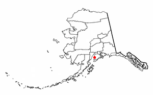
Kasilof is a census-designated place (CDP) in Kenai Peninsula Borough, Alaska, United States. At the 2020 census the population was 525, down from 549 in 2010.

Willow Valley is an unincorporated community and census-designated place (CDP) in Mohave County, Arizona, United States. The population was 1,059 as of the 2020 census.

Landmark is a census-designated place (CDP) in Pulaski County, Arkansas, United States. Per the 2020 census, the population was 3,585. It is part of the Little Rock–North Little Rock–Conway Metropolitan Statistical Area.
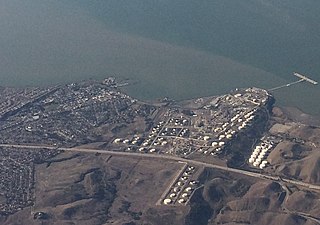
Rodeo is a census-designated place (CDP) located in Contra Costa County, California, in the East Bay sub-region of the San Francisco Bay Area, on the eastern shore of San Pablo Bay, 25 miles northeast of San Francisco. The population was 9,653 at the 2020 census. The place is named for the rodeos common in the late 19th century. Cattle from the surrounding hills were regularly driven down through the old town district to a loading dock on the shoreline of San Pablo Bay for shipment to slaughterhouses, a practice which continued through the early 20th century. Rodeo is served by the Interstate 80 freeway and State Route 4 and used to be served by the first transcontinental railroad which still passes through Rodeo. Rodeo has not been a stop on the railroad since the 1950s.

Twain Harte is a census-designated place (CDP) in Tuolumne County, California, United States. The population was 2,226 at the 2010 census, down from 2,586 at the 2000 census. Its name is derived from the last names of two famous authors who lived in California, Mark Twain and Bret Harte.

South Dennis is a census-designated place (CDP) in the town of Dennis in Barnstable County, Massachusetts, United States. The population was 3,643 at the 2010 census, the largest of the five CDPs in Dennis.

Escatawpa is an unincorporated community and census-designated place (CDP) in Jackson County, Mississippi, United States. It is part of the Pascagoula Metropolitan Statistical Area. The population was 3,254 at the 2020 census.

Carnot-Moon is a census-designated place (CDP) in central Moon Township, Allegheny County, Pennsylvania, United States. The population was 13,151 at the 2020 census.
Spring Ridge is a census-designated place (CDP) in Spring Township, Berks County, Pennsylvania, United States. The population was 1,003 at the 2010 census.
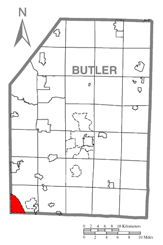
Fernway is a neighborhood in Cranberry Township, Butler County, Pennsylvania, United States. It includes 458 homes on 183 acres and was the first planned housing subdivision in the Township, dating back to the 1950s. Fernway was formerly used as the name of a census-designated place (CDP), but the designation was removed as of TIGER 2013 after Cranberry Township officials pointed out that users of Internet mapping websites frequently misinterpreted the CDP as the name of its parent municipality.

Fox Run is a neighborhood in Cranberry Township, Butler County, Pennsylvania, United States. It is among the Township's earliest housing developments, including 320 homes built on a 131-acre site in the late 1960s. It was formerly a census-designated place (CDP), but that designation was removed as of TIGER 2013 after Cranberry Township officials pointed out that users of Internet mapping websites had misinterpreted the CDP as the name of its parent municipality.

Oakland is an unincorporated area and census-designated place (CDP) in Lawrence County, Pennsylvania, United States. The population was 1,569 at the 2010 census.

Cecil-Bishop is a census-designated place (CDP) in Washington County, Pennsylvania, United States. The population was 2,730 at the 2020 census. The census-designated place encompasses two unincorporated communities: larger Cecil in the west and smaller Bishop in the east.

Gastonville is a census-designated place (CDP) in Washington County, Pennsylvania, United States. The population was 2,818 at the 2010 census.

McMurray is a census-designated place (CDP) in Peters Township, Washington County, Pennsylvania. The population was 4,736 at the 2020 census. It is part of the Pittsburgh metropolitan area. Its zip code is 15317, which it shares with neighboring borough Canonsburg.

Thompsonville is a census-designated place (CDP) in Washington County, Pennsylvania, United States. The population was 3,520 at the 2010 census.

Wolfdale is a census-designated place (CDP) in Washington County, Pennsylvania, United States. The population was 2,888 at the 2010 census.
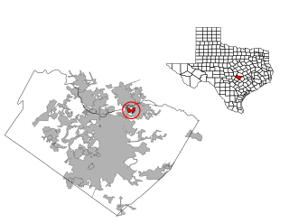
Windermere is a former census-designated place (CDP) in Travis County, Texas, United States. The population was 1,037 at the 2010 census. It has since largely been annexed by the city of Pflugerville.

Prairie Ridge is a census-designated place (CDP) in Pierce County, Washington, United States. The population was 12,288 at the 2020 census.

Three Lakes is a census-designated place (CDP) in Snohomish County, Washington, United States. The population was 3,941 at the 2020 census.


