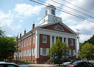
Bedford County is a county in the Commonwealth of Pennsylvania. As of the 2020 census, the population was 47,577. The county seat is Bedford.

Everett is a borough in Bedford County, Pennsylvania, United States. The population was 1,775 at the 2020 census.

Snake Spring Township is a township in Bedford County, Pennsylvania, United States. The population was 1,830 at the 2020 census.

The Juniata River is a tributary of the Susquehanna River, approximately 104 miles (167 km) long, in central Pennsylvania. The river is considered scenic along much of its route, having a broad and shallow course passing through several mountain ridges and steeply lined water gaps. It formed an early 18th-century frontier region in Pennsylvania and was the site of French-allied Native American attacks against English colonial settlements during the French and Indian War.

Pennsylvania Route 26 is a 125.5-mile (202.0 km) highway in the south-central area of Pennsylvania. Its northern terminus is at PA 150 northwest of Howard; its southern terminus is at the Maryland state line near Barnes Gap in Union Township. Two major destinations along this route are Raystown Lake near Huntingdon and the Pennsylvania State University at State College.
Yellow Creek is a 20.9-mile-long (33.6 km) tributary of the Raystown Branch Juniata River in Bedford County, Pennsylvania, in the United States.

The Frankstown Branch Juniata River is a 46.0-mile-long (74.0 km) tributary of the Juniata River in Blair and Huntingdon counties, Pennsylvania, in the United States.
Brush Creek is a 24.7-mile-long (39.8 km) tributary of the Raystown Branch Juniata River in Fulton and Bedford counties, Pennsylvania, in the United States.

The Raystown Branch Juniata River is the largest and longest tributary of the Juniata River in south-central Pennsylvania in the United States.

Bald Eagle Mountain – once known locally as Muncy Mountain – is a stratigraphic ridge in the Ridge-and-Valley Appalachians of central Pennsylvania, United States, running east of the Allegheny Front and northwest of Mount Nittany. It lies along the southeast side of Bald Eagle Creek and south of the West Branch Susquehanna River, and is the westernmost ridge in its section of the Ridge-and-Valley Appalachians. The ridge line separates the West Branch Susquehanna Valley from the Nippenose and White Deer Hole valleys, and Bald Eagle Valley from Nittany Valley.

Tuscarora Mountain is a mountain ridge of the Appalachian Mountains in the Ridge and Valley province in central Pennsylvania. It reaches its highest point on Big Mountain (Pennsylvania) at 2,458 feet (749 m) above sea level. The mountain is named after the Tuscarora people.

Evitts Mountain is a stratigraphic ridge in the Ridge and Valley region of the Appalachian Mountains, located in Bedford County, Pennsylvania, and Allegany County, Maryland.

Wills Mountain is a quartzite-capped ridge in the Ridge and Valley physiographic province of the Appalachian Mountains in Pennsylvania and Maryland, extending from near Bedford, Pennsylvania, to near Cumberland, Maryland. It is the northernmost of several mountain ridges included within the Wills Mountain Anticline.

Tussey Mountain is a stratigraphic ridge in central Pennsylvania, United States, trending east of the Bald Eagle, Brush, Dunning and Evitts Mountain ridges. Its southern foot just crosses the Mason–Dixon line near Flintstone, Maryland, running north 130 km (80 mi) to the Seven Mountains of central Pennsylvania, near Tusseyville, making it one of the longest named ridges in this section of the Ridge-and-valley Appalachians.

The Silurian Tuscarora Formation — also known as Tuscarora Sandstone or Tuscarora Quartzite — is a mapped bedrock unit in Pennsylvania, Maryland, West Virginia, and Virginia, US.
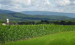
Bedford County, Pennsylvania is situated along the western border of the Ridge and Valley physiographic province, which is characterized by folded and faulted sedimentary rocks of early to middle Paleozoic age. The northwestern border of the county is approximately at the Allegheny Front, a geological boundary between the Ridge and Valley Province and the Allegheny Plateau.

Pennsylvania Route 915 is a 22-mile-long (35 km) state highway located in Fulton and Bedford counties in Pennsylvania. The southern terminus is at Interstate 70 (I-70) in Brush Creek Township. The northern terminus is at PA 26 in Hopewell.
Jacks Mountain is a stratigraphic ridge which is located in central Pennsylvania, United States, trending southeast of the Stone Mountain ridge and Jacks Mountain Anticline. The ridge line separates Kishacoquillas Valley from the Ferguson and Dry Valleys.
Mount Dallas is a populated place in Bedford County, Pennsylvania, United States. It is located in the water gap of Tussey Mountain, approximately one mile upstream of Everett along the Raystown Branch Juniata River. It was the northern terminus of the now dismantled Bedford and Bridgeport Railroad formerly controlled by the Pennsylvania Railroad, and was one of the main points for the planned South Pennsylvania Railroad that was never completed.


