Maggoty Gap

Last updated
Maggoty Gap
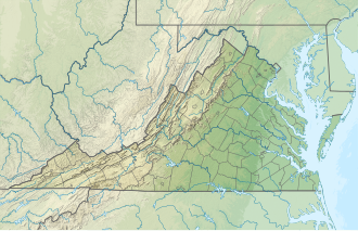
USA Virginia relief location map.svg
Red pog.svg
Location in Virginia
Elevation 1,125 ft (343 m)
Traversed byState Road 677 Willow Branch Road
Location Roanoke county, Virginia, United States
Range Blue Ridge Mountains
Coordinates 37°09′22″N79°58′19″W / 37.156°N 79.972°W / 37.156; -79.972 Coordinates: 37°09′22″N79°58′19″W / 37.156°N 79.972°W / 37.156; -79.972

The original Maggoty Gap was a wind gap in the Blue Ridge Mountains in the counties of Roanoke, Virginia and Franklin, Virginia. Over time, as roads were improved and relocated, the identified location of the gap moved with them. It is now mapped at a spot in Roanoke County.

Contents

Geography

"Maggoty Gap" is now named at a location approximately 5 miles (8.0 km) south of Roanoke, Virginia and 12 miles (19 km) north-northwest of Rocky Mount, Virginia at an elevation of 1,125 feet (343 m).

The present identified location of Maggoty Gap (or Willow Branch Gap) on topographic maps is at 37.156°N 79.972°W, which is actually inside the Back Creek watershed, not at the ridge line. [1] But State Road 677 does pass through it (under a railroad trestle) to the highway (US-220) leading to the true ridge line at "Murray Gap", which separates the Maggodee Creek watershed from the Back Creek watershed. [lower-alpha 1] This route connects Starkey, Virginia and Boone's Mill, Virginia. An alternate route is State Road 613 (Merriman Rd. & Naff Rd.) through the "Simmonds Gap".

There are also two unimproved ridge line gaps between Simmonds Gap and Murray Gap that lead south to Maggodee Creek. These are reached from Starkey, Virginia via Starlight Road (State Road 615) and Boone's Chapel Road (State Road 614). One is at the end of Boone's Chapel Road where a Jeep trail crosses the Franklin County line at a pipeline and descends to State Road 613 adjacent to the Maggodee Creek bridge. [lower-alpha 2] The other is at the end of Wild Turkey Road (branching southwest from Boone's Chapel Road) and passing just below and east of Milner Place, where it crosses the Franklin County line and descends to Maggodee Creek at the junction of State Road 852 (Guthrie Rd.) and State Road 613. [lower-alpha 3]

History

"Maggoty Gap" describes a natural gateway of the Great Wagon Road (locally known as The Carolina Road) that made it possible for wagons and livestock traffic to pass through the Blue Ridge Mountains at Roanoke, Virginia near Maggoty Creek (now called Maggodee Creek). [2] It carried enormous amounts of traffic in the late 18th century and much of the 19th century until a railroad was extended over the ridge in 1892. During the years from 1760 to 1776 it was said to be the heaviest traveled road in all of America. [3]

Morgan Bryan (1671–1763) cut the path for the first wagon to cross the gap from Starkey, Virginia to Boone's Mill, Virginia in 1746 (at age 78). He reported that he had to disassemble his wagon and carry it piecemeal up the last slope. (It reportedly took three months for him and his sons to travel a distance of about 80 miles from Roanoke to their destination at the "Shallow Ford" of the Yadkin River in the vicinity of Winston-Salem, North Carolina.) [4] In 1753, the original 15 Moravians used Bryan's road to get a wagon to their Wachovia Tract located at present-day Winston-Salem, but took a wrong turn and missed Maggoty Gap; instead with great difficulty they traveled over nearby Windy Gap and rejoined Bryan's road at present-day Boone's Mill.

In 1838, Claudius Crozet (1789–1864) surveyed the road for its improvement as the Pittsylvania, Franklin, and Botetourt Turnpike, still made of dirt but with grades generally to be less than 4 percent and the carriageway to be a minimum of 18 feet wide (right-of-way to be a total of 40 feet wide). [5] [6] In his field notes, he had two sketches showing "Maggoty Creek" winding around in the vicinity of the present-day junction of State Roads 613 and 726 (Wades Gap Rd.), and also a road continuing up past the Jacob Naff homestead and John Arthur Road to the "top of the Blue Ridge" where he labeled the present-day Simmonds Gap as "Maggoty Gap". [lower-alpha 4] His sketch showed the road continuing due north down to the cultivated fields of Starkey. He also noted that a nearby path (now called Daybreak Lane) was not "the lowest and best gap". [lower-alpha 5] [7] The turnpike was built immediately afterward, following the route over Simmonds Gap that eventually has become State Road 613 (Naff Road and Merriman Road). It suffered deterioration during the Civil War years, however, and the turnpike was abandoned by its owners around 1865. [8]

Maggoty Gap lost its economic importance when the paved highway US-220 was completed directly from Roanoke through Murray Gap to Rocky Mount, Virginia around 1930.

Notes

  1. Murray Gap is at 37.140°N 79.972°W Elevation 1250 feet.
  2. This "easterly" Old Maggoty Gap is at 37.143°N 79.978°W Elevation 1325 feet.
  3. This "middle" Old Maggoty Gap is at 37.142°N 79.986°W Elevation 1330 feet.
  4. Simmonds Gap is at 37.160°N 80.005°W Elevation 1635 feet. (This is the most "westerly" of several "Old Maggoty Gaps".)
  5. It must be recognized, however, that Crozet's sketches were not to scale and his notes could be misinterpreted.

Related Research Articles

<span class="mw-page-title-main">Franklin County, Virginia</span> County in Virginia, United States

Franklin County is located in the Blue Ridge foothills of the Commonwealth of Virginia. As of the 2020 census, the population was 54,477. Its county seat is Rocky Mount. Franklin County is part of the Roanoke Metropolitan Statistical Area and is located in the Roanoke Region of Virginia. The Roanoke River forms its northeast boundary with Bedford County.

<span class="mw-page-title-main">Boones Mill, Virginia</span> Town in Virginia, United States

Boones Mill is a town in Franklin County, Virginia, United States. The population was 239 in 2018, down from 285 at the 2000 census. It is part of the Roanoke Metropolitan Statistical Area.

<span class="mw-page-title-main">Roanoke metropolitan area</span> Metropolitan area in Virginia, United States

The Roanoke Metropolitan Statistical Area is a Metropolitan Statistical Area (MSA) in Virginia as defined by the United States Office of Management and Budget (OMB). The Roanoke MSA is sometimes referred to as the Roanoke Valley, even though the Roanoke MSA occupies a larger area than the Roanoke Valley. It is geographically similar to the area known as the Roanoke Region of Virginia, but while the latter includes Alleghany County, the former does not. As of the 2020 census, the MSA had a population of 315,251.

Swift Run Gap is a wind gap in the Blue Ridge Mountains located in the U.S. state of Virginia.

The Roanoke Valley in southwest Virginia is an area adjacent to and including the Roanoke River between the Blue Ridge Mountains to the east and the Appalachian Plateau to the west. The valley includes much of Roanoke County, as well as the two independent cities of Roanoke and Salem.

Buford's Gap is a wind gap in the Blue Ridge Mountains in Bedford County, Virginia. Buford's Gap was the original crossing of the Blue Ridge Mountains for the Virginia and Tennessee Railroad, later the Norfolk and Western Railway, a precursor of today's Norfolk Southern Railway system. It was the site of a battle in 1864 during the American Civil War. U.S. Route 460 also passes through the gap.

The Great Wagon Road was an improved trail through the Great Appalachian Valley from Pennsylvania to North Carolina, and from there to Georgia in colonial America.

Powell Mountain is a mountain ridge of the Ridge-and-valley Appalachians of the Appalachian Mountains. It is a long and narrow ridge, running northeast to southwest, from about Norton, Virginia to near Tazewell, Tennessee. It separates the Clinch River basin and the Powell River basin of Powell Valley. It was named for an 18th-century explorer.

<span class="mw-page-title-main">U.S. Route 220 in Virginia</span>

In the U.S. state of Virginia, U.S. Route 220 (US 220) is a major north-south state highway that extends from the North Carolina state line through Roanoke to the West Virginia state line. South of Roanoke, US 220 is a four-lane highway within the proposed Interstate 73 (I-73) corridor. US 220 narrows to two lanes north of Roanoke, connecting to I-64 near Clifton Forge and then paralleling the Appalachian Mountains north-northeasterly in the direction of Cumberland, Maryland.

<span class="mw-page-title-main">Virginia State Route 41</span>

State Route 41 is a primary state highway in the U.S. state of Virginia. Known as Franklin Turnpike, the state highway runs 22.5 miles (36.2 km) from SR 360 northeast of Danville to SR 57 in Callands. The Virginia Department of Transportation (VDOT) officially designates the route north of U.S. Route 29 Business in Danville as a part of SR 41 but the Franklin Turnpike south and east of this point is signed as SR 41.

<span class="mw-page-title-main">Virginia State Route 43</span> State highway in Virginia, United States

State Route 43 is a primary state highway in the U.S. state of Virginia. The state highway consists of two disjoint segments that have a total length of 61.20 miles (98.49 km). The southern portion of the state highway runs 39.79 miles (64.04 km) from U.S. Route 29 Business in Altavista north to the Blue Ridge Parkway at Peaks of Otter. The northern segment has a length of 21.41 miles (34.46 km) between the Blue Ridge Parkway near Buchanan and US 220 in Eagle Rock. The two sections of SR 43 are connected by 4.9 miles (7.9 km) of the Blue Ridge Parkway. The southern portion of the state highway connects Altavista with Bedford and Peaks of Otter. The northern section of SR 43 follows the James River through a narrow valley between Buchanan and Eagle Rock.

<span class="mw-page-title-main">U.S. Route 221 in Virginia</span> Highway in Virginia

U.S. Route 221 (US 221) is a part of the U.S. Highway System that runs from Perry, Florida to Lynchburg, Virginia. In Virginia, the U.S. Highway runs 149.61 miles (240.77 km) from the North Carolina state line near Independence north to its northern terminus at US 29 Business, US 460 Business, and US 501 Business in Lynchburg. US 221 connects Independence, Galax, and Hillsville in Southwest Virginia while running concurrently with US 58. The U.S. Highway connects those communities with Roanoke via Floyd County, within which US 221 is the main east–west highway. The U.S. Highway also runs concurrently with US 460 from Roanoke to Bedford and parallels that U.S. Highway from Bedford to Lynchburg.

<span class="mw-page-title-main">Virginia State Route 116</span> State highway in Virginia

State Route 116 is a primary state highway in the U.S. state of Virginia. The state highway runs 20.66 miles (33.25 km) from SR 122 at Burnt Chimney north to SR 101 in Roanoke. SR 116 connects northwestern Franklin County with the southeastern part of Roanoke. The state highway forms a major street through Downtown Roanoke and the city's north side.

<span class="mw-page-title-main">Virginia State Route 122</span> State highway in Virginia, United States

State Route 122 is a primary state highway in the U.S. state of Virginia. The state highway runs 54.58 miles (87.84 km) from SR 40 in Rocky Mount north to U.S. Route 501 in Big Island. SR 122 passes through the Blue Ridge foothills of Franklin and Bedford counties, connecting Rocky Mount with the town of Bedford. The state highway provides access to Booker T. Washington National Monument and Smith Mountain Lake, and the National D-Day Memorial via its Bedford business route.

<span class="mw-page-title-main">Black Creek (Nescopeck Creek tributary)</span>

Black Creek is a long source tributary of Nescopeck Creek so part of the Susquehanna River drainage basin. It is also the second & longer stream of the same name recognized by the USGS GNIS system in Luzerne County, Pennsylvania, in the United States—compared to the Black Creek beyond the ridgeline of the drainage divide, so in the Lehigh River valley and Carbon County. The headwaters of both Black Creeks in Luzerne county are only a few miles apart, and both valleys were traversed by the Lausanne-Nescopeck Turnpike in the first half of the 19th-century.

The Carolina Road or the "Old Carolina Road" are names for various sections of the Great Wagon Road and other routes in colonial America. "The 'Old Carolina Road', extending from Lancaster, Pennsylvania to the Yadkin Valley, was one of the most heavily traveled roads in eighteenth century America." Parts of the 180-mile-long (290 km) Journey Through Hallowed Ground National Heritage Area scenic byway follow the Old Carolina Road through Pennsylvania, Maryland and Virginia.

The Fincastle Turnpike, also known as the "Fincastle and Blue Ridge Turnpike Company", was approved in 1834 by the Virginia General Assembly to maintain a toll turnpike that followed part of the Wilderness Road from Fincastle, Virginia, to the Cumberland Gap. The Fincastle Turnpike also connected Narrows, Virginia and Tazewell, Virginia along the way to the Cumberland Gap, following roughly what is today parts of Virginia State Route 42 and Virginia State Route 61.

References

  1. "ACME Mapper 2.2". mapper.acme.com. Retrieved July 17, 2014.
  2. Maud Carter Clement, An Abbreviated History of Pittsylvania County, Virginia, chapter 5, Chatham, VA, 1952, per http://victorianvilla.com/sims-mitchell/local/clement/mc/abb/05.htm accessed June 25, 2014.
  3. Carl Bridenbaugh, Myths and Realities: Societies of the Colonial South (1952: Louisiana State University Press) p. 130.
  4. J.P. Crump & H.A. Spraker, The Boone Family, 1922, page 508.
  5. Virginia General Assembly, House of Delegates (1839). "Journal of the House of Delegates of the Commonwealth of Virginia": 15.{{cite journal}}: Cite journal requires |journal= (help)
  6. List of turnpikes in Virginia and West Virginia (Pittsylvania, Franklin, and Botetourt turnpike)
  7. J. Daniel Pezzoni (April 1996). "National Register of Historic Places Inventory/Nomination: Cahas Mountain Rural Historic District". Virginia Department of Historic Resources; and Accompanying photo and Accompanying map
  8. Herman E. Melton: The Franklin Turnpike accessed June 7, 2014, printed in The Pittsylvania Packet, Pittsylvania Historical Society, Chatham, Virginia, Fall 1995, pp. 14/15.