Starkey, Virginia

Last updated
Starkey, Virginia
USA Virginia location map.svg
Red pog.svg
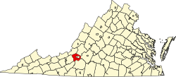
Location within the Commonwealth of Virginia
Usa edcp location map.svg
Red pog.svg
Starkey, Virginia (the United States)
Coordinates: 37°12′02″N79°59′55″W / 37.20056°N 79.99861°W / 37.20056; -79.99861 Coordinates: 37°12′02″N79°59′55″W / 37.20056°N 79.99861°W / 37.20056; -79.99861
CountryUnited States
State Virginia
County Roanoke
Elevation
1,138 ft (347 m)
Time zone UTC−5 (Eastern (EST))
  Summer (DST) UTC−4 (EDT)
ZIP code
24018
Area code(s) 540
GNIS feature ID1495131 [1]
USGS [2]

Starkey is an unincorporated community in southern Roanoke County, Virginia, United States. The community lies south of U.S. 221 near the Blue Ridge Parkway. [3] This is the location of the Starkey School listed on the National Register of Historic Places.

Starkey takes its name from the land owned by Tazewell M. Starkey. "The Starkey community took its name from the Starkey family, who, along with the Harveys, Sloans and Fowlers, were among the first settlers. The village incorporated land once owned by Tazewell Starkey. In the days when Roanoke's roads were rough and muddy, Starkey was an important shipping point for apples, barrels and barrel staves, which were sent in great quantities to Winston-Salem, North Carolina." [4]

The village had no name until the Roanoke and Southern Railroad connected with the Norfolk and Western Railroad in the early 1890s, when a railroad station was established and named for Tazewell Starkey, who gave the land for a railroad right of way. The Shenandoah Packing company was established here in 1908, and canned 11,000 cans per season of apples, tomatoes, sweet potatoes and beans. Later a Post Office was erected there, but was named "Farland" because another post office in nearby Floyd County, Virginia, also had the name "Starkey. When that name was discontinued, the name Starkey was given to this site in order to conform to the railroad station name. This was an important railroad transportation center for local farmers from Back Creek, Virginia, Cave Spring, Virginia and Bent Mountain, Virginia. Today the community is no longer distinct. [5]

Related Research Articles

Roanoke, Virginia Independent city in Virginia, United States

Roanoke is an independent city in the U.S. state of Virginia. At the 2010 census, the population was 97,032. It is located in the Roanoke Valley of the Roanoke Region of Virginia.

Roanoke College private liberal arts college in Salem, Virginia, USA

Roanoke College is a private liberal arts college in Salem, Virginia. It has approximately 2,000 students who represent approximately 40 states and 30 countries. The college offers 35 majors, 57 minors and concentrations, and pre-professional programs. Roanoke awards bachelor's degrees in arts, science, and business administration and is one of 280 colleges with a chapter of the Phi Beta Kappa honor society.

Portsmouth, Virginia Independent city in Virginia, United States

Portsmouth is an independent city in the Commonwealth of Virginia. As of the 2010 census, the population was 95,535. It is part of the Hampton Roads metropolitan area.

Lynchburg, Virginia Independent city in Virginia, United States

Lynchburg is an independent city in the Commonwealth of Virginia in the United States. As of the 2010 census, the population was 75,568, estimated to have risen to 82,126 as of 2018. Located in the foothills of the Blue Ridge Mountains along the banks of the James River, Lynchburg is known as the "City of Seven Hills" or the "Hill City". In the 1860s, Lynchburg was the only major city in Virginia that was not recaptured by the Union before the end of the American Civil War.

Victoria, Virginia Town in Virginia, United States

Victoria is an incorporated town in Lunenburg County, Virginia, United States. The population was 1,725 at the 2010 census, which was down from the 1,821 reported in 2000.

Vinton, Virginia Town in Virginia, United States

Vinton is a town in Roanoke County, Virginia, United States. The population was 8,098 at the 2010 census. Vinton is part of the Roanoke Metropolitan Statistical Area and the Roanoke Region of Virginia.

Inwood, West Virginia CDP in West Virginia, United States

Inwood is a census-designated place (CDP) in Berkeley County, West Virginia, United States, located south of Martinsburg in the lower Shenandoah Valley. The population was 2,954 at the 2010 census. It is located on U.S. Route 11.

Tazewell County, Virginia U.S. county in Virginia

Tazewell County is a county located in the southwestern portion of the U.S. state of Virginia. As of the 2010 census, the population was 45,078. Its county seat is Tazewell.

Norfolk and Western Railway US freight railroad

The Norfolk and Western Railway was a US class I railroad, formed by more than 200 railroad mergers between 1838 and 1982. It was headquartered in Roanoke, Virginia, for most of its existence. Its motto was "Precision Transportation"; it had a variety of nicknames, including "King Coal" and "British Railway of America". During the Civil War, the N&W was the largest railroad in the Confederacy and played an important role in moving supplies for the war effort.

The Roanoke Valley in southwest Virginia is an area adjacent to and including the Roanoke River between the Blue Ridge Mountains to the east and the Appalachian Plateau to the west. The valley includes much of Roanoke County, as well as the two independent cities of Roanoke and Salem.

Southwest Virginia

Southwest Virginia, often abbreviated as SWVA, is a mountainous region of Virginia in the westernmost part of the commonwealth. Located within the broader region of western Virginia, Southwest Virginia has been defined alternatively as all Virginia counties on the Appalachian Plateau, all Virginia counties west of the Eastern Continental Divide, or at its greatest expanse, as far east as Blacksburg and Roanoke. Another geographic categorization of the region places it as those counties within the Tennessee River watershed. Regardless of how borders are drawn, Southwest Virginia differs from the rest of the commonwealth in that its culture is more closely associated with Appalachia than the other regions of Virginia. Historically, the region has been and remains a rural area, but in the 20th century, coal mining became an important part of its economy. With the decline in the number of coal jobs and the decline of tobacco as a cash crop, Southwest Virginia is increasingly turning to tourism as a source of economic development. Collectively, Southwest Virginia's craft, music, agritourism and outdoor recreation are referred to as the region's "creative economy."

U.S. Route 460 in Virginia highway in Virginia

U.S. Route 460 (US 460) in Virginia runs west-east through the southern part of the Commonwealth. The road has two separate pieces in Virginia, joined by a relatively short section in West Virginia. Most of US 460 is a four-lane divided highway and is a major artery in the southern third of the state. From Petersburg to Suffolk, US 460 is a four-lane non-divided highway. It is a popular alternative to Interstate 64 (I-64) when going from Richmond and other points in central Virginia to the Currituck Sound and Outer Banks of North Carolina, avoiding the congestion and tunnels of the more northerly I-64 corridor. The road passes through several small towns that built up at stops along the railroad line. Two of these, Windsor and Waverly, have earned reputations for being speed traps.

Bonsack, Virginia Unincorporated community in Virginia, United States

Bonsack is an unincorporated community in eastern Roanoke County, Virginia, United States. The community is located near the junction of US 460 and US 220 Alternate.

Allentown, Illinois Unincorporated community in Illinois, United States

Allentown is an unincorporated community in Tazewell County, Illinois, United States. Allentown is in the Tremont Township, though it is much closer to Mackinaw than to Tremont. Allentown is 2.5 miles (4.0 km) northwest of Mackinaw and 6 miles (9.7 km) northeast of Tremont.

Bent Mountain, Virginia Unincorporated community in Virginia, United States

Bent Mountain is an unincorporated community in Roanoke County, Virginia, United States. Bent Mountain is located on U.S. Route 221 13.6 miles (21.9 km) southwest of Roanoke. Bent Mountain has a post office with ZIP code 24059.

Starkey School United States historic place

Starkey School is a historic school building located at Starkey, Roanoke County, Virginia. It was built about 1915, and is thought to incorporate an earlier one-room school built about 1894. It is a brick school building flanked by wings built in 1928, and measuring 24 feet by 33 feet. In December 1962, the school was closed and was purchased by Roanoke County. The school is now privately owned.

First National Bank (Roanoke, Virginia) United States historic place

First National Bank, also known as People's Federal Building and Liberty Trust Co., is a historic bank and office building located at Roanoke, Virginia. It was built in 1910, and is a seven-story, granite and buff-colored brick building in the French Renaissance style. It features a Roman Ionic columned main entrance and Doric columns in the main banking hall derived from the Temple of Apollo at Delos.

John Henry Pinkard was a businessman, banker, and herb doctor in Roanoke, Virginia. He was also known as a spiritualist and clairvoyant. Other people considered him a practitioner of quackery and a charlatan.

The Rev. Fleming Emory Alexander was a noted minister, businessman and newspaper publisher. Alexander founded and published the Roanoke Tribune in Roanoke, Virginia, which is one of the nation's longest-running black newspapers. He was also a noted anti-segregationist.

Tazewell Merriman Starkey (1829-1901) was a prominent farmer, banker and civic leader in Roanoke County, Virginia. Born in Franklin County, Virginia and moved to Roanoke County, Virginia, in 1850. "He was a son of Mr. and Mrs. Jack Starkey, and was educated in the private schools of his native county... In May, 1865, he was married to Henrietta P. Harvey, daughter of Colonel and Mrs. Robert Harvey, of Roanoke County, and as a result of that union there were four children; namely, Mrs. Junior W. White, of Cave Spring; Mrs. Eliza B. Smith, of Roanoke; II. Clay Starkey, of Roanoke; and Joseph G. Starkey, who resides at the old homestead."

References

  1. "US Board on Geographic Names". United States Geological Survey. 2007-10-25. Retrieved 2008-01-31.
  2. USGS. "Geographic Names Information System Feature Detail Report: Starkey" . Retrieved 2008-08-06.
  3. "Google Maps" . Retrieved 2008-08-06.
  4. Writers' Program (U.S.). Roanoke, Story of County and City. [Roanoke]: [Stone Print. and manufacturing Co.], 1942. Compiled by workers of the Writers' program of the Work projects administration in the state of Virginia ... Sponsored by the School board of Roanoke city and the School board of Roanoke county. http://www.worldcat.org/oclc/2881615 Page 163.
  5. Kagey, Deedie Dent. When Past Is Prologue: A History of Roanoke County. Roanoke, Va: Roanoke County Sesquicentennial Committee, 1988. http://www.worldcat.org/oclc/19279340 Pages 310-311.