Ashby Gap

Last updated
Ashby's Gap
Ashbys gap.png
The view west into Ashby's Gap (2007)
Elevation 1,027 ft (313 m) [1]
Traversed by US 50.svg U.S. Route 50
Location Virginia, United States
Range Blue Ridge Mountains
Coordinates 39°00′49″N77°57′43″W / 39.01361°N 77.96194°W / 39.01361; -77.96194 [1]
USA Virginia relief location map.svg
Red pog.svg
Ashby's Gap
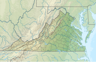
Location of the gap in Virginia

Ashby Gap, more commonly known as Ashby's Gap is a wind gap in the Blue Ridge Mountains on the border of Clarke County, Loudoun County and Fauquier County in Virginia. The gap is traversed by U.S. Route 50. The Appalachian trail also passes across the gap.
Contents

Geography

At 1,027 feet (313 m) the gap is 500 feet (150 m) below the adjacent ridge line to the north, and 700 feet (210 m) above the Shenandoah River, which flows to the north, west of the gap. To the west lies Virginia's Shenandoah Valley, which is part of the Great Appalachian Valley and to the east lies Virginia's Piedmont region. Just south of this gap is Sky Meadows State Park.

The gap serves as the western demarcation point for the border between Fauquier and Loudoun counties, originally marked by a "double-bodied poplar tree standing in or near the middle of the thoroughfare of Ashby's Gap on the top of the Blue Ridge." [2] The tree has since died [2] and the thoroughfare, modern day U.S. Route 50, realigned to the south so that Loudoun County is not entered when traveling through the gap.[ citation needed ]

History

The earliest known use of the gap was as part of a trail of the Native Americans. Upon European colonization, the gap was first referred to as the "Upper Thoroughfare of the Blue Ridge". It was later named "Ashby's Bent" when Thomas Ashby received lands along Goose Creek, and settled Paris, Virginia, at the eastern entrance to the gap. Later it came to be called Ashby's Gap. In the early 19th century the Ashby's Gap Turnpike was completed from Aldie to the crest of the gap where it met up with the Millwod Pike. Those roads in turn became the modern U.S. Route 50 in 1922 when the Commonwealth took possession of them. [3]

Importance during American Civil War

During the American Civil War, Ashby's Gap was often used by the Confederate Army and Union Army in the several Shenandoah Valley campaigns. The nearby ridgetop was used by the Confederate Signal Corps.

Ashby's Gap, sketched by Alfred Waud Ashby's Gap LCCN2004660572.jpg
Ashby's Gap, sketched by Alfred Waud

In July 1861 Brigadier General Thomas J. "Stonewall" Jackson led his 1st Virginia Brigade through Ashby's Gap on his way from Winchester to Piedmont Station (present day Delaplane) where they boarded railcars on the Manassas Gap Railroad and were taken to Manassas Junction where the First Battle of Manassas was underway. This marked the first use of railroads for troop movement in a war.[ citation needed ]

In June 1863, Confederate Major General J.E.B. Stuart's cavalry held this gap to prevent elements from the Union Army under Major General Joseph Hooker from interfering with General Robert E. Lee's army as it marched north toward Pennsylvania in the Gettysburg Campaign.[ citation needed ]

On July 19, 1864, a small cavalry battle, sometimes referred to as the Battle of Ashby's Gap, was fought at the gap when Union cavalry attempted to force passage across the gap and Shenandoah River in an attempt to attack the rear of Confederate Lieutenant General Jubal Early's army and supply trains as he repositioned himself near Berryville as part of the Valley Campaigns of 1864. [4]

Related Research Articles

<span class="mw-page-title-main">Shenandoah Valley</span> Region of Virginia and West Virginia

The Shenandoah Valley is a geographic valley and cultural region of western Virginia and the Eastern Panhandle of West Virginia in the United States. The valley is bounded to the east by the Blue Ridge Mountains, to the west by the eastern front of the Ridge-and-Valley Appalachians, to the north by the Potomac River and to the south by the James River. The cultural region covers a larger area that includes all of the valley plus the Virginia highlands to the west, and the Roanoke Valley to the south. It is physiographically located within the Ridge and Valley province and is a portion of the Great Appalachian Valley.

<span class="mw-page-title-main">Great Appalachian Valley</span> Major landform in eastern North America

The Great Appalachian Valley, also called The Great Valley or Great Valley Region, is one of the major landform features of eastern North America. It is a gigantic trough, including a chain of valley lowlands, and the central feature of the Appalachian Mountains system. The trough stretches about 1,200 miles (1,900 km) from Quebec in the north to Alabama in the south and has been an important north–south route of travel since prehistoric times.

<span class="mw-page-title-main">Turner Ashby</span> Confederate cavalry officer during the American Civil War

Turner Ashby Jr. was an American officer. He was a Confederate cavalry commander in the American Civil War.

<span class="mw-page-title-main">Battle of Aldie</span> 1863 battle of the American Civil War

The Battle of Aldie took place on June 17, 1863, in Loudoun County, Virginia, as part of the Gettysburg Campaign of the American Civil War.

The Battle of Manassas Gap, also known as the Battle of Wapping Heights, took place on July 23, 1863, in Warren County, Virginia, at the conclusion of General Robert E. Lee's retreat back to Virginia in the final days of the Gettysburg Campaign of the American Civil War. Union forces attempted to force passage across the Blue Ridge Mountains and attack the Confederate rear as it formed a defensive position in the upper Shenandoah Valley. Despite successfully forcing the passage at Manassas Gap, the Union force was unable to do so before Lee retreated further up the valley to safety, resulting in an inconclusive battle.

The Battle of Cool Spring, also known as Castleman's Ferry, Island Ford, Parker's Ford, and Snicker's Ferry, was a battle in the American Civil War fought July 17–18, 1864, in Clarke County, Virginia, as part of the Valley Campaigns of 1864. The battle was a Confederate victory.

The Bull Run Mountains are a mountain range of the Blue Ridge Mountains in northern Virginia in the United States. Located approximately 20 miles (32 km) east of the main chain, across the Loudoun Valley. The Bull Run Mountains, together with Catoctin Mountain in Virginia and Maryland, make up the easternmost front of the Blue Ridge.

<span class="mw-page-title-main">Blue Ridge Mountain</span>

Blue Ridge Mountain, also known as Blue Mountain, is the colloquial name of the westernmost ridge of the Blue Ridge Mountains in northern Virginia and the Eastern Panhandle of West Virginia. The Appalachian Trail traverses the entire length of the mountain along its western slope and crest.

<span class="mw-page-title-main">Loudoun Valley</span> Valley in northern Virginia

The Loudoun Valley is a small, but historically significant valley in the Blue Ridge Mountains located in Loudoun County in Northern Virginia in the United States.

<span class="mw-page-title-main">U.S. Route 50 in Virginia</span>

U.S. Route 50 is a transcontinental highway which stretches from Ocean City, Maryland to West Sacramento, California. In the U.S. state of Virginia, US 50 extends 86 miles (138 km) from the border with Washington, D.C. at a Potomac River crossing at Rosslyn in Arlington County to the West Virginia state line near Gore in Frederick County.

Loudoun County, Virginia, was destined to be an area of significant military activity during the American Civil War. Located on Virginia's northern frontier, the Potomac River, Loudoun County became a borderland after Virginia's secession from the Union in early 1861. Loudoun County's numerous Potomac bridges, ferries and fords made it an ideal location for the Union and Confederate armies to cross into and out of Virginia. Likewise, the county's several gaps in the Blue Ridge Mountains that connected the Piedmont to the Shenandoah Valley and Winchester were of considerable strategic importance. The opposing armies would traverse the county several times throughout the war leading to several small battles, most notably the Battle of Ball's Bluff.

<span class="mw-page-title-main">Linden, Virginia</span> Unincorporated community in Virginia, United States

Linden is a small unincorporated village in Fauquier and Warren Counties in the U.S. state of Virginia. It is located west of Washington, D.C. at exit 13 off of Interstate 66.

The Manassas Gap Railroad (MGRR) ran from Mount Jackson, Virginia, to the Orange and Alexandria Railroad's Manassas Junction, which later became the city of Manassas, Virginia. Chartered by the Virginia General Assembly in 1850, the MGRR was a 4 ft 8 in narrow gauge line whose 90 completed miles of track included 38 miles (61 km) of 60 pounds-per-yard T-rail and 52 miles (84 km) of 52 pounds-per-yard T-rail. A total of nine locomotives and 232 cars were operated on the line, serving 20 stations.

<span class="mw-page-title-main">Battle of Unison</span> Battle of the American Civil War

The Battle of Unison or Battle of Union refers to a series of American Civil War cavalry skirmishes in Loudoun County, Virginia, between October 31 – November 2, 1862, between the Confederate forces of J.E.B. Stuart and various units of the Union Army of the Potomac. Although driven from the field in individual engagements, Stuart accomplished his mission to delay the enemy and screen the movements of the retreating Army of Northern Virginia.

<span class="mw-page-title-main">Snickers Gap</span>

Snickers Gap, originally William's Gap, is a wind gap in the Blue Ridge Mountain on the border of Loudoun County and Clarke County in Virginia. The gap is traversed by Virginia State Route 7. The Appalachian Trail also passes across the gap. Bear's Den and Raven Rocks are adjacent to the gap.

<span class="mw-page-title-main">Paris, Virginia</span> Unincorporated Village in Fauquier County, Virginia, U.S.

Paris is an unincorporated hamlet in Fauquier County, Virginia, United States. Located in Virginia's hunt country, it was established in a strategic spot at the eastern base of Ashby Gap along U.S. Route 17 and U.S. Route 50.

Heaton's Crossroads, also known as the Purcellville Wagon Raid, was an American Civil War skirmish that took place between Federal cavalry under Brig. Gen. Alfred N. Duffié and Confederate infantry under Maj. Gen. John C. Breckinridge on July 16, 1864, near present-day Purcellville, Virginia in Loudoun County as part of the Valley Campaigns of 1864. The action was tactically inconclusive.

<span class="mw-page-title-main">7th Virginia Cavalry Regiment</span> Military unit

The 7th Virginia Cavalry Regiment also known as Ashby's Cavalry was a Confederate cavalry regiment raised in the spring of 1861 by Colonel Angus William McDonald The regiment was composed primarily of men from the counties of the Shenandoah Valley as well as from the counties of Fauquier and Loudoun. Two companies contained men from the border counties of Maryland.

<span class="mw-page-title-main">Burning Raid</span> 1864 Union raid during American Civil War

The Burning Raid was a Union raid conducted in the Loudoun Valley of Loudoun and Fauquier counties in Virginia in 1864 during the American Civil War. It was aimed at destroying the forage on which Confederate partisans operating in the area, specifically Mosby's Rangers, subsisted as well as at breaking the will of the citizens of the area for supporting the partisans.

<span class="mw-page-title-main">Timeline of Fauquier County, Virginia in the Civil War</span>

Timeline of Fauquier County, Virginia in the Civil War

References

  1. 1 2 "Ashby Gap". Geographic Names Information System . United States Geological Survey, United States Department of the Interior.
  2. 1 2 Head, James W. (1909). History and Comprehensive Description of Loudoun County, Virginia. Washington, D.C.: Park View Press. pp. 17–18. LCCN   09019166.
  3. Route50.org
  4. Patchan, Scott. Shenandoah Summer: The 1864 Valley Campaign. University of Nebraska Press, 2007. ISBN   0-8032-3754-5

See also