
Bethel Township is a township in Berks County, Pennsylvania, United States. The population was 4,072 at the 2020 census.
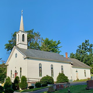
Union Township is a township in Lebanon County, Pennsylvania, United States. It is part of the Lebanon, Pennsylvania metropolitan statistical area. The population was 2,925 at the 2020 census.

Delaware Water Gap is a water gap on the border of the U.S. states of New Jersey and Pennsylvania where the Delaware River cuts through a large ridge of the Appalachian Mountains.

Swatara Creek is a 72-mile-long (116 km) tributary of the Susquehanna River in east-central Pennsylvania in the United States. It rises in the Appalachian Mountains in central Schuylkill County and passes through northwest Lebanon County before draining into the Susquehanna at Middletown in Dauphin County.

Blue Mountain, Blue Mountain Ridge, or the Blue Mountains of Pennsylvania is a ridge of the Appalachian Mountains in eastern Pennsylvania. Forming the southern and eastern edge of the Ridge-and-Valley Appalachians physiographic province in Pennsylvania, Blue Mountain extends 150 miles (240 km) from the Delaware Water Gap on the New Jersey border in the east to Big Gap in Franklin County in south-central Pennsylvania at its southwestern end.

McConnells Mill State Park is a 2,546 acres (1,030 ha) Pennsylvania state park in Perry and Slippery Rock Townships, Lawrence County, Pennsylvania in the United States. The park features a deep scenic gorge with the restored watermill and a covered bridge at the bottom, accessible by a roadway that winds between large, room-sized boulders on the hillside. McConnells Mill State Park is along the Slippery Rock Creek. just southwest of the intersection of US 422 and US 19.
Joseph E. Ibberson Conservation Area is a 783-acre (317 ha) Pennsylvania state park in Middle Paxton and Wayne Townships, Dauphin County, Pennsylvania in the United States.

Pennsylvania Route 72 is a 37.8-mile-long (60.8 km) north–south state route located in southeast Pennsylvania. The southern terminus of the route is at U.S. Route 222 /PA 272 in Lancaster. The northern terminus is at PA 443 north of Lickdale in Union Township. PA 72 serves as a major road connecting Lancaster and Lebanon counties, serving East Petersburg, Manheim, Cornwall, Lebanon, and Jonestown. The route intersects several major roads including US 30 and PA 283 north of Lancaster, the Pennsylvania Turnpike south of Cornwall, US 322 along a concurrency on a freeway bypassing Cornwall, US 422 in Lebanon, US 22 near Jonestown, and I-81 via Fisher Avenue in Lickdale.

Cowans Gap State Park is a 1,085-acre (439 ha) Pennsylvania state park in Todd Township, Fulton County and Metal Township, Franklin County, Pennsylvania in the United States. The park is largely surrounded by Buchanan State Forest in Allens Valley just off Pennsylvania Route 75 near Fort Loudon.
Swatara State Park is a 3,515-acre (1,422 ha) Pennsylvania state park in Bethel, Swatara and Union Townships, Lebanon and Pine Grove Township, Schuylkill Counties in Pennsylvania in the United States. 8 miles (13 km) of Swatara Creek lie within the park's boundaries, which are roughly formed by Pennsylvania Route 443 to the north and Interstate 81 to the south. The park is in a valley in the ridge and valley region of Pennsylvania between Second Mountain (north) and Blue Mountain (south).

Boyd Big Tree Preserve Conservation Area is a 949.49-acre (384.24 ha) Pennsylvania state park in Lower Paxton and Middle Paxton Townships in Dauphin County, Pennsylvania. The land for the conservation area was donated to the state by real estate developer Alex Boyd in 1999. Boyd Big Tree Preserve Conservation Area is a sanctuary for mature trees and an environment education study area. The park is on Blue Mountain just off Pennsylvania Route 443.

Pennsylvania Route 443 is an 80-mile-long (130 km) east–west state highway in the US state of Pennsylvania. The western terminus is at an intersection with State Route 3009 at North Front Street on the east bank of the Susquehanna River in the community of Fort Hunter in Middle Paxton Township, just west of an interchange with the U.S. Route 22 /US 322 freeway. The eastern terminus is at US 209 in Lehighton. The route runs through rural areas in the Ridge-and-Valley Appalachians in Dauphin, Lebanon, Schuylkill, and Carbon counties, serving Fort Indiantown Gap, Pine Grove, Schuylkill Haven, Orwigsburg, New Ringgold, and South Tamaqua. PA 443 intersects several major roads, including US 22/US 322 near its western terminus, PA 72 in Union Township, Interstate 81 (I-81) near Pine Grove, PA 61 between Schuylkill Haven and Orwigsburg, and PA 309 in South Tamaqua.

Reeds Gap State Park is a 220 acres (89 ha) Pennsylvania state park in Armagh Township, Mifflin County, Pennsylvania in the United States. The park is largely a wilderness area with large white pine and hemlock trees. Honey Creek flows through the park, providing a habitat for trout. Reeds Gap State Park is 7 miles (11 km) from U.S. Route 322 near Milroy in New Lancaster Valley and Bald Eagle State Forest.
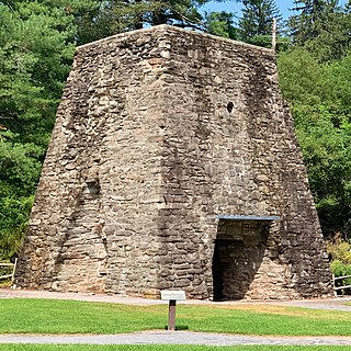
Pine Grove Furnace State Park is a protected Pennsylvania area that includes Laurel and Fuller Lakes in Cooke Township of Cumberland County. The Park accommodates various outdoor recreation activities, protects the remains of the Pine Grove Iron Works (1764), and was the site of Laurel Forge (1830), Pine Grove Park (1880s), and a brick plant (1892). The Park is 8 miles (13 km) from exit 37 of Interstate 81 on Pennsylvania Route 233.

Pennsylvania Route 645 is a state highway in the U.S. state of Pennsylvania. The route runs from U.S. Route 422 in Myerstown, Lebanon County north to PA 443 in Pine Grove Township, Schuylkill County. PA 645 heads north from Myerstown into agricultural areas and enters Berks County, where it passes through Frystown and comes to an interchange with Interstate 78 (I-78)/US 22. Past here, the route heads across forested Blue Mountain and continues into Schuylkill County, where it reaches its northern terminus. PA 645 is a two-lane undivided road its entire length. The road was paved for a short distance north of Myerstown by 1928. The paved portion was extended to Frystown in the 1930s and north of there by 1953. PA 645 was designated onto its current alignment in 1962.

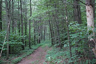
The Pine Creek Rail Trail is the only rail trail in the Appalachian Mountains of north-central Pennsylvania.
The Waterville Bridge is a lenticular truss bridge designed and manufactured by the Berlin Iron Bridge Co. It was built in 1890.
Lower Little Swatara Creek is a tributary of Swatara Creek in southern Schuylkill County, Pennsylvania, US. The creek is 11 miles (18 km) long. The creek starts on Blue Mountain and flows west-southwest into Swatara Creek near the community of Pine Grove. Fishing and canoeing are the primary recreational activities on the creek. Significant amounts of phosphorus and sediment flow through the creek.
The Pennsylvania State Game Lands Number 80 are Pennsylvania State Game Lands in Berks, Lebanon and Schuylkill Counties in Pennsylvania, providing hunting, bird watching, and other activities.
Suedberg is an unincorporated community in Schuylkill County, Pennsylvania, United States.


