Wilson Gap

Last updated
Wilson Gap
Gregory's Gap
Wilson gap sign.jpg
Sign for Wilson Gap on the Appalachian Trail
Elevation 1,444 ft (440 m) [1]
Location Loudoun County, Virginia / Jefferson County, West Virginia, United States
Range Blue Ridge Mountains
Appalachian Mountains
Coordinates 39°10′20″N77°48′22″W / 39.1723261°N 77.8061055°W / 39.1723261; -77.8061055 Coordinates: 39°10′20″N77°48′22″W / 39.1723261°N 77.8061055°W / 39.1723261; -77.8061055 [1]
USA Virginia relief location map.svg
Red pog.svg
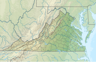
Location of Wilson Gap in Virginia, on the border with West Virginia

Wilson Gap, originally known as Gregory's Gap, is a wind gap in the Blue Ridge Mountain, located on the border of Loudoun County, Virginia and Jefferson County, West Virginia. The Appalachian Trail crosses the gap.

The 1,444 feet (440 m) gap once served as a thoroughfare between Round Hill, the former terminus of the Washington and Old Dominion Railroad in western Loudoun, and the resort communities of Shannondale and Mountain Mission in Jefferson County via the Wilson Gap Road. The resorts fell victim to the Great Depression and the upper reaches of Wilson Gap Road became impassable to vehicular traffic by the outbreak of World War II. [2] Though no longer maintained as a public road, the old road bed can still be found by the discerning hiker.
Related Research Articles

<span class="mw-page-title-main">Loudoun County, Virginia</span> County in Virginia, United States

Loudoun County is in the northern part of the Commonwealth of Virginia in the United States. In 2020, the census found a population of 420,959, making it Virginia's third-most populous county. Loudoun County's seat is Leesburg. Loudoun County is part of the Washington–Arlington–Alexandria, DC–VA–MD–WV Metropolitan Statistical Area. As of 2020, Loudoun County had a median household income of $147,111. Since 2008, the county has been ranked first in the U.S. in median household income among jurisdictions with a population of 65,000 or more.

<span class="mw-page-title-main">Hillsboro, Loudoun County, Virginia</span> Town in Virginia

Hillsboro is a rural town in Loudoun County, Virginia, United States. The population was 80 at the 2010 census and an estimated 169 as of 2019.

<span class="mw-page-title-main">Purcellville, Virginia</span> Town in Virginia

Purcellville is a town in Loudoun County, Virginia. The population was 8,929 according to the 2020 Census. Purcellville is the major population center for Western Loudoun and the Loudoun Valley. Many of the older structures remaining in Purcellville reflect the Victorian architecture popular during the early twentieth century.

<span class="mw-page-title-main">Round Hill, Loudoun County, Virginia</span> Town in Virginia

Round Hill is a town in Loudoun County, Virginia, United States. Its population was 539 at the 2010 census and an estimated 656 in 2019. The town is located at the crossroads of Virginia Routes 7 and 719, approximately 50 miles (80 km) northwest of Washington, D.C. The town's name refers a hill two miles northeast of a 910-foot (280 m) hill used during the American Civil War as a signal post by both Confederate and Union troops.

<span class="mw-page-title-main">U.S. Route 340</span> US Numbered Highway in Virginia, West Virginia and Maryland, United States

U.S. Route 340 is a spur route of US 40, and runs from Greenville, Virginia to Frederick, Maryland. In Virginia, it runs north–south, parallel and east of US 11, from US 11 north of Greenville via Waynesboro, Grottoes, Elkton, Luray, Front Royal, and Berryville to the West Virginia state line. A short separate piece crosses northern Loudoun County on its way from West Virginia to Maryland.

<span class="mw-page-title-main">Catoctin Mountain</span> Mountain ridge in the United States

Catoctin Mountain, along with the geologically associated Bull Run Mountains, forms the easternmost mountain ridge of the Blue Ridge Mountains, which are in turn a part of the Appalachian Mountains range. The ridge runs northeast–southwest for about 50 miles (80 km) departing from South Mountain near Emmitsburg, Maryland, and running south past Leesburg, Virginia, where it disappears into the Piedmont in a series of low-lying hills near New Baltimore, Virginia. The ridge forms the eastern rampart of the Loudoun and Middletown valleys.

The Bull Run Mountains are a mountain range of the Blue Ridge Mountains in northern Virginia in the United States. Located approximately 20 miles (32 km) east of the main chain, across the Loudoun Valley. The Bull Run Mountains, together with Catoctin Mountain in Virginia and Maryland, make up the easternmost front of the Blue Ridge.

<span class="mw-page-title-main">Bluemont, Virginia</span> Unincorporated community in Virginia, United States

Bluemont is an unincorporated village in Loudoun County, Virginia located at the eastern base of Snickers Gap in the Blue Ridge Mountains. The village's center is located along Snickersville Turnpike, 4 miles (6.4 km) west of the incorporated town of Round Hill. The village borders Virginia's fox hunting country and is within 1 mile (1.6 km) of the Appalachian Trail and the Bears Den and Raven Rocks formations in the Blue Ridge.

<span class="mw-page-title-main">Blue Ridge Mountain</span>

Blue Ridge Mountain, also known as Blue Mountain, is the colloquial name of the westernmost ridge of the Blue Ridge Mountains in northern Virginia and the Eastern Panhandle of West Virginia. The Appalachian Trail traverses the entire length of the mountain along its western slope and crest.

<span class="mw-page-title-main">Aldie, Virginia</span> Census-designated place in Virginia

Aldie is an unincorporated community and census-designated place (CDP) located between Chantilly and Middleburg in Loudoun County, Virginia, United States. The historic village of Aldie is located on the John Mosby Highway in a gap between the Catoctin Mountains and Bull Run Mountains, through which the Little River flows. Aldie traditionally serves as the gateway to the Loudoun Valley and beyond.

Little Washington is a now mostly uninhabited African American village in Loudoun County, Virginia, United States.

<span class="mw-page-title-main">Ashby Gap</span>

Ashby Gap, more commonly known as Ashby's Gap is a wind gap in the Blue Ridge Mountains on the border of Clarke County, Loudoun County and Fauquier County in Virginia. The gap is traversed by U.S. Route 50. The Appalachian trail also passes across the gap.

<span class="mw-page-title-main">U.S. Route 50 in Virginia</span>

U.S. Route 50 is a transcontinental highway which stretches from Ocean City, Maryland to West Sacramento, California. In the U.S. state of Virginia, US 50 extends 86 miles (138 km) from the border with Washington, D.C. at a Potomac River crossing at Rosslyn in Arlington County to the West Virginia state line near Gore in Frederick County.

Neersville is an unincorporated community in northwestern Loudoun County, Virginia, United States. It is located in the Between the Hills area of the Loudoun Valley on Harpers Ferry Road at the foot of Short Hill Mountain. It is notable for being the birthplace of Confederate guerrilla John Mobberly.

<span class="mw-page-title-main">Short Hill Mountain</span>

Short Hill Mountain is a mountain ridge of the Blue Ridge Mountains in northwest Loudoun County, Virginia.

The Snicker's Gap Turnpike was a turnpike road in the northern part of the U.S. state of Virginia. Part of it is now maintained as State Route 7, a primary state highway, but the road between Aldie and Bluemont in Loudoun County, via Mountville, Philomont, and Airmont, is a rural Virginia Byway known as Snickersville Turnpike, and includes the about 180-year-old Hibbs Bridge over Beaverdam Creek. This turnpike replaced, in part, the first toll road in the United States, which consisted of two roads from Alexandria northwest into the Shenandoah Valley.

<span class="mw-page-title-main">Snickers Gap</span>

Snickers Gap, originally William's Gap, is a wind gap in the Blue Ridge Mountain on the border of Loudoun County and Clarke County in Virginia. The gap is traversed by Virginia State Route 7. The Appalachian Trail also passes across the gap. Bear's Den and Raven Rocks are adjacent to the gap.

<span class="mw-page-title-main">Clarke's Gap</span>

Clarke's Gap, also known as Clarks Gap, is a pass through Catoctin Mountain west of Leesburg, Virginia. The gap has an elevation of 643 feet (196 m). The gap is not a true wind gap, but rather a man-made railroad cut through a local saddle point between two ridges to the southeast and northwest created by the drainage of Dry Mill Branch of Tuscarora Creek to the east and an unnamed tributary of Catoctin Creek to the west.

Keyes Gap or Keyes' Gap is a wind gap in the Blue Ridge Mountain on the border of Loudoun County, Virginia and Jefferson County, West Virginia. The gap is traversed by Virginia State Route 9/West Virginia Route 9. The Appalachian Trail also crosses the gap.

<span class="mw-page-title-main">Raven Rocks (rock formation)</span>

Raven Rocks is spur of Blue Ridge Mountain in Jefferson County, West Virginia. The peak is located just north of Jefferson County's border with Clarke County, Virginia and west of its border with Loudoun County, Virginia.

References

  1. 1 2 "Wilson Gap". Geographic Names Information System . United States Geological Survey, United States Department of the Interior.
  2. Scheel, E.M. Loudoun Discovered: Communities, Corners & Crossroads Vol. 4, Friends of the Thomas Balch Library, Leesburg, Va. 2002, p. 77.