Hillsboro Gap

Last updated
Hillsboro Gap
The Gap in the Short Hill
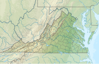
USA Virginia relief location map.svg
Red pog.svg
Location of Hillsboro Gap in Virginia
Elevation 510 ft (155 m)
Traversed by Virginia 9.svg Virginia Route 9
Location Loudoun County, Virginia, United States
Range Short Hill Mountain
Blue Ridge Mountains
Coordinates 39°12′N77°42′W / 39.2°N 77.7°W / 39.2; -77.7

Hillsboro Gap, also known as the Gap in the Short Hill is a water gap in the Short Hill Mountain formed by the North Fork of the Catoctin Creek in Loudoun County, Virginia. The gap derives its name from the town of Hillsboro, which is nestled in the gap. Virginia State Route 9 passes through the gap in the town.

In colonial times the main road between Alexandria and Winchester, Vestal's Gap Road, passed through the gap. That road eventually became the Charles Town Pike and modern day Route 9.

The gap poses a barrier to any widening of Route 9 as the historic town completely fills the gap.[ citation needed ]
Related Research Articles

<span class="mw-page-title-main">Hillsboro, Loudoun County, Virginia</span> Town in Virginia

Hillsboro is a rural town in Loudoun County, Virginia, United States. The population was 114 at the 2020 census.

<span class="mw-page-title-main">Purcellville, Virginia</span> Town in Virginia, US

Purcellville is a town in Loudoun County, Virginia. The population was 8,929 according to the 2020 Census. Purcellville is the major population center for Western Loudoun and the Loudoun Valley. Many of the older structures remaining in Purcellville reflect the Victorian architecture popular during the early twentieth century.

<span class="mw-page-title-main">Round Hill, Loudoun County, Virginia</span> Town in Virginia

Round Hill is a town in Loudoun County, Virginia, United States. Its population was 693 at the 2020 census. The town is located at the crossroads of Virginia Routes 7 and 719, approximately 50 miles (80 km) northwest of Washington, D.C. The town's name refers a hill two miles northeast of a 910-foot (280 m) hill used during the American Civil War as a signal post by both Confederate and Union troops. House of Round Hill was built in 2004. Patsy Cline went to Round Hill Elementary School.

<span class="mw-page-title-main">U.S. Route 340</span> US Numbered Highway in Virginia, West Virginia and Maryland, United States

U.S. Route 340 is a spur route of US 40, and runs from Greenville, Virginia, to Frederick, Maryland. In Virginia, it runs north–south, parallel and east of US 11, from US 11 north of Greenville via Waynesboro, Grottoes, Elkton, Luray, Front Royal, and Berryville to the West Virginia state line. A short separate piece crosses northern Loudoun County on its way from West Virginia to Maryland.

<span class="mw-page-title-main">Virginia State Route 7</span> State highway in northern Virginia, US

Virginia State Route 7 (VA 7) is a major primary state highway and busy commuter route in northern Virginia, United States. It travels southeast from downtown Winchester to SR 400 in downtown Alexandria. Its route largely parallels those of the Washington & Old Dominion Trail and the Potomac River. Between its western terminus and Interstate 395 (I-395), SR 7 is part of the National Highway System. In 1968, the Virginia State Highway Commission designated the road as the "Harry Flood Byrd Highway" between Alexandria and Winchester to commemorate Harry F. Byrd Sr. (1887–1966).

<span class="mw-page-title-main">Bluemont, Virginia</span> Unincorporated community in Virginia, United States

Bluemont is an unincorporated village in Loudoun County, Virginia located at the eastern base of Snickers Gap in the Blue Ridge Mountains. The village's center is located along Snickersville Turnpike, 4 miles (6.4 km) west of the incorporated town of Round Hill. The village borders Virginia's fox hunting country and is within 1 mile (1.6 km) of the Appalachian Trail and the Bears Den and Raven Rocks formations in the Blue Ridge.

<span class="mw-page-title-main">West Virginia Route 9</span> State highway in West Virginia, United States

West Virginia Route 9 (WV 9) is a major east–west state highway located in the eastern extents of West Virginia's Eastern Panhandle. The western terminus of the route is at the Maryland state line on the north edge of Paw Paw, where WV 9 becomes Maryland Route 51 (MD 51) upon crossing the Potomac River. The eastern terminus is at the Virginia state line at Keyes Gap near Mannings, West Virginia, where WV 9 continues onward as Virginia State Route 9 (SR 9).

<span class="mw-page-title-main">Catoctin Creek (Virginia)</span> River in Virginia, United States

Catoctin Creek is a 14.1-mile-long (22.7 km) tributary of the Potomac River in Loudoun County, Virginia, with a watershed of 59,000 acres (240 km2). Agricultural lands make up 67 percent and forests 30 percent of Catoctin Creek's watershed. It is the main drainage system for the northern Loudoun Valley, including all of the Catoctin Valley.

<span class="mw-page-title-main">Loudoun Valley</span> Valley in northern Virginia

The Loudoun Valley is a small, but historically significant valley in the Blue Ridge Mountains located in Loudoun County in Northern Virginia in the United States.

<span class="mw-page-title-main">U.S. Route 50 in Virginia</span> Segment of American highway

U.S. Route 50 is a transcontinental highway which stretches from Ocean City, Maryland to West Sacramento, California. In the U.S. state of Virginia, US 50 extends 86 miles (138 km) from the border with Washington, D.C. at a Potomac River crossing at Rosslyn in Arlington County to the West Virginia state line near Gore in Frederick County.

Neersville is an unincorporated community in northwestern Loudoun County, Virginia, United States. It is located in the Between the Hills area of the Loudoun Valley on Harpers Ferry Road at the foot of Short Hill Mountain. It is notable for being the birthplace of Confederate guerrilla John Mobberly.

<span class="mw-page-title-main">Short Hill Mountain</span>

Short Hill Mountain is a mountain ridge of the Blue Ridge Mountains in northwest Loudoun County, Virginia.

Between the Hills is a small valley in northwest Loudoun County, Virginia, distinct from, but associated with, the greater Loudoun Valley.

Loudoun County, Virginia, was destined to be an area of significant military activity during the American Civil War. Located on Virginia's northern frontier, the Potomac River, Loudoun County became a borderland after Virginia's secession from the Union in early 1861. Loudoun County's numerous Potomac bridges, ferries and fords made it an ideal location for the Union and Confederate armies to cross into and out of Virginia. Likewise, the county's several gaps in the Blue Ridge Mountains that connected the Piedmont to the Shenandoah Valley and Winchester were of considerable strategic importance. The opposing armies would traverse the county several times throughout the war leading to several small battles, most notably the Battle of Ball's Bluff.

<span class="mw-page-title-main">Virginia State Route 9</span> State highway in Loudoun County, Virginia, US

Virginia State Route 9 is a primary state highway in the U.S. state of Virginia. Known as Charles Town Pike, the state highway runs 13.08 miles (21.05 km) from the West Virginia state line near Mechanicsville, where the highway continues west as West Virginia Route 9, east to SR 7 and SR 7 Business in Paeonian Springs. SR 9 is the main east–west highway of northwestern Loudoun County, connecting Leesburg with Hillsboro and the West Virginia cities of Charles Town and Martinsburg. As a result, the state highway and its West Virginia continuation are a major, overburdened commuter route between the Eastern Panhandle of West Virginia and Washington, D.C.

<span class="mw-page-title-main">Virginia State Route 234</span> State highway in Prince William County, Virginia, US

Virginia State Route 234 is a primary state highway in the U.S. state of Virginia. It runs from U.S. Route 1 near Dumfries via Independent Hill as Dumfries Road, bypasses Manassas as Prince William Parkway, and has a brief concurrency with Interstate 66 for 2.27 miles (3.65 km) between exits 44 and 47 before continuing northwest via Catharpin to U.S. Route 15 near Woolsey as Sudley Road.

The Snicker's Gap Turnpike was a turnpike road in the northern part of the U.S. state of Virginia. Part of it is now maintained as State Route 7, a primary state highway, but the road between Aldie and Bluemont in Loudoun County, via Mountville, Philomont, and Airmont, is a rural Virginia Byway known as Snickersville Turnpike, and includes the about 180-year-old Hibbs Bridge over Beaverdam Creek. This turnpike replaced, in part, the first toll road in the United States, which consisted of two roads from Alexandria northwest into the Shenandoah Valley.

<span class="mw-page-title-main">Clarke's Gap</span>

Clarke's Gap, also known as Clarks Gap, is a pass through Catoctin Mountain west of Leesburg, Virginia. The gap has an elevation of 643 feet (196 m). The gap is not a true wind gap, but rather a man-made railroad cut through a local saddle point between two ridges to the southeast and northwest created by the drainage of Dry Mill Branch of Tuscarora Creek to the east and an unnamed tributary of Catoctin Creek to the west.

Heaton's Crossroads, also known as the Purcellville Wagon Raid, was an American Civil War skirmish that took place between Federal cavalry under Brig. Gen. Alfred N. Duffié and Confederate infantry under Maj. Gen. John C. Breckinridge on July 16, 1864, near present-day Purcellville, Virginia in Loudoun County as part of the Valley Campaigns of 1864. The action was tactically inconclusive.

References