Jarman Gap

Last updated
Jarman Gap
USA Virginia relief location map.svg
Red pog.svg
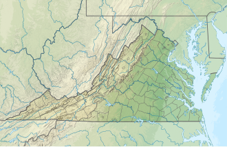
Location in Virginia
Elevation 2,172 ft (662 m) [1]
Traversed byCircle sign 611.svg SR 611 (Jarmans Gap Road)
Location Albemarle / Augusta counties, Virginia, United States
Range Blue Ridge Mountains
Coordinates 38°05′52″N78°46′51″W / 38.09778°N 78.78083°W / 38.09778; -78.78083

Jarman Gap (also Jarman's Gap or Jarmans Gap) is a wind gap in the Blue Ridge Mountains in the counties of Albemarle and Augusta, Virginia.

Contents

Geography

Jarman Gap is located approximately 6.7 miles (10.8 km) northeast of Waynesboro, Virginia and 16.7 miles (26.9 km) west-northwest of Charlottesville, Virginia at an elevation of 2,172 feet (662 m). [1] [2]

History

Jarman Gap, known as Woods' Gap in its early history, was a major early crossing of the Blue Ridge Mountains. The gap was originally a buffalo trail and a Native American path, and is the site of the earliest settlement in the area. Michael Woods was the first European to settle in the Blue Ridge Mountains of Albemarle County, having traveled down the Shenandoah Valley from Pennsylvania in 1734. [3] Woods and his family crossed the Blue Ridge using what is today known as Jarman Gap, and settled on a 2,006-acre plot registered in 1737 called "Mountain Plains" on the eastern slope of the gap. This gap became known as Woods' Gap after the family, and was renamed as Jarman Gap around 1800, when Thomas Jarman bought the property. [3] Jarman Gap was also crossed by the historic Three Notch'd Road, a colonial era road in use by the 1730s. The portion of the Three Notch'd Road over then Woods' Gap was constructed by Michael Woods from west to east beginning in 1737. [4] During the American Civil War, Confederate General Thomas "Stonewall" Jackson moved troops over Jarman Gap in 1862. [5] Today, Rockfish Gap, 6.3 miles (10.1 km) southwest of Jarman Gap, serves as the main crossing of the Blue Ridge from Albemarle County to Augusta County via U.S. Route 250, Interstate 64, and the CSX Transportation rail line. [6]

Related Research Articles

<span class="mw-page-title-main">Waynesboro, Virginia</span> Independent city in Virginia, United States

Waynesboro is an independent city in the Commonwealth of Virginia. It is a principal city of the Staunton-Waynesboro Metropolitan Statistical Area. Waynesboro is located in the Shenandoah Valley and is surrounded by Augusta County. As of the 2020 census, the population was 22,196.

<span class="mw-page-title-main">Rockingham County, Virginia</span> County in Virginia, United States

Rockingham County is a county located in the U.S. state of Virginia. As of the 2020 census, the population was 83,757. Its county seat is the independent city of Harrisonburg.

<span class="mw-page-title-main">U.S. Route 340</span> US Numbered Highway in Virginia, West Virginia and Maryland, United States

U.S. Route 340 is a spur route of US 40, and runs from Greenville, Virginia, to Frederick, Maryland. In Virginia, it runs north–south, parallel and east of US 11, from US 11 north of Greenville via Waynesboro, Grottoes, Elkton, Luray, Front Royal, and Berryville to the West Virginia state line. A short separate piece crosses northern Loudoun County on its way from West Virginia to Maryland.

<span class="mw-page-title-main">U.S. Route 250</span> Highway in the United States

U.S. Route 250 is a route of the United States Numbered Highway System, and is a spur of U.S. Route 50. It currently runs for 514 miles (827 km) from Richmond, Virginia to Sandusky, Ohio. It passes through the states of Virginia, West Virginia, and Ohio. It goes through the cities of Richmond, Charlottesville, Staunton, and Waynesboro, Virginia; and Wheeling, West Virginia. West of Pruntytown, West Virginia, US 250 intersects and forms a short overlap with its parent US 50.

<span class="mw-page-title-main">Skyline Drive</span> National Scenic Byway in Shenandoah National Park, Virginia, US

Skyline Drive is a 105-mile (169 km) National Parkway that runs the entire length of the National Park Service's Shenandoah National Park in the Blue Ridge Mountains of Virginia, generally along the ridge of the mountains. The drive's northern terminus is at an intersection with U.S. Route 340 (US 340) near Front Royal, and the southern terminus is at an interchange with US 250 near Interstate 64 (I-64) in Rockfish Gap, where the road continues south as the Blue Ridge Parkway. The road has intermediate interchanges with US 211 in Thornton Gap and US 33 in Swift Run Gap. Skyline Drive is part of Virginia State Route 48, which also includes the Virginia portion of the Blue Ridge Parkway, but this designation is not signed.

<span class="mw-page-title-main">Blue Ridge Tunnel</span> Historic railroad tunnel

The Blue Ridge Tunnel is a historic railroad tunnel built during the construction of the Blue Ridge Railroad in the 1850s. The tunnel was the westernmost and longest of four tunnels engineered by Claudius Crozet to cross the Blue Ridge Mountains at Rockfish Gap in central Virginia.

<span class="mw-page-title-main">Rockfish Gap</span>

Rockfish Gap is a wind gap located in the Blue Ridge Mountains between Charlottesville and Waynesboro, Virginia, United States, through Afton Mountain, which is frequently used to refer to the gap.

Swift Run Gap is a wind gap in the Blue Ridge Mountains located in the U.S. state of Virginia.

<span class="mw-page-title-main">Virginia State Route 6</span> State highway in Virginia, US

State Route 6 is a primary state highway in the U.S. state of Virginia. Known for most of its length as River Road, the state highway runs 102.26 miles (164.57 km) from U.S. Route 250 in Afton east to SR 161 in Richmond. SR 6 is one of the main highways of mountainous Nelson County, where the highway runs north–south from its beginning to US 29. From Scottsville to Richmond, the state highway parallels the James River. SR 6 is a major suburban highway through southwestern Henrico County and the main street of Richmond's West End.

<span class="mw-page-title-main">Transportation in Virginia</span>

Transportation in the Commonwealth of Virginia is by land, sea and air. Virginia's extensive network of highways and railroads were developed and built over a period almost 400 years, beginning almost immediately after the founding of Jamestown in 1607, and often incorporating old established trails of the Native Americans.

<span class="mw-page-title-main">U.S. Route 50 in Virginia</span> Segment of American highway

U.S. Route 50 is a transcontinental highway which stretches from Ocean City, Maryland to West Sacramento, California. In the U.S. state of Virginia, US 50 extends 86 miles (138 km) from the border with Washington, D.C. at a Potomac River crossing at Rosslyn in Arlington County to the West Virginia state line near Gore in Frederick County.

<span class="mw-page-title-main">Virginia State Route 20</span> State highway in central Virginia, US

State Route 20 is a primary state highway in the U.S. state of Virginia. The state highway runs 89.79 miles (144.50 km) from U.S. Route 15 in Dillwyn north to SR 3 in Wilderness. SR 20 is a C-shaped route that connects Charlottesville with Farmville in Southside Virginia. The state highway also links Charlottesville to Fredericksburg by way of Orange County, within which SR 20 is the main east–west highway and intersects US 15 again in the county seat of Orange.

<span class="mw-page-title-main">U.S. Route 33 in Virginia</span> Section of US highway in Virginia

U.S. Route 33 is a part of the U.S. Highway System that runs from Elkhart, Indiana to Richmond, Virginia. In Virginia, the U.S. Highway runs 135.60 miles (218.23 km) from the West Virginia state line near Rawley Springs east to its eastern terminus at SR 33 in Richmond. US 33 is the primary east–west highway of Rockingham County, which lies in the Shenandoah Valley. The highway connects the independent city of Harrisonburg, the town of Elkton, and an entrance to Shenandoah National Park. East of the Blue Ridge Mountains, US 33 connects the Piedmont communities of Stanardsville, Gordonsville, and Louisa. The U.S. Highway is a major suburban and urban route in the Richmond metropolitan area. Within Richmond, US 33 runs concurrently with US 250. SR 33 continues from US 33's eastern terminus as a state-numbered extension of the U.S. Highway that connects Richmond with Virginia's Middle Peninsula.

<span class="mw-page-title-main">Virginia State Route 56</span> State highway in Virginia, United States

State Route 56 is a primary state highway in the U.S. state of Virginia. The state highway runs 60.87 miles (97.96 km) from U.S. Route 11 at Steeles Tavern east to US 60 near Buckingham. SR 56 is the main east–west highway of Nelson County. The state highway connects the county seat of Lovingston with Buckingham to the east and the Blue Ridge Mountains and the Shenandoah Valley to the west.

<span class="mw-page-title-main">U.S. Route 60 in Virginia</span> Section of U.S. Numbered Highway in Virginia, United States

U.S. Route 60 (US 60) in the Commonwealth of Virginia runs 303 miles (488 km) west to east through the central part of the state, generally close to and paralleling the Interstate 64 corridor, except for the crossing of the Blue Ridge Mountains, and in the South Hampton Roads area.

<span class="mw-page-title-main">Virginia State Route 151</span> State highway in central Virginia, US

State Route 151 is a primary state highway in the U.S. state of Virginia. The state highway runs 35.22 miles (56.68 km) from U.S. Route 29 at Buffalo Hill north to US 250 at Critzers Shop. SR 151 traverses the Blue Ridge foothills of western Nelson County, where the highway provides access to the Wintergreen Resort.

<span class="mw-page-title-main">Virginia State Route 231</span> State highway in Virginia, United States

State Route 231 is a primary state highway in the U.S. state of Virginia. The state highway runs 49.82 miles (80.18 km) from SR 22 in Cismont north to U.S. Route 522 near Sperryville. SR 231 forms part of the connection between Charlottesville and Gordonsville, where the highway meets US 15 and US 33. The state highway also serves as the main north–south highway of Madison County, connecting the county seat of Madison, where the highway intersects US 29, with Gordonsville to the south and passing through the foothills of the Blue Ridge Mountains to the north.

<span class="mw-page-title-main">U.S. Route 250 in Virginia</span> Segment of American highway

U.S. Route 250 is a part of the U.S. Highway System that runs from Sandusky, Ohio to Richmond, Virginia. In Virginia, the highway runs 166.74 miles (268.34 km) from the West Virginia state line near Hightown east to its eastern terminus at US 360 in Richmond. US 250 is the main east–west highway of Highland County, which is known as Virginia's Little Switzerland; the highway follows the path of the 19th century Staunton and Parkersburg Turnpike. From Staunton east to Richmond, the highway serves as the local complement to Interstate 64 (I-64), roughly following the 18th century Three Notch'd Road through Waynesboro and Charlottesville on its way through the Shenandoah Valley, its crossing of the Blue Ridge Mountains at Rockfish Gap, and the Piedmont. In the Richmond metropolitan area, US 250 is known as Broad Street, a major thoroughfare through the city's West End and downtown areas.

<span class="mw-page-title-main">Three Notch'd Road</span> Colonial-era route across Virginia

Three Notch'd Road was a colonial-era major east-west route across central Virginia. It is believed to have taken its name from a distinctive marking of three notches cut into trees to blaze the trail. By the 1730s, the trail extended from the vicinity of the fall line of the James River at the future site of Richmond westerly to the Shenandoah Valley, crossing the Blue Ridge Mountains at Jarmans Gap. In modern times, a large portion of U.S. Route 250 in Virginia follows the historic path of the Three Notch'd Road, as does nearby Interstate 64.

Humpback Rocks is a massive greenstone outcropping near the peak of Humpback Mountain in the Blue Ridge Mountains of Augusta County and Nelson County, Virginia, United States, with a summit elevation of 3,080 feet (940 m). The rock formation is so named for the visual effect of a "hump" it creates on the western face of the mountain.

References

  1. 1 2 "Jarman Gap". Geographic Names Information System . United States Geological Survey, United States Department of the Interior.
  2. "Jarman Gap" (Map). Google Maps . Retrieved December 30, 2012.
  3. 1 2 Jarman Gap, www.visitcharlottesville.org, 2012, retrieved December 30, 2012
  4. Pawlett, Nathaniel; Newlon, Howard Jr. (1976), The Route of the Three Notch'd Road (PDF), Charlottesville, Virginia: Virginia Highway & Transportation Research Council, pp. 10–11, retrieved December 30, 2012
  5. Wayland, John (1969), History of Shenandoah County, Virginia, Genealogical Publishing Com, p. 670, ISBN   9780806380117 , retrieved December 30, 2012
  6. Logue, Victoria and Frank; Blouin, Nicole (2010), Guide to the Blue Ridge Parkway, Menasha Ridge Press, ISBN   9780897329095 , retrieved December 30, 2012