Snickers Gap

Last updated
Snickers Gap
Williams Gap
Sickers Gap.jpg
Snickers Gap as seen from across the Loudoun Valley on Mount Gilead
Elevation 1,056 feet (322 m) [1]
Traversed by Virginia 7.svg Virginia Route 7
Location Clarke County / Loudoun County, Virginia, United States
Range Blue Ridge Mountains
Appalachian Mountains
Coordinates 39°6′56″N77°50′43″W / 39.11556°N 77.84528°W / 39.11556; -77.84528 [2]
USA Virginia relief location map.svg
Red pog.svg
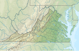
Location of Snickers Gap in Virginia

Snickers Gap, originally William's Gap, is a wind gap in the Blue Ridge Mountain on the border of Loudoun County and Clarke County in Virginia. The gap is traversed by Virginia State Route 7. The Appalachian Trail also passes across the gap. Bear's Den and Raven Rocks are adjacent to the gap.

Contents

During the autumn bird migration the gap is a favored spot for birdwatchers to count and study the many raptors that follow the ridge on their way south.
Geography

At 1,056 feet (322 m) the gap is approximately 300 to 600 feet (91 to 183 m) below the adjacent ridge line and 400 to 600 feet (120 to 180 m) above the surrounding countryside. Due to the dwindling height of the Blue Ridge as it approaches the Potomac River, Snickers Gap is one of the lowest wind gaps of the ridge in Virginia, with only Manassas Gap and the adjacent Keyes Gap being lower. The gap connects the northern Virginia piedmont with the lower Shenandoah Valley and serves as a main thoroughfare between the two regions.

Snickers Gap road sign, where Virginia State Route 7 leaves Loudoun County and enters Clarke County SnickersGap.jpg
Snickers Gap road sign, where Virginia State Route 7 leaves Loudoun County and enters Clarke County

History

The gap has been a major thoroughfare between the Piedmont and the Shenandoah Valley since before the European colonization of the area. Native Americans originally cut a trail through the gap that continued to be used by white settlers. The gap was known as Williams' Gap until the early 1780s, when the modern name began to be used. The gap derived its name from Edward Snickers, who owned the gap and surrounding land and operated a ferry across the Shenandoah River on the western side of the gap. By the late 18th century the Snickersville Turnpike and the Snickers Gap Turnpike were completed, and Snickers Gap became the main thoroughfare between Loudoun County and the Shenandoah, bypassing Keyes Gap, which to that point had been the preferred route. The two turnpikes joined at Snickersville (present-day Bluemont) and then proceeded over the gap to Winchester. The toll at the gap persisted well into the 20th century. The Snickers Gap turnpike was eventually made into Virginia State Route 7, and the toll was dropped. The gap was the scene of many small American Civil War skirmishes, and part of the Battle of Cool Spring (sometimes referred to as the "Battle of Snicker's Gap") took place there.

Portion of the 1944 Berryville, Virginia topographic map showing route 7 crossing Snickers Gap on Blue Ridge Mountain west of Bluemont. Snickers Gap, Virginia.jpg
Portion of the 1944 Berryville, Virginia topographic map showing route 7 crossing Snickers Gap on Blue Ridge Mountain west of Bluemont.

Related Research Articles

<span class="mw-page-title-main">Great Appalachian Valley</span> Major landform in eastern North America

The Great Appalachian Valley, also called The Great Valley or Great Valley Region, is one of the major landform features of eastern North America. It is a gigantic trough, including a chain of valley lowlands, and the central feature of the Appalachian Mountains system. The trough stretches about 1,200 miles (1,900 km) from Quebec in the north to Alabama in the south and has been an important north–south route of travel since prehistoric times.

<span class="mw-page-title-main">Battle of Aldie</span> 1863 battle of the American Civil War

The Battle of Aldie took place on June 17, 1863, in Loudoun County, Virginia, as part of the Gettysburg Campaign of the American Civil War.

The Bull Run Mountains are a mountain range of the Blue Ridge Mountains in northern Virginia in the United States. Located approximately 20 miles (32 km) east of the main chain, across the Loudoun Valley. The Bull Run Mountains, together with Catoctin Mountain in Virginia and Maryland, make up the easternmost front of the Blue Ridge.

<span class="mw-page-title-main">Virginia State Route 7</span> State highway in northern Virginia, US

Virginia State Route 7 (VA 7) is a major primary state highway and busy commuter route in northern Virginia, United States. It travels southeast from downtown Winchester to SR 400 in downtown Alexandria. Its route largely parallels those of the Washington & Old Dominion Trail and the Potomac River. Between its western terminus and Interstate 395 (I-395), SR 7 is part of the National Highway System. In 1968, the Virginia State Highway Commission designated the road as the "Harry Flood Byrd Highway" between Alexandria and Winchester to commemorate Harry F. Byrd Sr. (1887–1966).

<span class="mw-page-title-main">Bluemont, Virginia</span> Unincorporated community in Virginia, United States

Bluemont is an unincorporated village in Loudoun County, Virginia located at the eastern base of Snickers Gap in the Blue Ridge Mountains. The village's center is located along Snickersville Turnpike, 4 miles (6.4 km) west of the incorporated town of Round Hill. The village borders Virginia's fox hunting country and is within 1 mile (1.6 km) of the Appalachian Trail and the Bears Den and Raven Rocks formations in the Blue Ridge.

Swift Run Gap is a wind gap in the Blue Ridge Mountains located in the U.S. state of Virginia.

<span class="mw-page-title-main">Thornton Gap</span>

Thornton Gap is a wind gap located in the Blue Ridge Mountains in Virginia separating the Shenandoah Valley from the Piedmont region of the state.

<span class="mw-page-title-main">Valley Pike</span>

Valley Pike or Valley Turnpike is the traditional name given for the Indian trail and roadway which is now approximated by U.S. Route 11 in the Shenandoah Valley of Virginia.

<span class="mw-page-title-main">Blue Ridge Mountain</span>

Blue Ridge Mountain, also known as Blue Mountain, is the colloquial name of the westernmost ridge of the Blue Ridge Mountains in northern Virginia and the Eastern Panhandle of West Virginia. The Appalachian Trail traverses the entire length of the mountain along its western slope and crest.

<span class="mw-page-title-main">Aldie, Virginia</span> Unincorporated community in Virginia, United States

Aldie is an unincorporated community and census-designated place (CDP) located between Chantilly and Middleburg in Loudoun County, Virginia, United States. The historic village of Aldie is located on the John Mosby Highway in a gap between the Catoctin Mountains and Bull Run Mountains, through which the Little River flows. Aldie traditionally serves as the gateway to the Loudoun Valley and beyond.

<span class="mw-page-title-main">Ashby Gap</span>

Ashby Gap, more commonly known as Ashby's Gap is a wind gap in the Blue Ridge Mountains on the border of Clarke County, Loudoun County and Fauquier County in Virginia. The gap is traversed by U.S. Route 50. The Appalachian trail also passes across the gap.

<span class="mw-page-title-main">Loudoun Valley</span> Valley in northern Virginia

The Loudoun Valley is a small, but historically significant valley in the Blue Ridge Mountains located in Loudoun County in Northern Virginia in the United States.

<span class="mw-page-title-main">U.S. Route 50 in Virginia</span> Segment of American highway

U.S. Route 50 is a transcontinental highway which stretches from Ocean City, Maryland to West Sacramento, California. In the U.S. state of Virginia, US 50 extends 86 miles (138 km) from the border with Washington, D.C. at a Potomac River crossing at Rosslyn in Arlington County to the West Virginia state line near Gore in Frederick County.

Loudoun County, Virginia, was destined to be an area of significant military activity during the American Civil War. Located on Virginia's northern frontier, the Potomac River, Loudoun County became a borderland after Virginia's secession from the Union in early 1861. Loudoun County's numerous Potomac bridges, ferries and fords made it an ideal location for the Union and Confederate armies to cross into and out of Virginia. Likewise, the county's several gaps in the Blue Ridge Mountains that connected the Piedmont to the Shenandoah Valley and Winchester were of considerable strategic importance. The opposing armies would traverse the county several times throughout the war leading to several small battles, most notably the Battle of Ball's Bluff.

The Snicker's Gap Turnpike was a turnpike road in the northern part of the U.S. state of Virginia. Part of it is now maintained as State Route 7, a primary state highway, but the road between Aldie and Bluemont in Loudoun County, via Mountville, Philomont, and Airmont, is a rural Virginia Byway known as Snickersville Turnpike, and includes the about 180-year-old Hibbs Bridge over Beaverdam Creek. This turnpike replaced, in part, the first toll road in the United States, which consisted of two roads from Alexandria northwest into the Shenandoah Valley.

<span class="mw-page-title-main">Battle of Unison</span> Battle of the American Civil War

The Battle of Unison or Battle of Union refers to a series of American Civil War cavalry skirmishes in Loudoun County, Virginia, between October 31 – November 2, 1862, between the Confederate forces of J.E.B. Stuart and various units of the Union Army of the Potomac. Although driven from the field in individual engagements, Stuart accomplished his mission to delay the enemy and screen the movements of the retreating Army of Northern Virginia.

Keyes Gap or Keyes' Gap is a wind gap in the Blue Ridge Mountain on the border of Loudoun County, Virginia and Jefferson County, West Virginia. The gap is traversed by Virginia State Route 9/West Virginia Route 9. The Appalachian Trail also crosses the gap.

<span class="mw-page-title-main">Burning Raid</span> 1864 Union raid during American Civil War

The Burning Raid was a Union raid conducted in the Loudoun Valley of Loudoun and Fauquier counties in Virginia in 1864 during the American Civil War. It was aimed at destroying the forage on which Confederate partisans operating in the area, specifically Mosby's Rangers, subsisted as well as at breaking the will of the citizens of the area for supporting the partisans.

<span class="mw-page-title-main">Fishers Gap</span>

Fishers Gap is a wind gap of the Blue Ridge Mountains located on the border of Madison County and Page County in Virginia in the Shenandoah National Park. Both Skyline Drive and the Appalachian Trail pass across the gap.

References

  1. "The National Map: Elevation". usgs.gov. Retrieved 8 October 2015.
  2. "Snickers Gap". Geographic Names Information System . United States Geological Survey, United States Department of the Interior.

Further reading