Thoroughfare Gap (Bull Run Mountain)

Last updated
Thoroughfare Gap
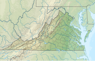
USA Virginia relief location map.svg
Red pog.svg
Location of the Gap in Virginia
Elevation 423 ft (129 m) [1]
Traversed by Virginia 55.svg Virginia Route 55
I-66.svg Interstate 66
Location Fauquier / Prince William counties, Virginia, United States
Range Bull Run Mountains Blue Ridge Mountains
Coordinates 38°49′28″N77°42′57″W / 38.824559°N 77.7158261°W / 38.824559; -77.7158261 Coordinates: 38°49′28″N77°42′57″W / 38.824559°N 77.7158261°W / 38.824559; -77.7158261

Thoroughfare Gap is a water gap in the Bull Run Mountains created by Broad Run between High Point Mountain to the north and Bisquit Mountain to the south. It is located on the border of Prince William and Fauquier counties in Virginia.

True to its name, the small gap is traversed by Interstate 66, Virginia State Route 55 and the Manassas Gap Railroad.

The ruins of historic Beverley Mill are located at the gap.

The gap was the site of the 1862 Battle of Thoroughfare Gap during the American Civil War. The Thoroughfare Gap Battlefield was listed on the National Register of Historic Places in 1999. [2]
Related Research Articles

The Battle of Thoroughfare Gap, also known as Chapman's Mill, took place on August 28, 1862, in Fauquier County and Prince William County, Virginia, as part of the Northern Virginia Campaign of the American Civil War. Confederate forces under Maj. Gen. James Longstreet successfully drove back Union forces under Brig. Gen. James B. Ricketts and Col. Percy Wyndham, allowing his corps to unite with that of Thomas J. "Stonewall" Jackson prior to the Second Battle of Bull Run.

<span class="mw-page-title-main">Skyline Drive</span> National Scenic Byway in Shenandoah National Park, Virginia, USA

Skyline Drive is a 105-mile (169 km) National Parkway that runs the entire length of the National Park Service's Shenandoah National Park in the Blue Ridge Mountains of Virginia, generally along the ridge of the mountains. The drive's northern terminus is at an intersection with U.S. Route 340 (US 340) near Front Royal, and the southern terminus is at an interchange with US 250 near Interstate 64 (I-64) in Rockfish Gap, where the road continues south as the Blue Ridge Parkway. The road has intermediate interchanges with US 211 in Thornton Gap and US 33 in Swift Run Gap. Skyline Drive is part of Virginia State Route 48, which also includes the Virginia portion of the Blue Ridge Parkway, but this designation is not signed.

The Bull Run Mountains are a mountain range of the Blue Ridge Mountains in northern Virginia in the United States. Located approximately 20 miles (32 km) east of the main chain, across the Loudoun Valley. The Bull Run Mountains, together with Catoctin Mountain in Virginia and Maryland, make up the easternmost front of the Blue Ridge.

<span class="mw-page-title-main">Cacapon River</span> River in West Virginia, United States

The Cacapon River, located in the Appalachian Mountains of West Virginia's Eastern Panhandle region, is an 81.0-mile-long (130.4 km) shallow river known for its fishing, boating, wildlife, hunting, and wilderness scenery. As part of the Potomac River watershed, it is an American Heritage River.

Short Gap is an unincorporated community in Mineral County, West Virginia, United States, located at the intersection of Routes 956 and 28; approximately eight miles from Cumberland, Maryland. The community is home to Frankfort High School, as well as Frankfort Middle School, which serve the northern part of Mineral County, including students from the towns of Ridgeley and Fort Ashby. The ZIP codes for Short Gap are 26753 and 26726.

Circleville is an unincorporated community located in Pendleton County, West Virginia, United States. Circleville was originally named Zyrkleville after John Zyrkle, who ran a dry goods store in the town. The old Circleville School is listed on the National Register of Historic Places.

<span class="mw-page-title-main">Aldie, Virginia</span> Census-designated place in Virginia

Aldie is an unincorporated community and census-designated place (CDP) located between Chantilly and Middleburg in Loudoun County, Virginia, United States. The historic village of Aldie is located on the John Mosby Highway in a gap between the Catoctin Mountains and Bull Run Mountains, through which the Little River flows. Aldie traditionally serves as the gateway to the Loudoun Valley and beyond.

<span class="mw-page-title-main">Turner's Gap</span> Wind gap in Maryland, United States

Turner's Gap is a wind gap in the South Mountain Range of the Blue Ridge Mountains, located in Frederick County and Washington County, Maryland. The gap is traversed by U.S. Route 40 Alternate, the old National Pike. The Appalachian Trail also crosses the gap along the ridgeline.

<span class="mw-page-title-main">National Register of Historic Places listings in Virginia</span>

Buildings, sites, districts, and objects in Virginia listed on the National Register of Historic Places:

New Manchester is an unincorporated community in Hancock County, West Virginia, United States. It is located along West Virginia Route 8 northeast of New Cumberland near Tomlinson Run State Park.

Ridgeway is an unincorporated community in Berkeley County, West Virginia, United States. It lies off U.S. Route 11 on Specks Run Road near the Virginia state line.

<span class="mw-page-title-main">Tomahawk, West Virginia</span> Unincorporated community in West Virginia, United States

Tomahawk is an unincorporated community on Back Creek in Berkeley County, West Virginia, United States. The community is named for a nearby series of springs in the shape of a tomahawk. The community includes the historic Tomahawk Presbyterian Church, established c. 1745, and its adjacent community cemetery, which has gravestones dating to the late 18th century. The community lies 9.5 miles from Martinsburg.

<span class="mw-page-title-main">Swoope, Virginia</span> Unincorporated community in Virginia, United States

Swoope is an unincorporated community in Augusta County, Virginia. Swoope is located on State Routes 703 and 860 7.4 miles (11.9 km) west of Staunton. Swoope has a post office with ZIP code 24479, which opened on March 6, 1838. Polyface Farm, a sustainable farm run by Joel Salatin, is also near Swoope. Students in the area go to Beverley Manor Elementary School, Churchville Elementary School, attend Beverley Manor Middle School, and Buffalo Gap High School.

<span class="mw-page-title-main">Hardy, Virginia</span> Unincorporated community in Virginia, United States

Hardy is an unincorporated community in Franklin/Bedford County, Virginia, United States, and is about twenty miles southeast of Roanoke. It is also the home place of Confederate Gen. Jubal Anderson Early, who was born near the bottom of Windy Gap Mountain. It is the home place of NCAA baseball coach Charles Buddy Bolding as well.

Broad Run is a small, unincorporated community in Fauquier County, Virginia. It is on Bust Head Road just north of Interstate 66 and State Route 55, near the Prince William County line. Broad Run is named after the waterway that flows through the town. Broad Run has its own ZIP Code of 20137, and its post office serves a population of 1,510.

<span class="mw-page-title-main">Snickers Gap</span>

Snickers Gap, originally William's Gap, is a wind gap in the Blue Ridge Mountain on the border of Loudoun County and Clarke County in Virginia. The gap is traversed by Virginia State Route 7. The Appalachian Trail also passes across the gap. Bear's Den and Raven Rocks are adjacent to the gap.

<span class="mw-page-title-main">Tesla, West Virginia</span> Unincorporated community in West Virginia, United States

Tesla is an unincorporated community in Braxton County, West Virginia, United States. Tesla is 4.5 miles (7.2 km) south of Sutton.

Coe is an unincorporated community in Nicholas County, West Virginia, United States. Coe is located on County Route 7/6, 5.4 miles (8.7 km) east of Craigsville.

<span class="mw-page-title-main">Beverley Mill</span> United States historic place

Beverley Mill, also known as Chapman Mill, is a historic grist mill located north of Interstate 66 and Virginia State Route 55 in Thoroughfare Gap near Broad Run, Virginia, straddling the county line between Prince William and Fauquier Counties. It was built about 1759, and is a five-story, four bay by three bay, rubble stone structure. The water power was provided by Broad Run which, in its 1,300-foot (400-metre) passage through the Gap, drops 87 feet. Exterior mill machinery included a 29-foot (8.8-metre) metal waterwheel and sluice gate as well as a stone mill race. The mill continued in operation through World War II. It is included in the Thoroughfare Gap Battlefield.

<span class="mw-page-title-main">Thoroughfare Gap Battlefield</span> American Civil War battlefield

Thoroughfare Gap Battlefield is a historic American Civil War battlefield located at Thoroughfare Gap, Broad Run, Prince William County, Virginia. It was the site of the Battle of Thoroughfare Gap. The property includes a number of resources present at the time of the battle including the separately listed Beverley Mill, a five-story, coursed-rubble stone building set into the north side of Thoroughfare Gap. Meadowlands, the Chapman's house and the second Upper Mill are clearly visible on the landscape, as well as an important ice pit and a walled cemetery associated with the Chapman family.

References

  1. "Thoroughfare Gap". Geographic Names Information System . United States Geological Survey, United States Department of the Interior.
  2. "National Register Information System". National Register of Historic Places . National Park Service. July 9, 2010.