Related Research Articles

Beale Township is a township in Juniata County, Pennsylvania, United States. The population was 830 at the 2010 census, up from 726 at the 2000 census.

Greenwood Township is a township in Juniata County, Pennsylvania, United States. The population was 617 at the 2010 census, up from 548 at the 2000 census.

Spruce Hill Township is a township in Juniata County, Pennsylvania, United States. The population was 834 at the 2010 census, up from 724 at the 2000 census.

Perry Township is a township in Snyder County, Pennsylvania, in the United States. As of the 2000 census, the township population was 1,973.
Aughwick Creek is a 30.8-mile-long (49.6 km) tributary of the Juniata River in Huntingdon County, Pennsylvania in the United States.
Yellow Creek is a 20.9-mile-long (33.6 km) tributary of the Raystown Branch Juniata River in Bedford County, Pennsylvania, in the United States.
Dunning Creek is a 27.8-mile-long (44.7 km) tributary of the Raystown Branch Juniata River in south west/south central Pennsylvania in the United States.
Conodoguinet Creek is a 104-mile-long (167 km) tributary of the Susquehanna River in South central Pennsylvania in the United States. The name is Native American, and means "A Long Way with Many Bends".

The Frankstown Branch Juniata River is a 46.0-mile-long (74.0 km) tributary of the Juniata River in Blair and Huntingdon Counties, Pennsylvania, in the United States.
Brush Creek is a 24.7-mile-long (39.8 km) tributary of the Raystown Branch Juniata River in Fulton and Bedford counties, Pennsylvania, in the United States.

The Raystown Branch Juniata River is the largest and longest tributary of the Juniata River in south-central Pennsylvania in the United States.
Tuscarora Creek is a 49.2-mile-long (79.2 km) tributary of the Juniata River in central Pennsylvania in the United States. It rises in eastern Huntingdon County, east of the borough of Shade Gap, and flows northeast between Tuscarora Mountain and Shade Mountain, reaching the Juniata River at Port Royal in Juniata County.

Standing Stone Creek is a 34.2-mile-long (55.0 km) tributary of the Juniata River in Huntingdon and Centre counties, Pennsylvania, in the United States.

Fishing Creek is a 42.8-mile-long (68.9 km) tributary of Bald Eagle Creek in Clinton County, Pennsylvania, in the United States.
Bald Eagle Creek is a 55.2-mile-long (88.8 km) tributary of the West Branch Susquehanna River mostly in Centre County, Pennsylvania, in the United States.

Great Trough Creek is a tributary of the Raystown Branch Juniata River in Bedford, Fulton and Huntingdon counties in Pennsylvania in the United States. The creek is 33.2 miles (53.4 km) long, flows northeast for half its length then northwest, and its watershed is 85.4 square miles (221.2 km2) in area.
Cocolamus Creek is a 22.1-mile-long (35.6 km) tributary of the Juniata River in Juniata and Perry counties, Pennsylvania in the United States.
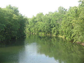
Sideling Hill Creek is a 21.9-mile-long (35.2 km) tributary of Aughwick Creek in Huntingdon County, Pennsylvania in the United States. Via Aughwick Creek and the Juniata River, it is part of the Susquehanna River watershed.
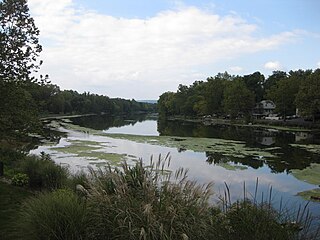
Mahantango Creek is a 2.1-mile-long (3.4 km) tributary of the Susquehanna River in Snyder and Juniata counties, Pennsylvania, in the United States. Its name comes from a Delaware Indian word meaning "where we had plenty to eat". The creek flows along the border between Snyder County and Juniata County.

The Osterburg Covered Bridge, also known as Bowser's Covered Bridge, is a historic wooden covered bridge located at East St. Clair Township in Bedford County, Pennsylvania. It is a 90-foot-long (27 m), Burr Truss bridge with a shallow gable roof. It crosses Bobs Creek. It is one of 15 historic covered bridges in Bedford County.
References
- ↑ Gertler, Edward. Keystone Canoeing, Seneca Press, 2004. ISBN 0-9749692-0-6
- ↑ U.S. Geological Survey. National Hydrography Dataset high-resolution flowline data. The National Map Archived 2012-04-05 at WebCite , accessed August 8, 2011
- ↑ "Pennsylvania whitewater, Bobs Creek". Riverfacts.com. Retrieved 25 September 2016.
- ↑ "National Historic Landmarks & National Register of Historic Places in Pennsylvania" (Searchable database). CRGIS: Cultural Resources Geographic Information System.Note: This includes Susan M. Zacher and Barbara Hufnagel (n.d.). "National Register of Historic Places Inventory Nomination Form: Osterburg Covered Bridge" (PDF). Archived from the original (PDF) on 2012-06-05. Retrieved 2011-11-19.


Coordinates: 40°08′39″N78°33′25″W / 40.144246°N 78.556963°W
| This Bedford County, Pennsylvania state location article is a stub. You can help Wikipedia by expanding it. |
| This article related to a river in Pennsylvania is a stub. You can help Wikipedia by expanding it. |